Winter Grand Circle in December, part 6: Wednesday, December 22, 2021, from breakfast to 2:30 p.m.
Our day at Arches National Park in December started with breakfast in Moab. We walked up to Delicate Arch and back with our kid, swung past Skyline Arch, walked into Devils Garden, and left the park a little after 2 p.m.
- This postThe morning of day 6 on a counterclockwise winter Grand Circle road trip by rental car in December. We slept in Moab, Utah, drove just north into Arches National Park and hiked the Delicate Arch trail with our kid. Back at the car, we stopped at the Fiery Furnace Viewpoint and Skyline Arch, then walked the Devils Garden trail out to Landscape Arch.
- LocationEastern Utah, about 5 mi (8 km) north of downtown Moab, a little over 10 minutes by car. From Las Vegas it’s about a 6½-hour drive.
- Date and weatherDecember 22. Clear in the morning, cloudy in the afternoon. Frost on the railings and the grass first thing.
- StopsDelicate Arch 3 mi (4.8 km) round-trip trail, 3 hours with our kidFiery Furnace Viewpoint and Skyline Arch seen from roadside pulloutsLandscape Arch 1.8 mi (2.9 km) round trip on the Devils Garden trail
- EntryWe used a national parks annual pass. As of 2026, no timed-entry reservation is needed.
- To bookA room in Moab
- Where we stayedDecember 21: Hampton Inn Moab
- Who wentThe three of us (my wife, our kid and me)
- The day’s routeWednesday, December 22, morning to afternoon
- Leave Hampton Inn MoabHotelAfter breakfast
- 🚗 10 min north on US 191
- Arches entrance, Balanced RockSightSeen from the car
- Delicate Arch trailHike3 hrAt the arch 10:25–11:15 a.m.
- Fiery Furnace Viewpoint, Skyline ArchSight15 min
- Devils Garden, Landscape ArchHike55 min
- 🚗 South on the park road, past Park Avenue
- Downtown MoabLunchOn to Goblin Valley, next post
Contents
Morning at Hampton Inn Moab
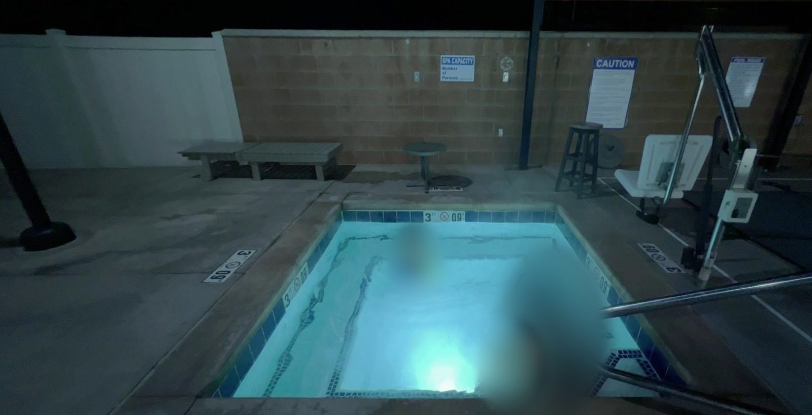
We spent the night before at Hampton Inn Moab, on the north side of town. Even in December the outdoor heated pool and hot tub were open, and there’s a particular pleasure in sinking into warm water while the air around you is cold. A winter night in steaming water had a nice feel to it.

The breakfast room had a make-your-own waffle machine: pour in the batter and flip the iron to bake it. Our kid held a fresh waffle in both hands and ate it happily.

Where to stay
Where we stayed in Moab
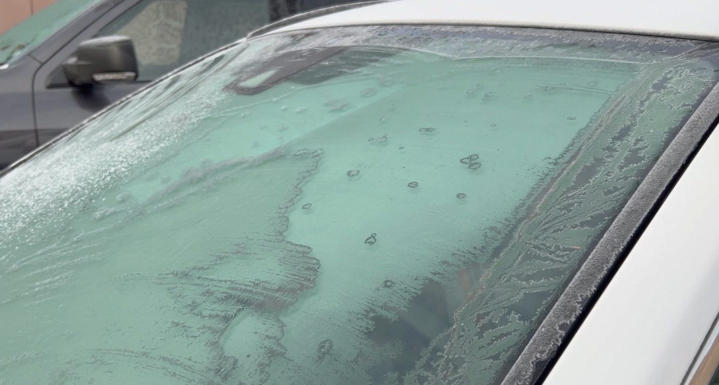
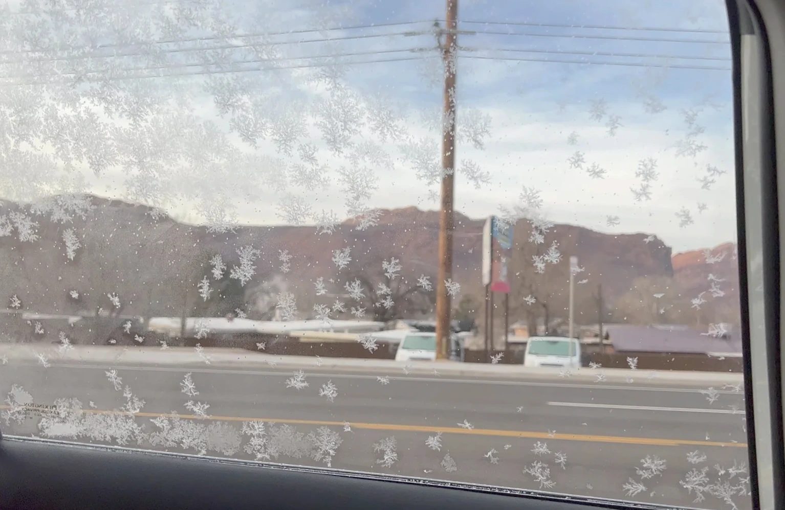
When we loaded the car around 8:20 a.m., frost had bloomed across the windows overnight like flowers. Ice crystals had formed on the windows the morning we woke up in Page, too; winter mornings in Utah turned out to be no different. We ran the heater until the glass cleared, then drove about 10 minutes north on US 191 to the Arches National Park entrance.
What makes Arches different
True to its name, Arches National Park has more than 2,000 recorded arches, openings worn clean through the rock. They range from thin slits to spans more than 295 ft (90 m) long. Most formed in red Entrada Sandstone, the hardened remains of desert sand dunes from 150 million years ago. A deep layer of salt pushed upward, cracking the sandstone above it into thin rock walls. Water seeped into those cracks, froze and thawed again and again, and eventually wore holes through the walls.
New openings are still forming, and every arch that grows will one day fall. In August 2008, Wall Arch, then the 12th largest in the park, collapsed overnight. Walking around, we saw small unnamed holes in rock after rock.
The park sits about 5 mi (8 km) north of downtown Moab in eastern Utah. Canyonlands National Park, where we’d been the day before, is about 31 mi (50 km) to the southwest, so plenty of people base themselves in Moab and see both.
From the entrance to Balanced Rock
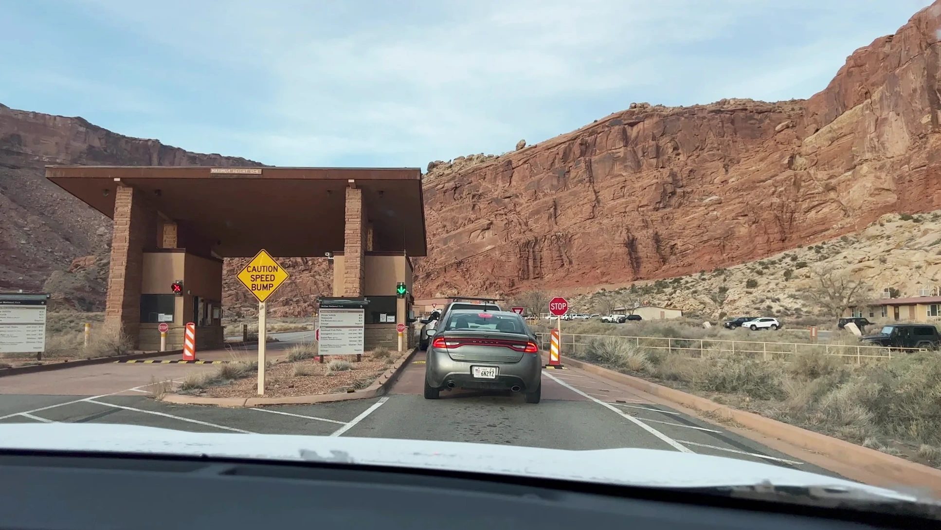
We passed the entrance booth around 8:30 a.m., showed our annual pass and got a park map. Right after the entrance, the road switchbacks up a red cliff, and the morning sun was just starting to slip between the rock towers.
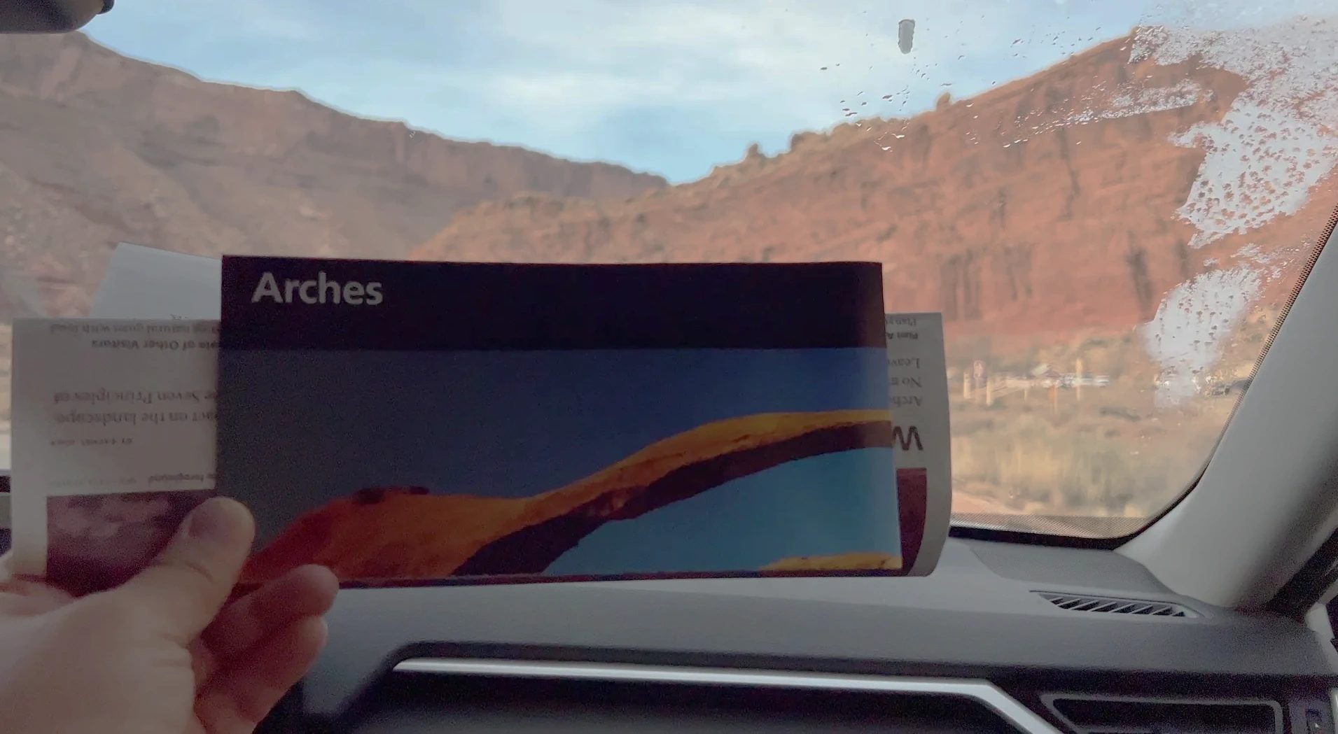
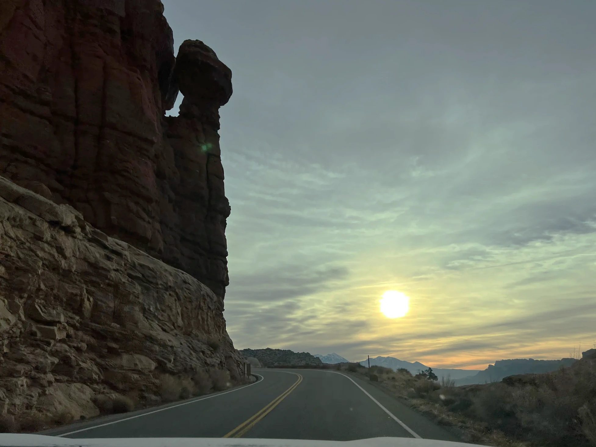
At the top of the grade, the snow-covered La Sal Mountains stretched along the eastern horizon. Seeing a white range behind a field of red rock was a sudden reminder that we’d come in winter.
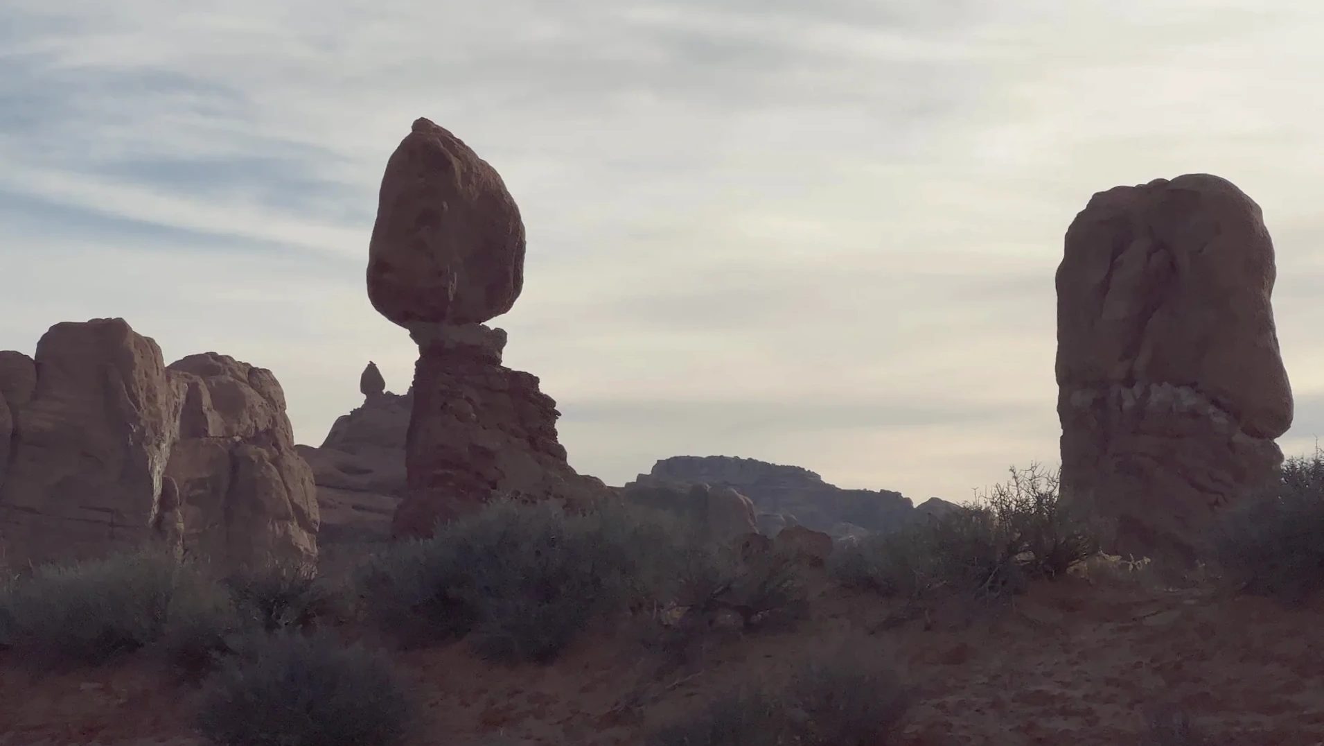
Around 8:50 a.m. we passed Balanced Rock, a huge boulder perched on a slender pedestal. With the sun behind it, it stood there like a black silhouette. We hurried past in the morning and looked at it again on our way out in the afternoon.
Delicate Arch trail with a kid in winter
Delicate Arch is Utah’s signature arch, the one printed on Utah license plates. To stand right in front of it, you hike from the Wolfe Ranch parking lot: 3 mi (4.8 km) round trip with a 480 ft (146 m) climb. We parked around 9:15 a.m.
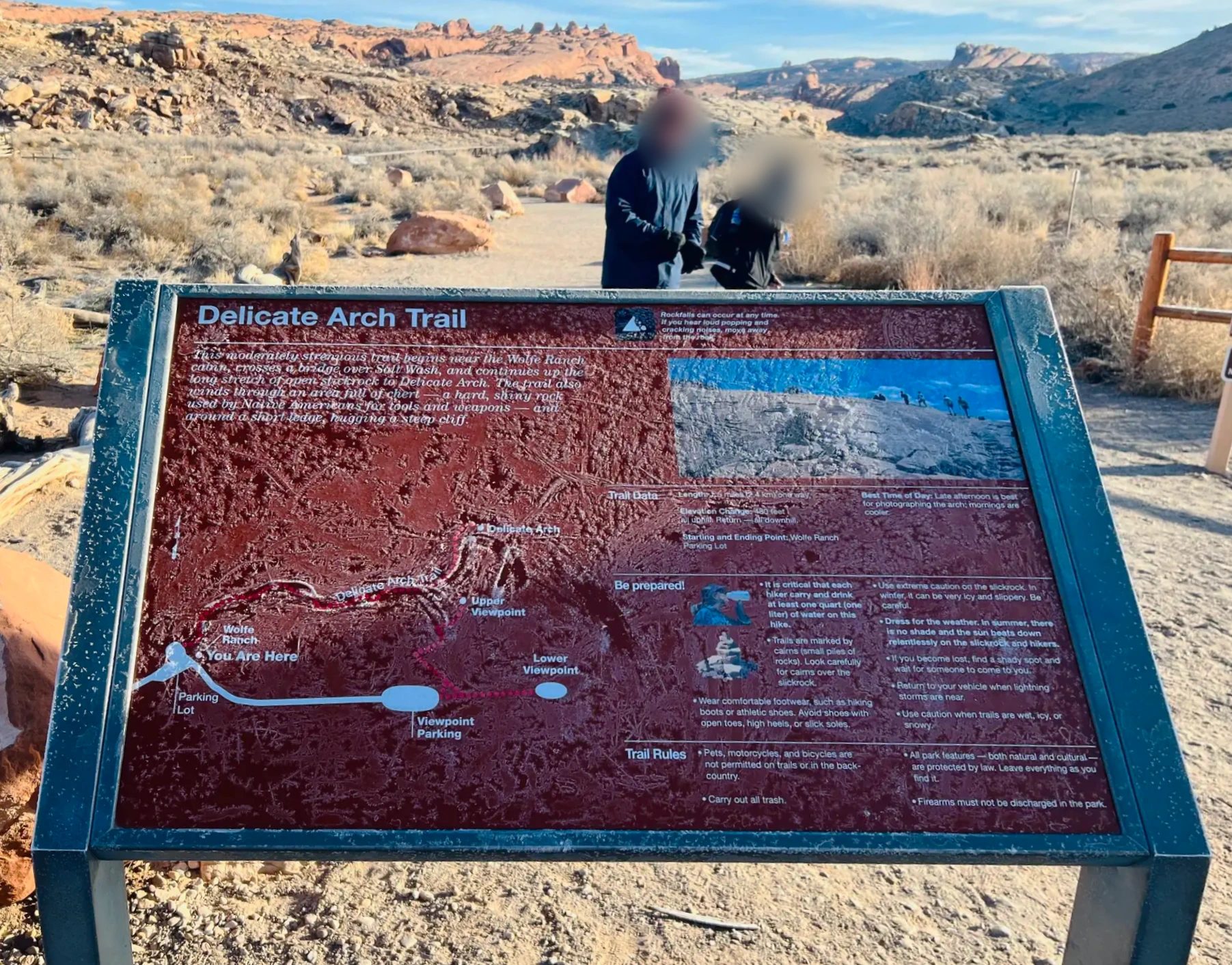
The sign at the trailhead was white with frost. It asked hikers to carry 1 liter (about 1 quart) of water per person, follow the cairns (small rock piles) across the slickrock, wear hiking boots or sneakers with good grip, and watch for icy, slippery rock in winter. It also noted that late afternoon is the best time to photograph the arch.
Winter trail
Gear for a winter hike
The National Park Service notes that the Delicate Arch trail gets slippery quickly after snow and recommends traction devices and trekking poles.
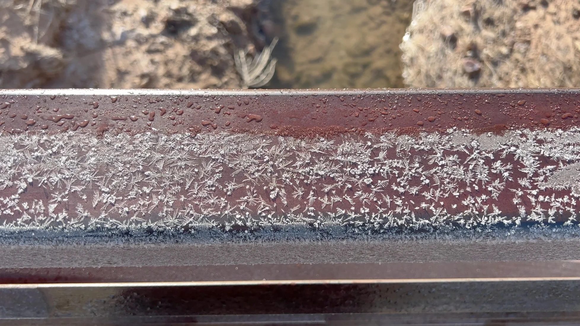
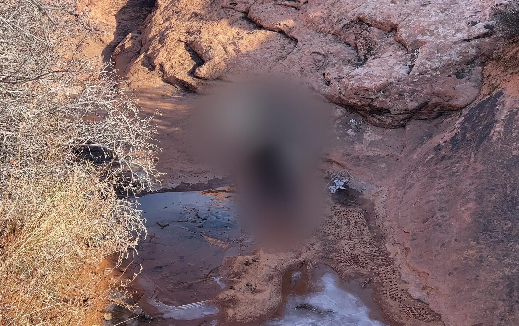
Frost still clung to every shaded patch of the trail. Ice crystals coated the railing of the footbridge over the creek. Every time we passed a small puddle, our kid crouched down to crack the thin ice on top.
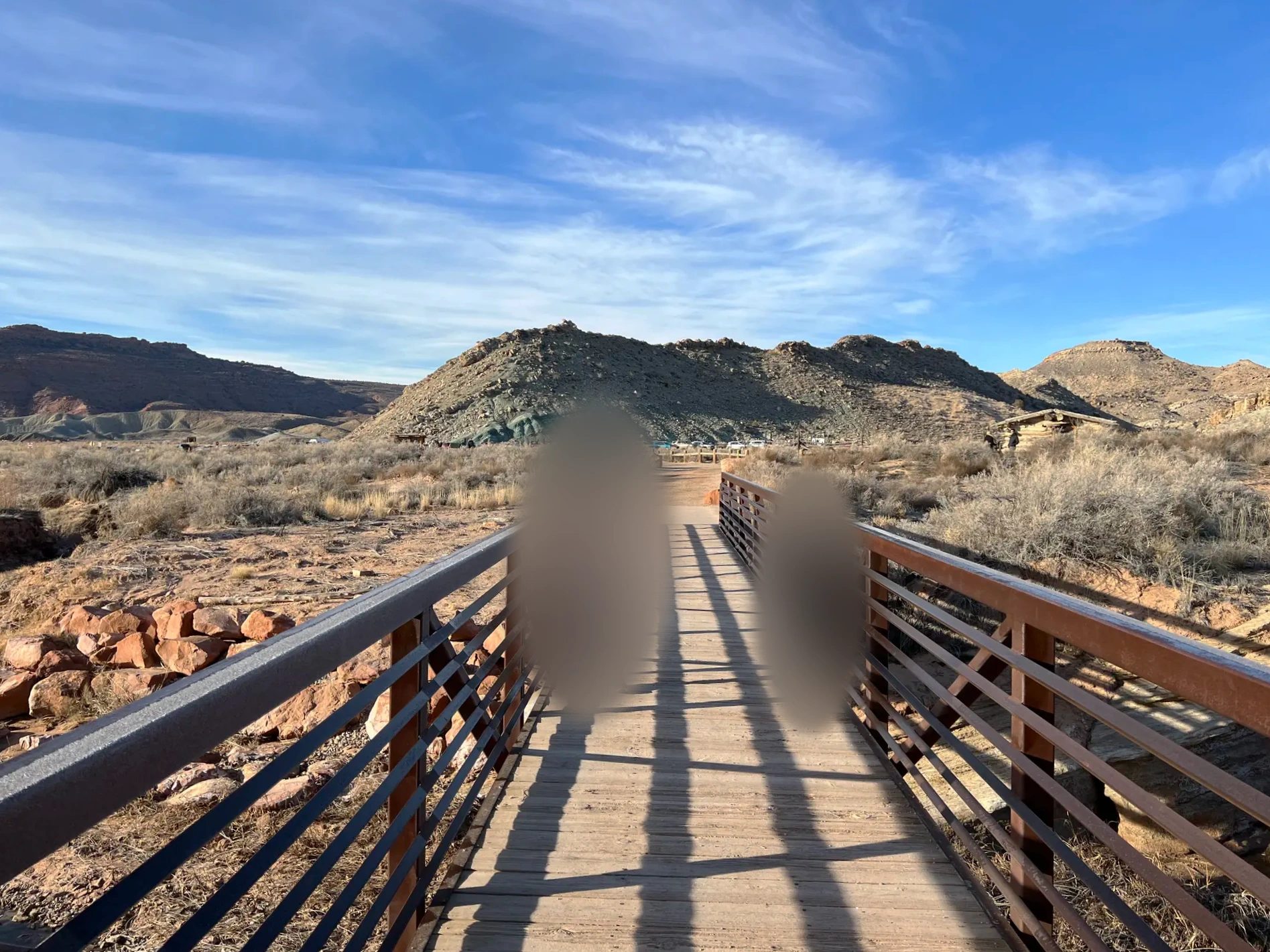
Past the bridge, the trail turns into a broad, smooth slope of bare rock. There’s no worn path here, so you steer by the cairns stacked on the rock. The climb was steady, but once we got moving we weren’t cold. A light sweater was enough for me, and our kid peeled off the down jacket. My wife and I each carried a Peak Design pack; they sat close to the body and stayed comfortable over the long walk.
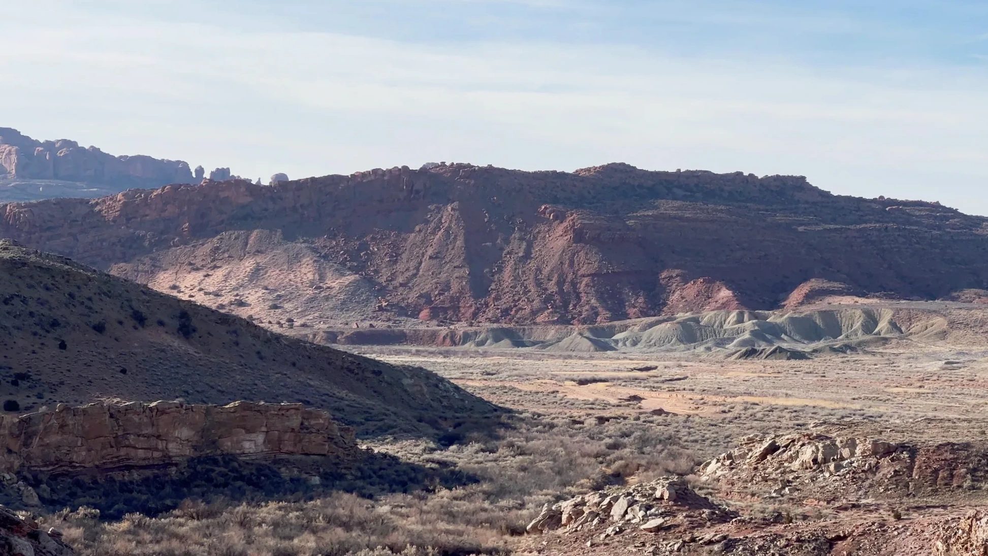
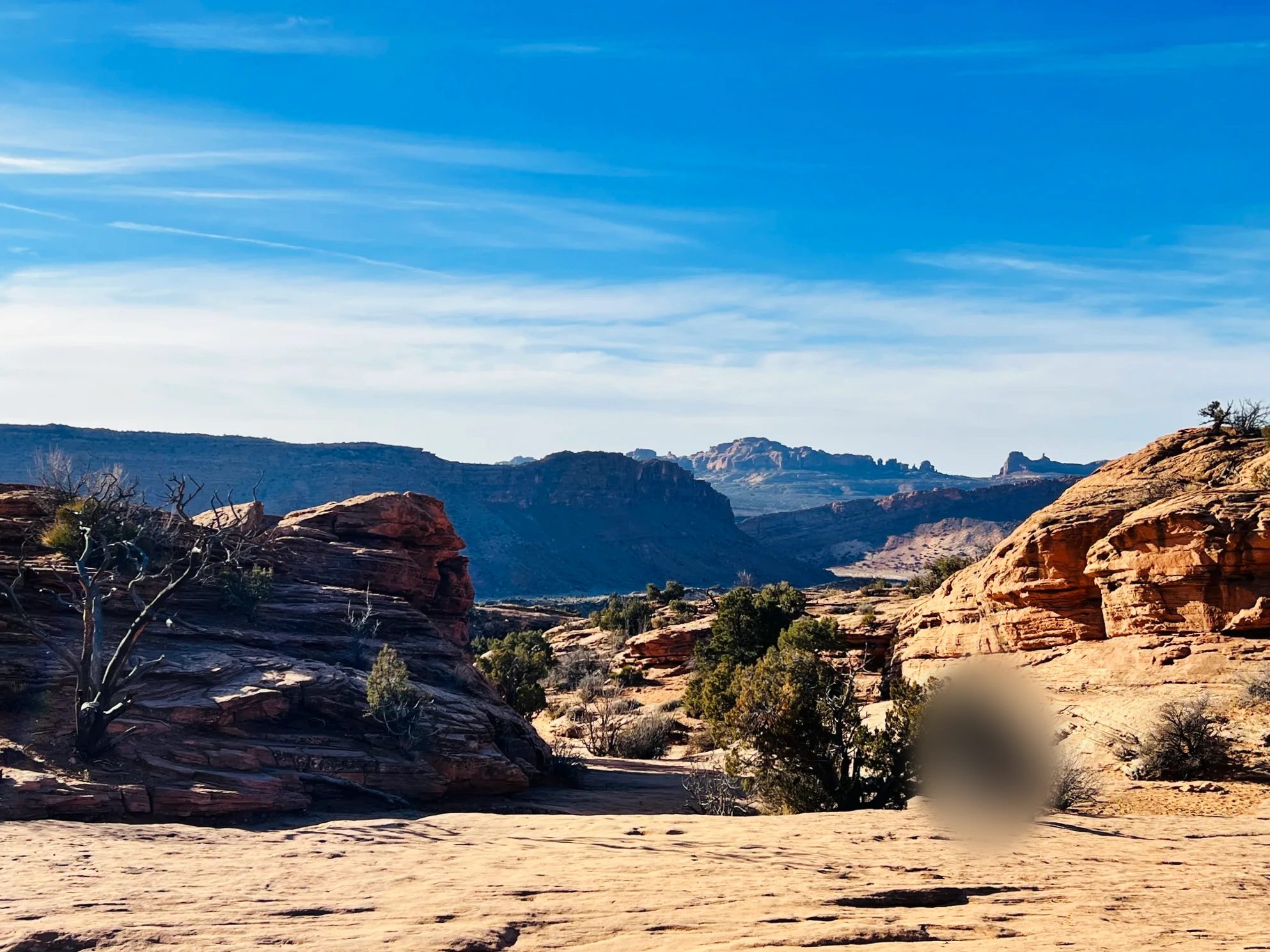
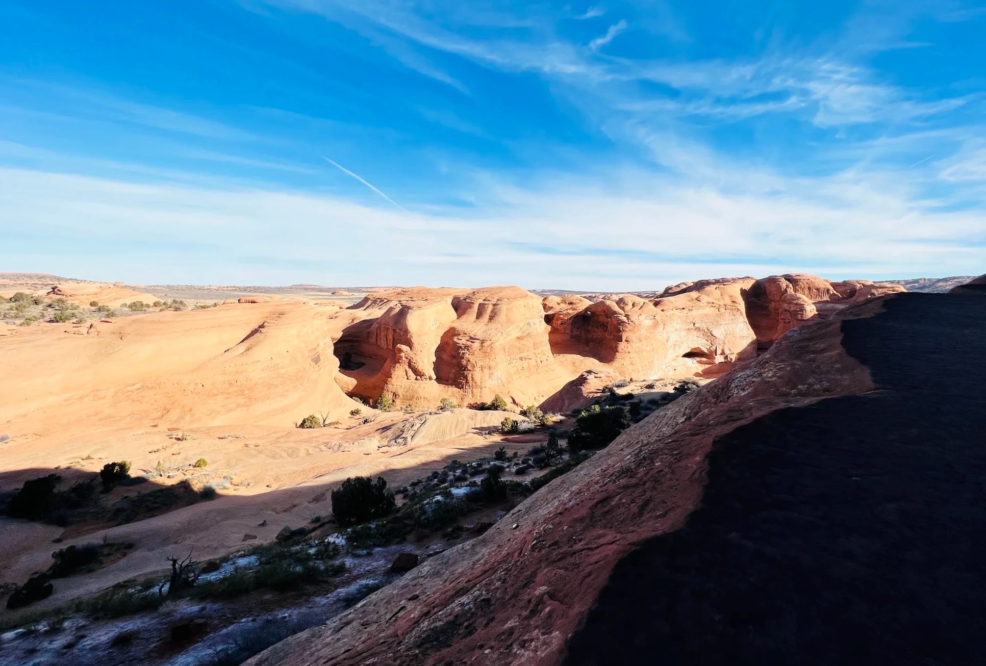
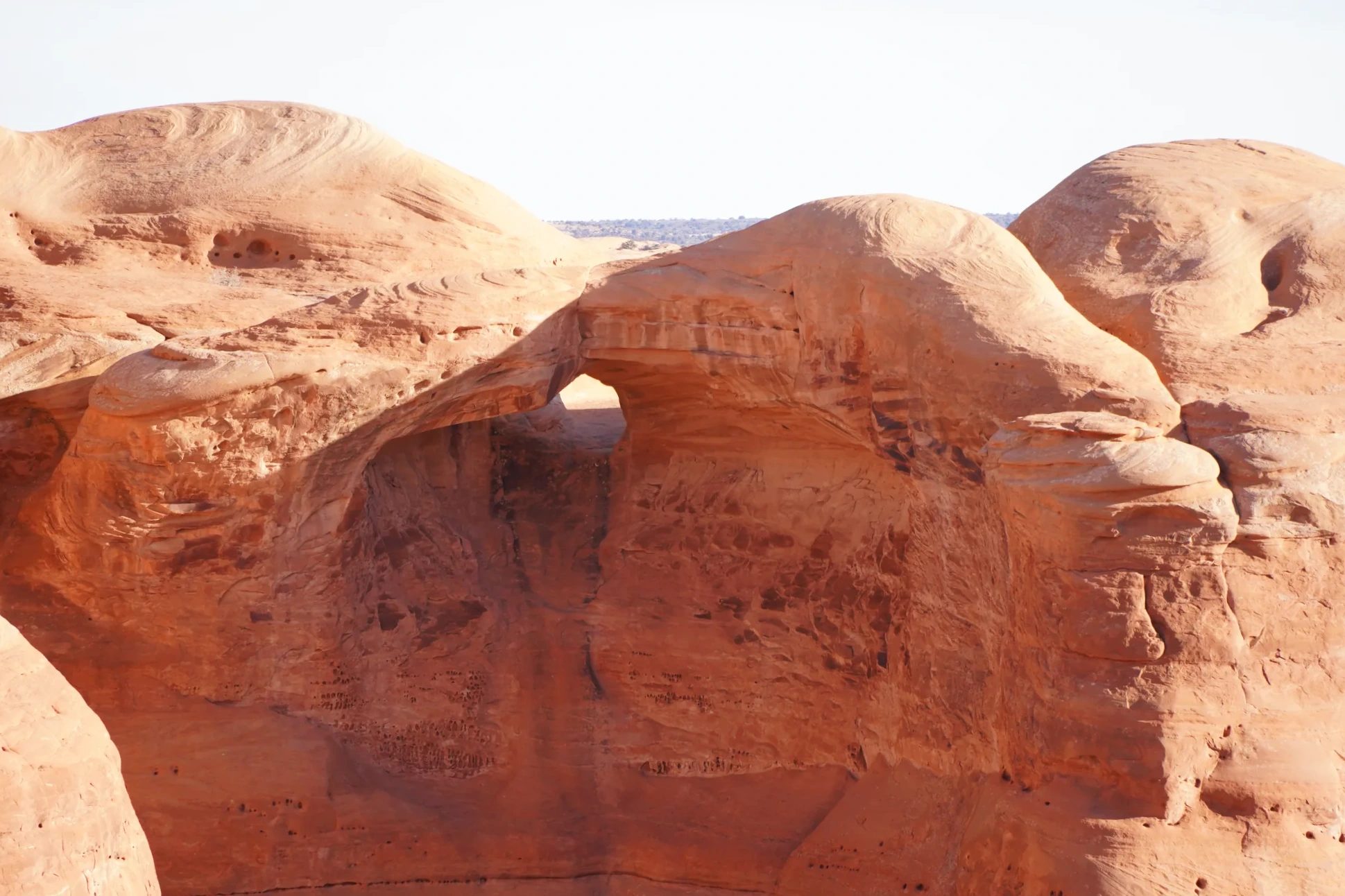
The last stretch is a narrow ledge cut into the side of a cliff, rock wall on one side and a drop-off on the other. Near the end, a small hole appeared in the rock wall. Give a hole like that enough time and it becomes an arch.
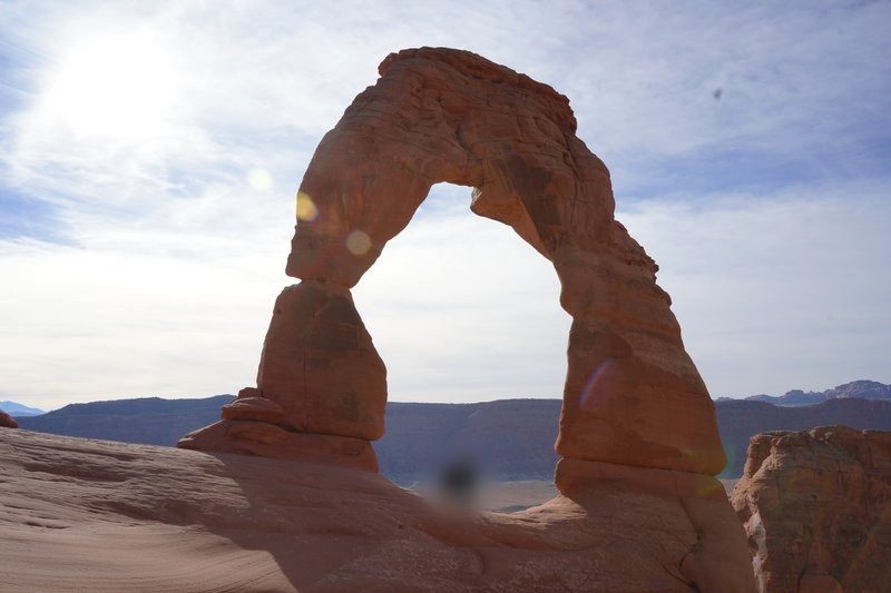
Around 10:25 a.m. we rounded the corner, and there was Delicate Arch, standing alone across a wide stone bowl. I’d seen it in photos many times, and I still stopped in my tracks. The snowy peaks of the La Sal Mountains rose behind it. It had taken us about 1 hour 10 minutes from the parking lot.
The opening is about 46 ft (14 m) tall, roughly eight times an adult’s height. Look at the people standing beneath it and the scale clicks right away. A big raven landed on the rock and watched the visitors.
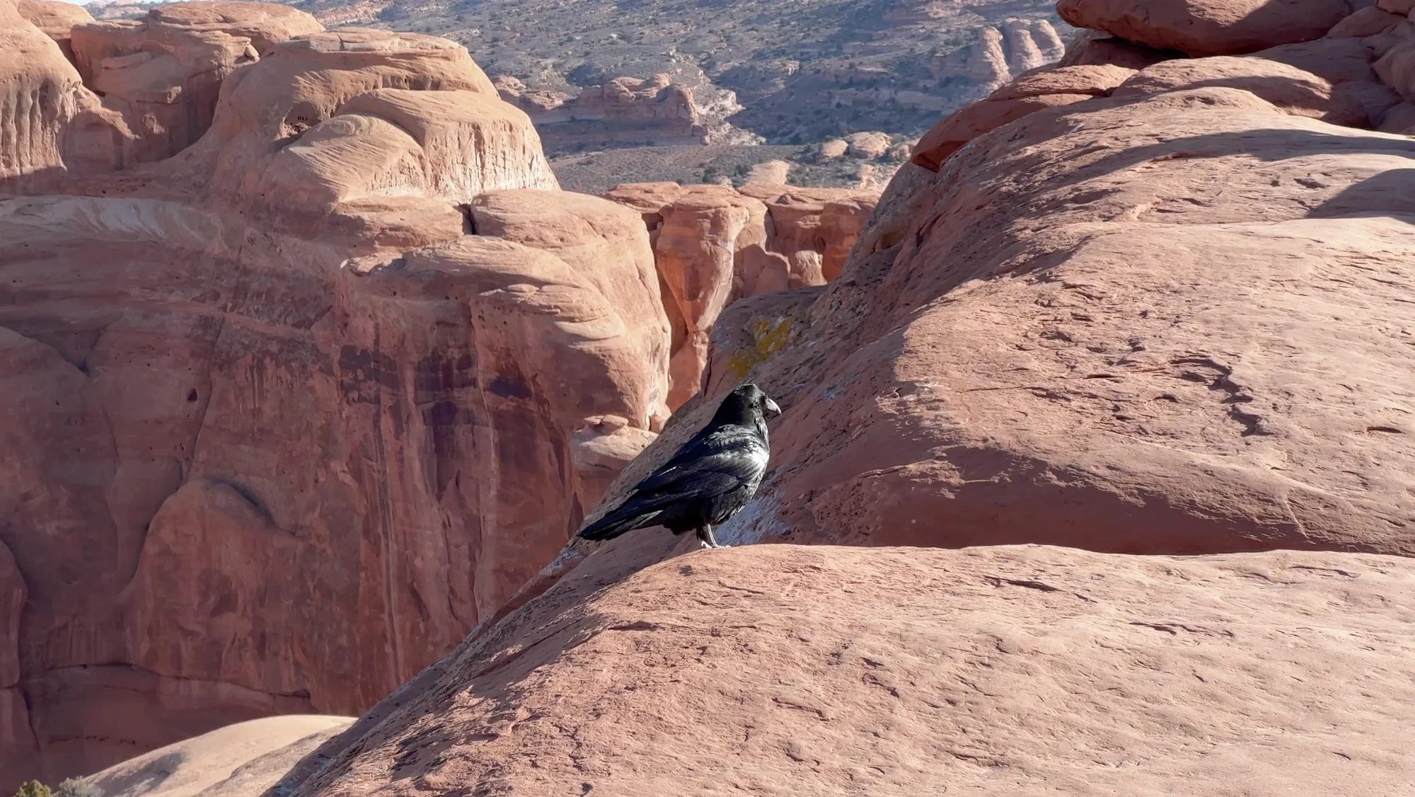
We spent about 50 minutes at the arch. That day I had a Sony A7C on a Peak Design carbon tripod and fired it with a camera remote. The iPhone sat on a Moment MagSafe stand on a rock, triggered with its own remote. That’s how we came home with several photos of all three of us. The tripod is light enough that carrying it 3 mi (4.8 km) round trip was no burden.
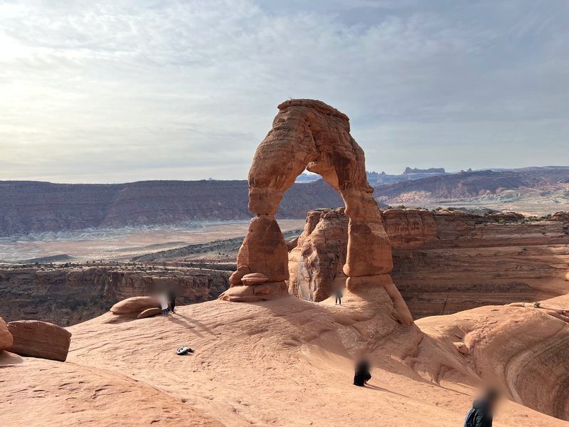
Around 11:15 a.m. we headed back, turning for one more look from the upper rim of the bowl. More people had arrived by then, and someone was sitting on almost every rock below the arch. The walk down took about 50 minutes, and we were back at the car around 12:05 p.m.
Fiery Furnace Viewpoint and Skyline Arch
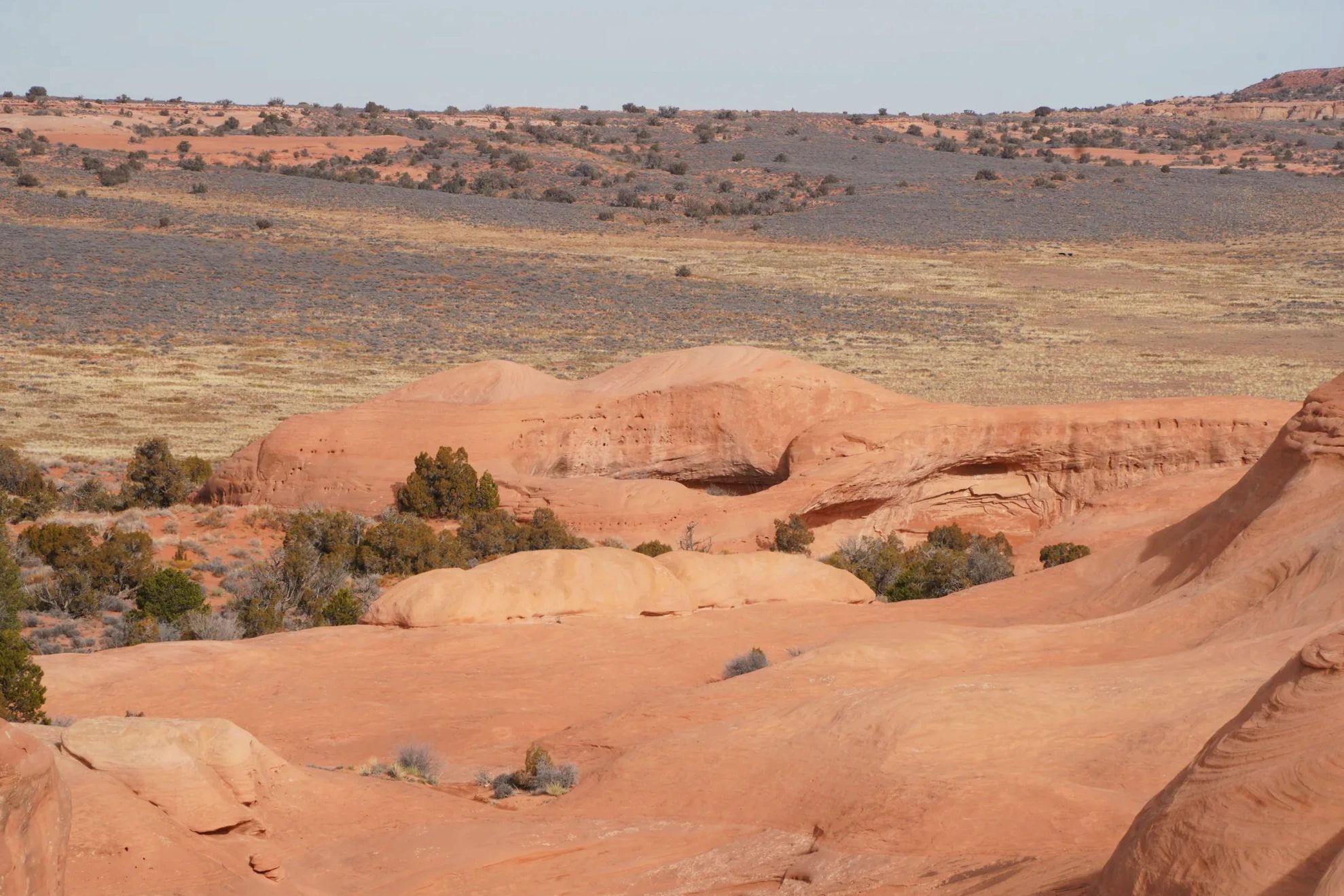
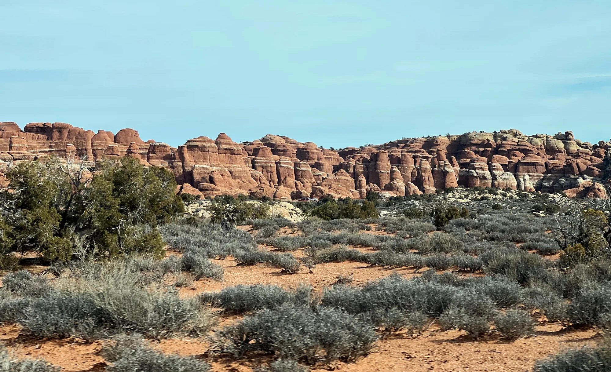
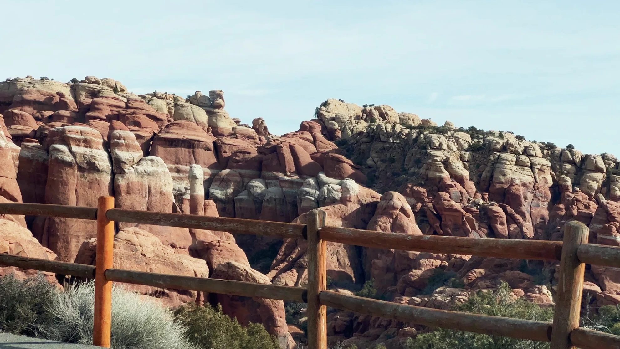
From the trailhead we drove north on the park road and pulled over at Fiery Furnace Viewpoint around 12:30 p.m. Here, thin sandstone walls stand packed together like a maze. The walls rise like fish fins, and rock walls like these are called fins. At sunset the rock looks like it’s on fire, which is how the place got its name. Going in among the fins requires a permit or a ranger-led program, so we only looked from the viewpoint. Above a white-banded layer of rock stood a row of formations with small heads and long bodies. They looked like “little giants.”
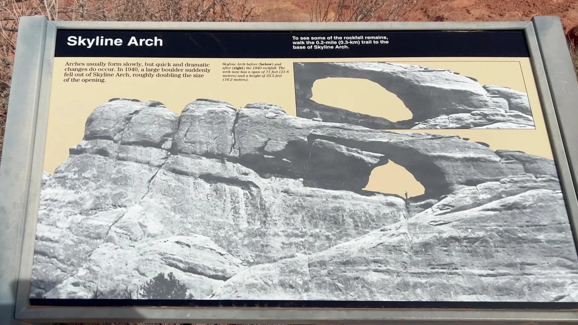
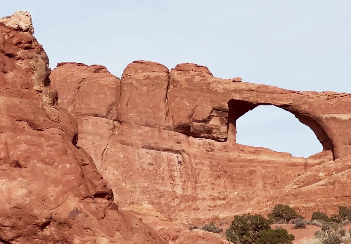
A little farther on, Skyline Arch shows up on the right side of the road, a big opening punched through the rock wall. A roadside sign tells how its shape suddenly changed. In 1940 a large block broke loose from inside the arch, roughly doubling the opening; today it measures 71 ft (21.6 m) wide and 33 ft (10.2 m) high. Arches usually form very slowly, the sign explained, but they can also change in an instant. A walk of about 0.4 mi (600 m) round trip takes you to the base of the arch, where you can see the fallen rock.
Devils Garden to Landscape Arch
We reached the Devils Garden parking lot, at the end of the park road, around 12:50 p.m. The name is said to come from a prospector who roamed the area in the 1920s and gave it to this stretch of fins and arches. Despite the name, the sandy path between the rock walls felt snug and sheltered. Even at midday, frost still whitened the grass along the trail.
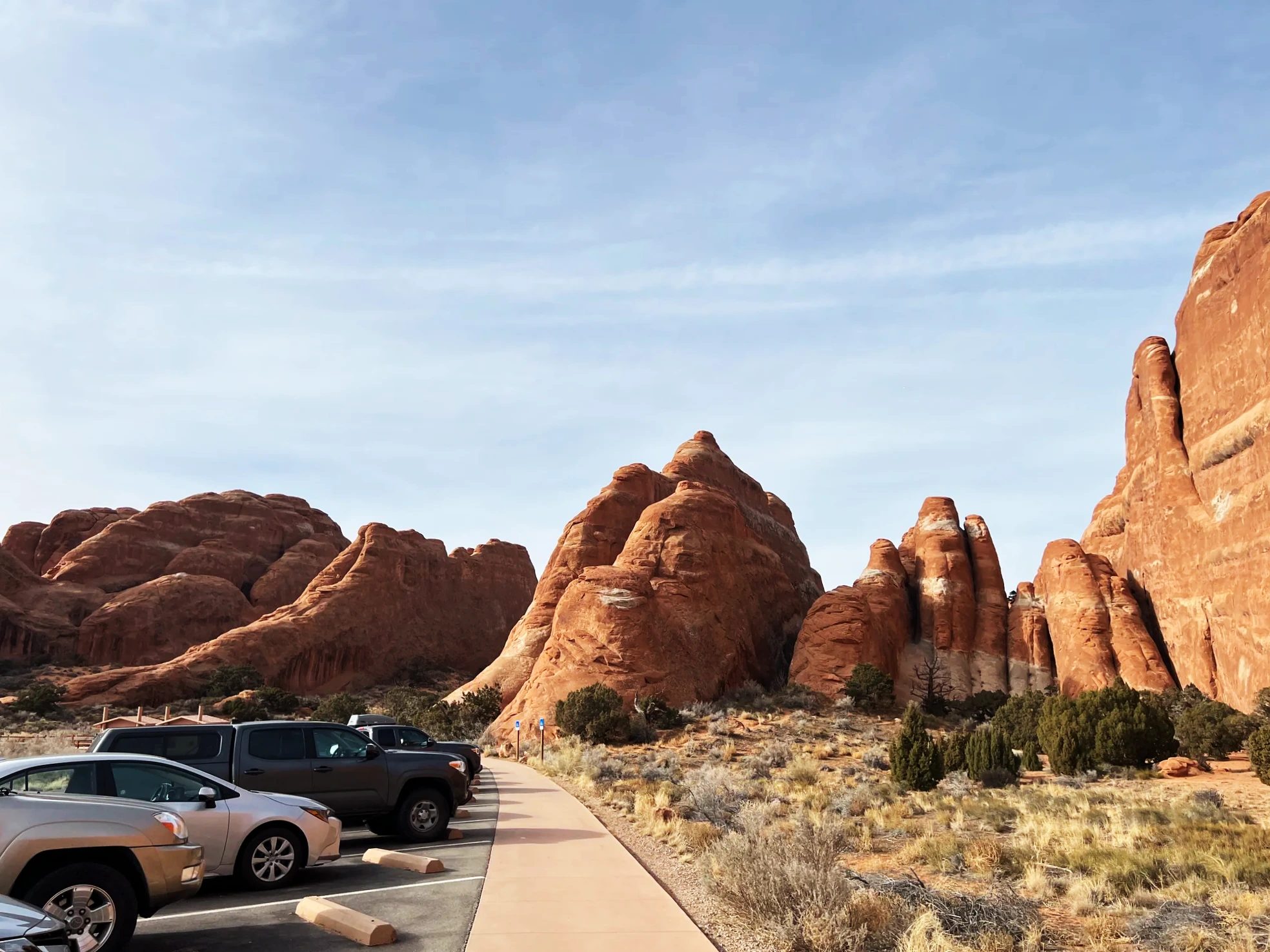
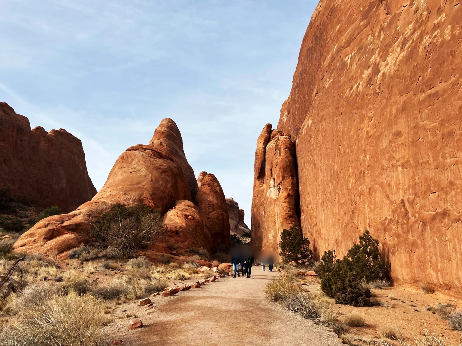
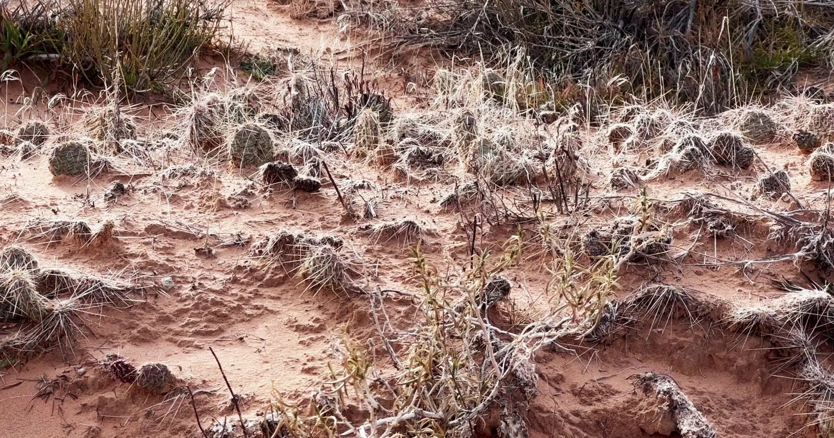
Our kid spotted a hollow dug into the dirt beside the trail, asked whether an animal lived in it, and studied it for a long time. With its low junipers and rounded boulders, the path looked like Hobbiton from The Lord of the Rings. Ravens kept circling overhead. It was one of the most fun walks of the whole trip.
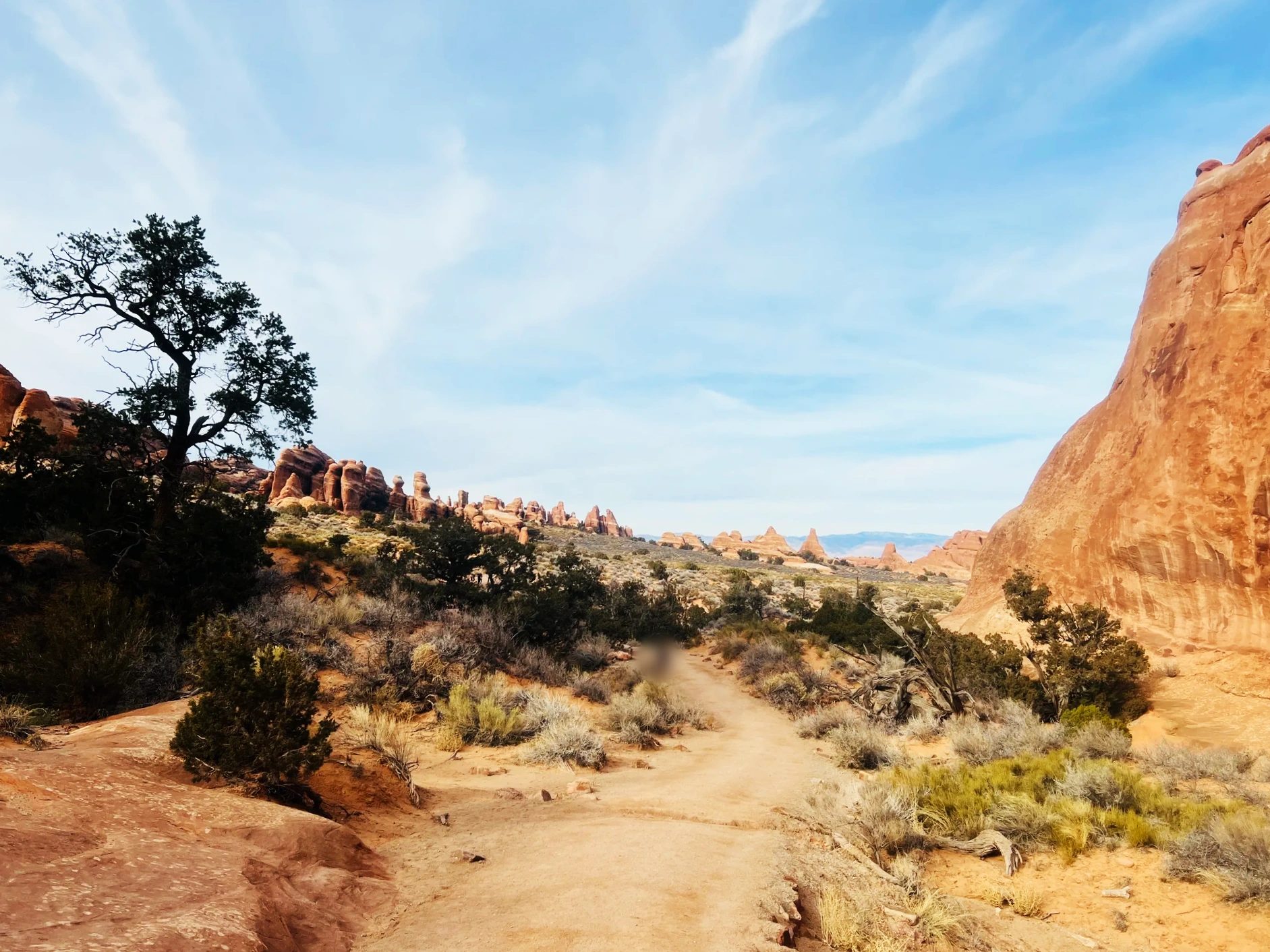
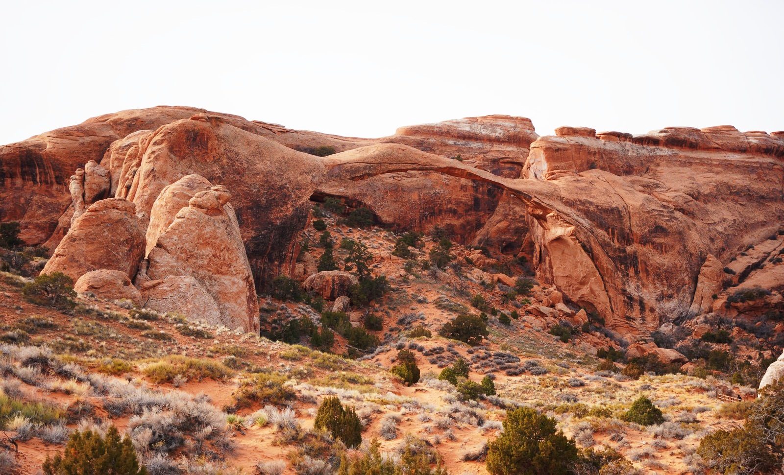
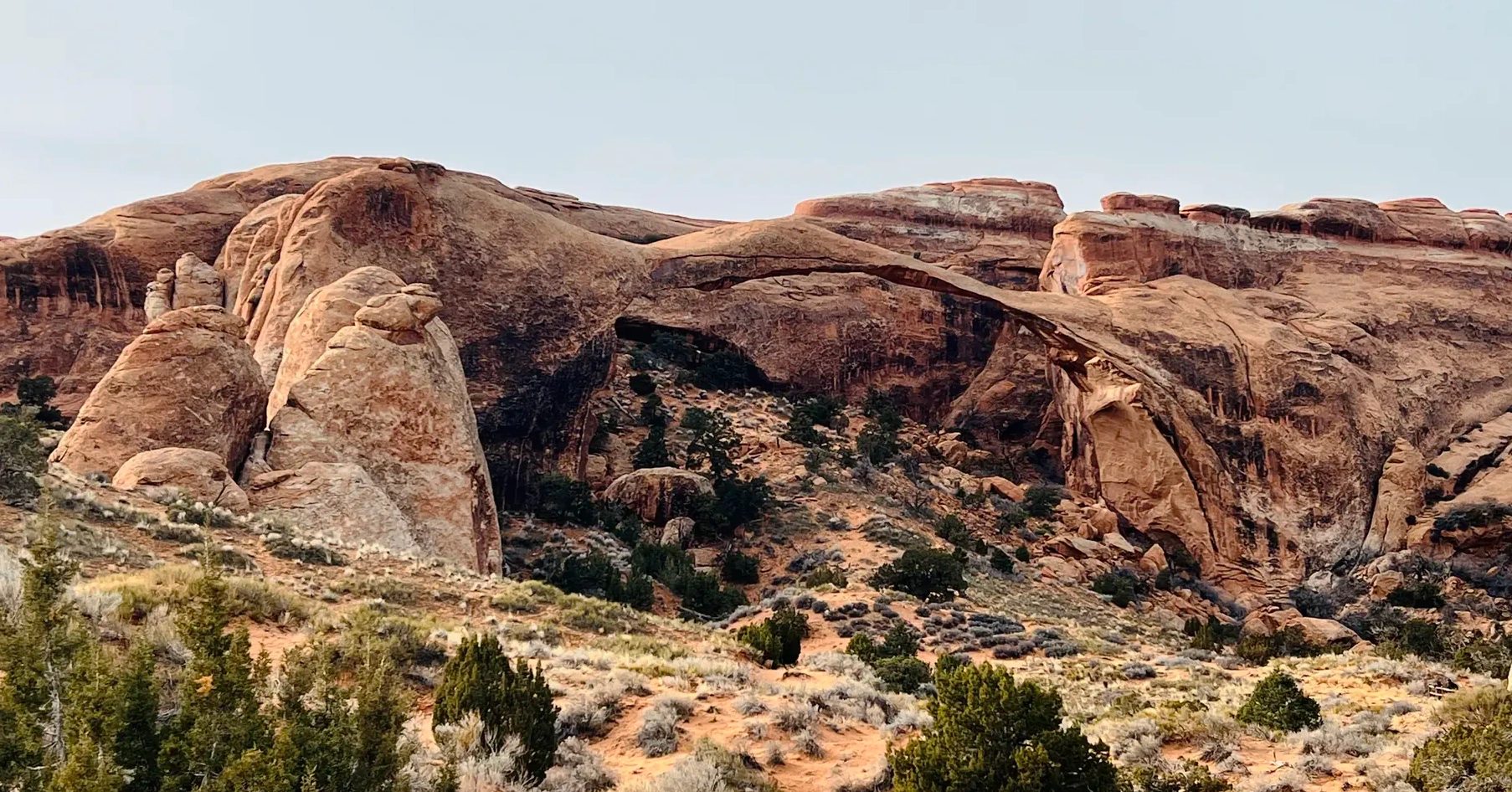
Around 1:20 p.m. we reached Landscape Arch. At 306 ft (93 m) long, it’s the longest arch in North America. At its thinnest it’s less than 6.5 ft (2 m) thick, so from a distance it looks like a single thread strung between the rocks. Large slabs broke off it in the 1990s. The trail continues to more arches farther in, but this is where we turned around.
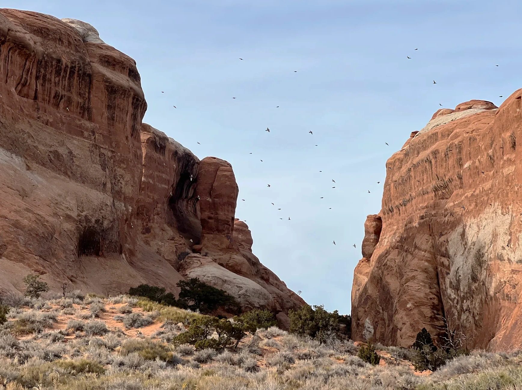
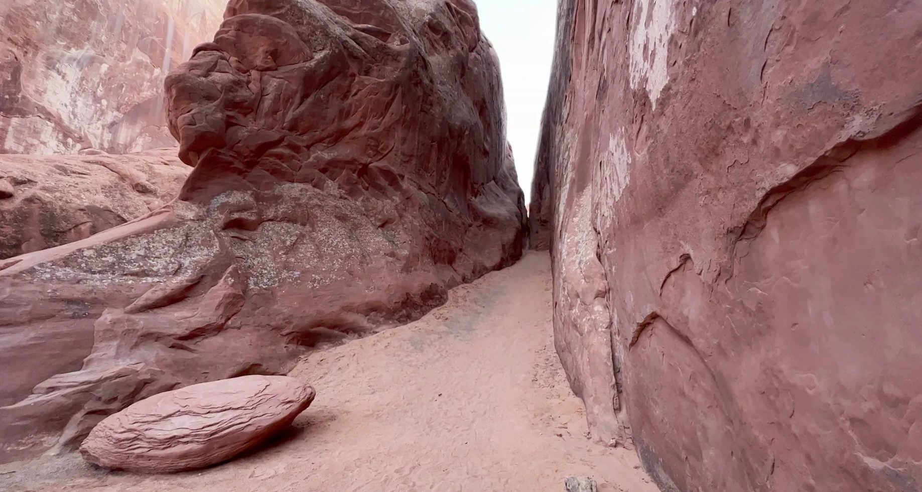
On the way back, a flock of ravens lifted off all at once above a gap in the rocks. Between some of the boulders ran narrow passages with fine sand underfoot, like little alleys. We were back at the parking lot around 1:45 p.m., having walked the 1.8 mi (2.9 km) round trip to Landscape Arch in about 55 minutes.
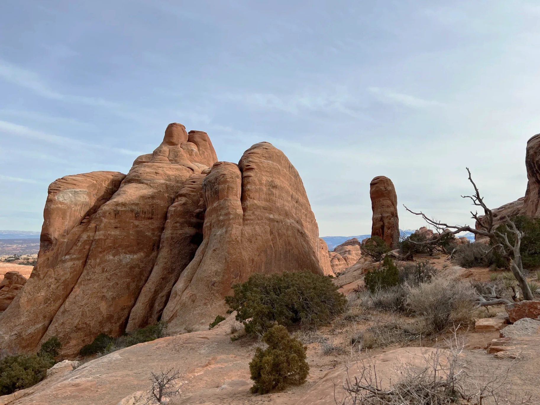
Driving out past Park Avenue
Around 2:05 p.m. we passed Balanced Rock again, the one we had hurried by that morning. By afternoon clouds had spread across the sky, and the rock no longer stood in silhouette. It showed a clear, distinct red.
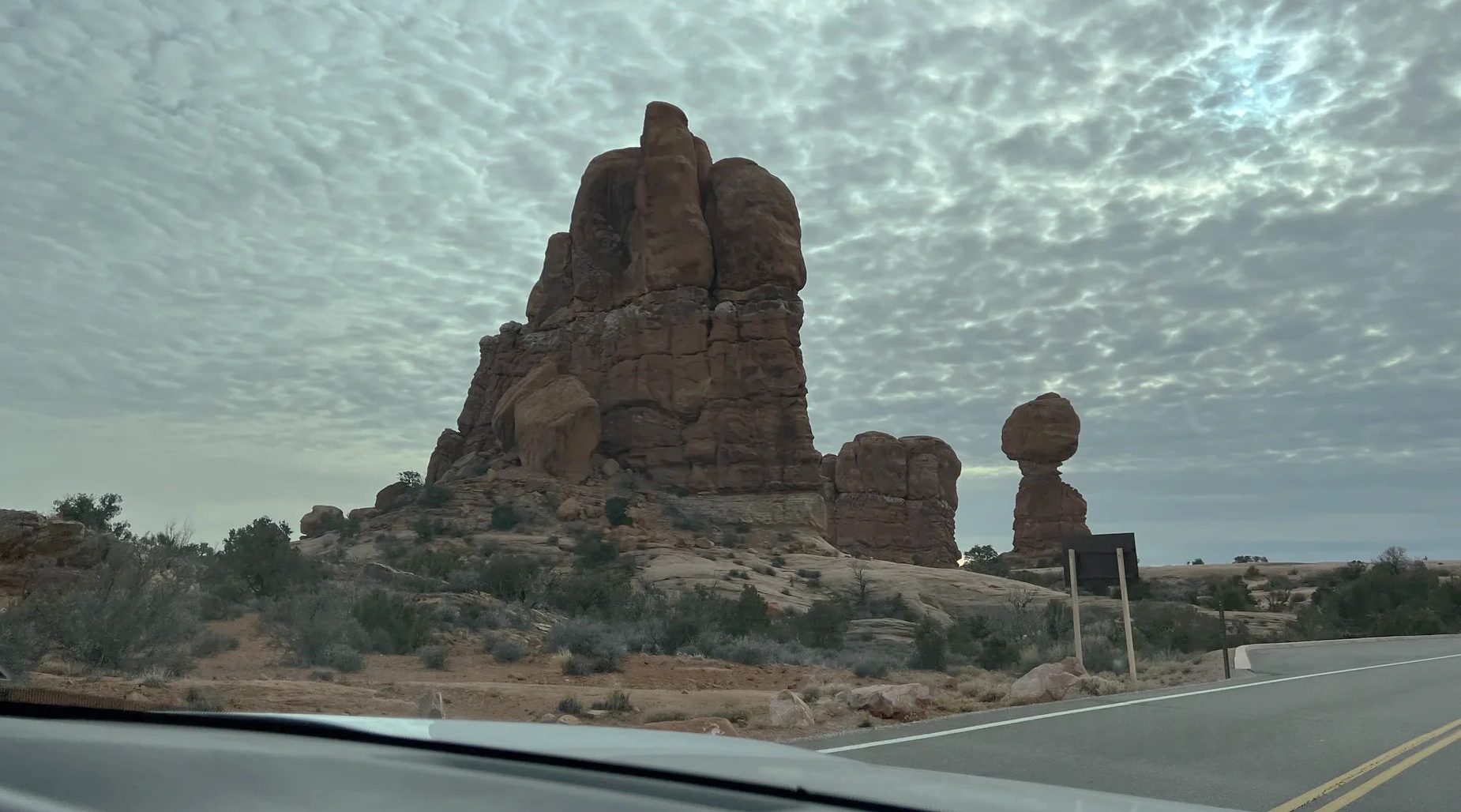
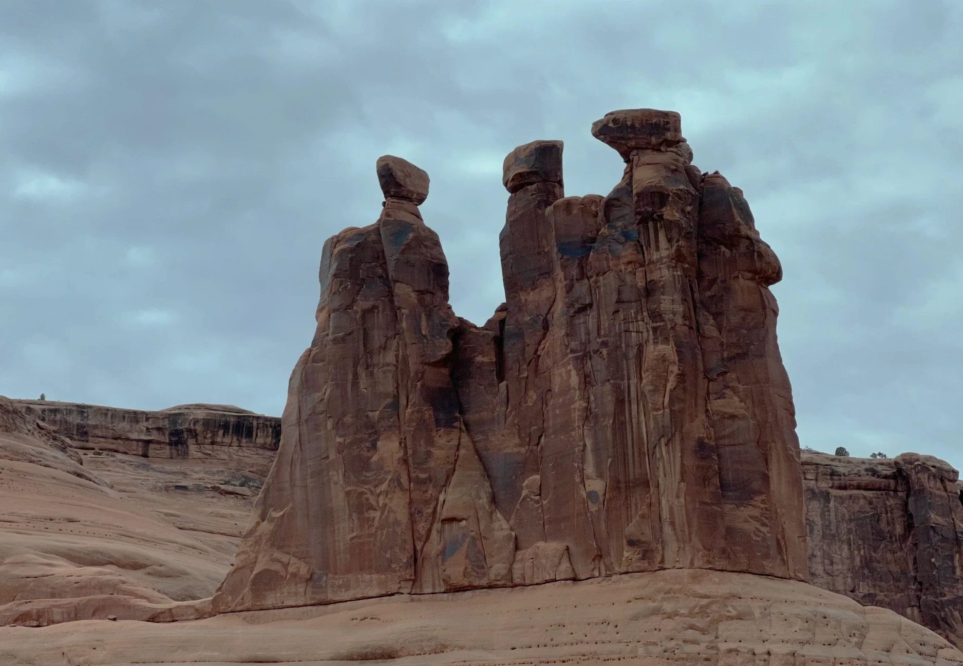
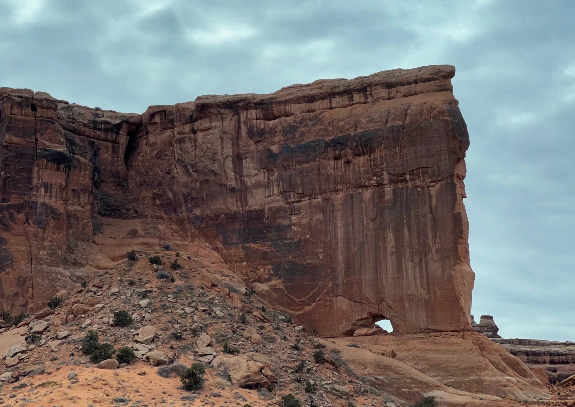
On the way back down toward the entrance, rocks rise along the road like buildings. This is the area around the stretch called Park Avenue. One rock formation looks like three people leaning in to talk, and it has a name to match: the Three Gossips, a sandstone tower about 330 ft (100 m) tall. A rock wall with a small hole near its base slid past the car window too. Many of the rocks reminded us of what we had seen in Monument Valley. The scenery felt familiar but kept changing a little, and we never got tired of it.
We left the park around 2:20 p.m. and drove into Moab. There are no restaurants inside the park, and we wanted to get moving toward our next stop, Goblin Valley, so we picked up lunch at McDonald’s and ate in the car on the road.
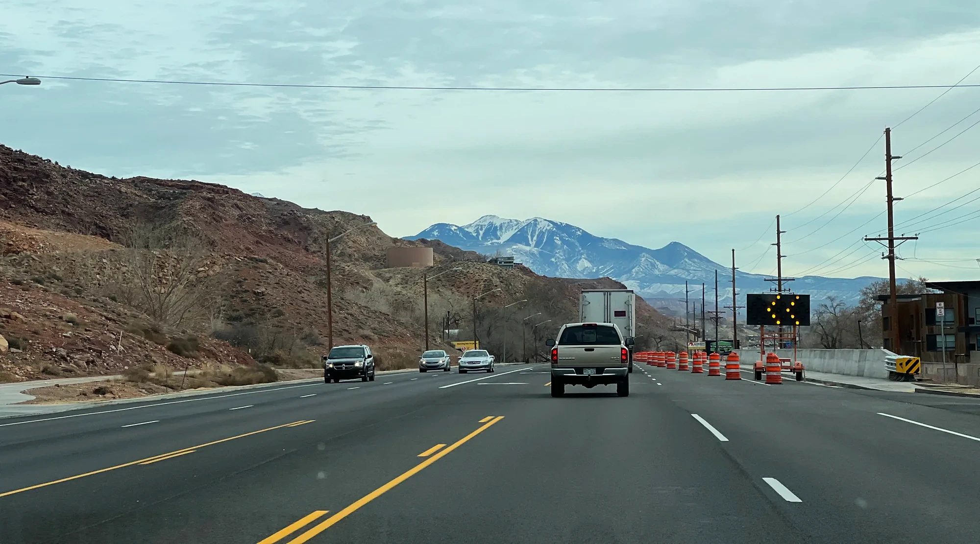
How long each stop took
Arches mixes sights you can see from the car with ones you have to walk to. Here is how our day broke down. These times are with a kid along, so a group of adults would likely move a bit faster.
| Stop | Time | Time spent | Walking |
|---|---|---|---|
| Entrance, Balanced Rock | 8:30–8:50 a.m. | Drove past | None |
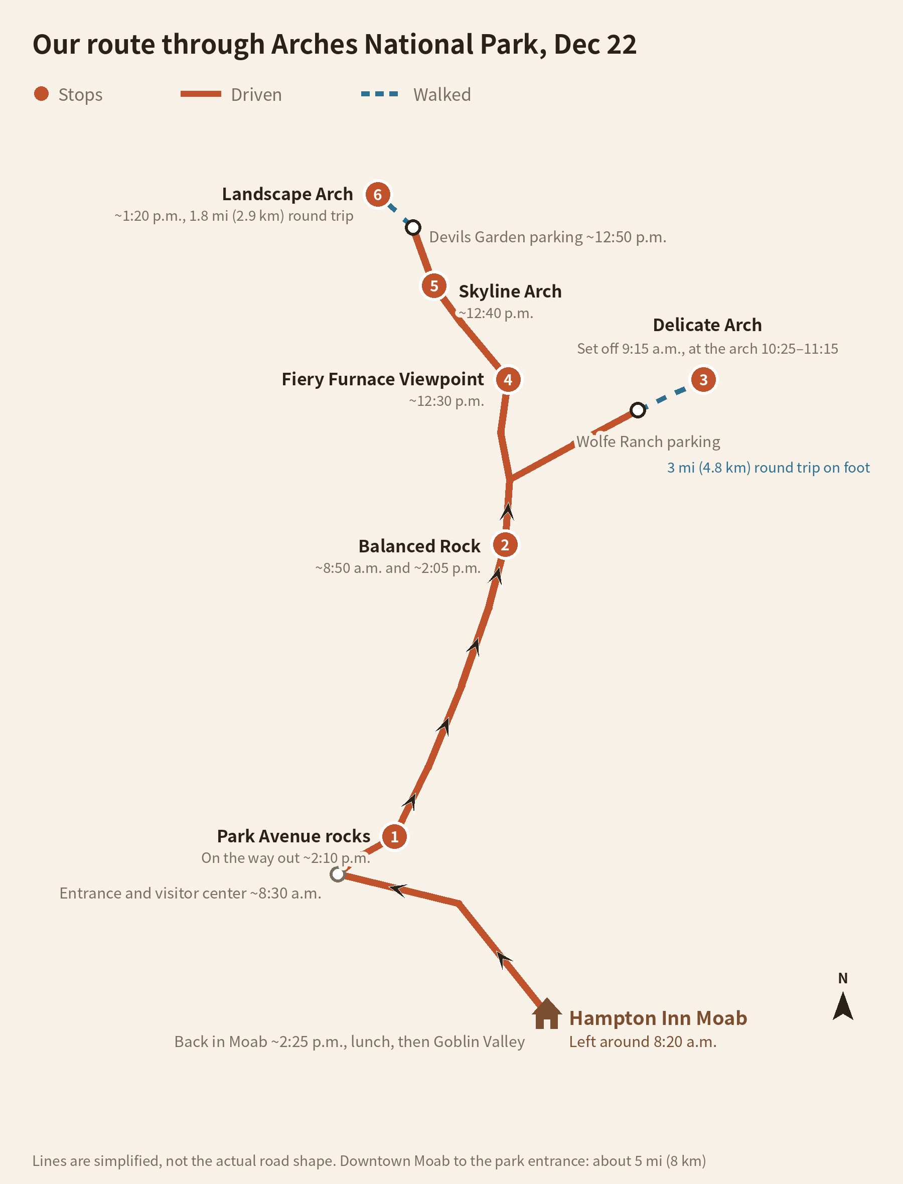
| Delicate Arch trail | 9:15 a.m.–12:05 p.m. | 2 hr 50 min (50 min at the arch) | 3 mi (4.8 km) round trip, 480 ft (146 m) climb |
| Fiery Furnace Viewpoint | 12:30 p.m. | 10 min | Viewpoint only |
| Skyline Arch | 12:40 p.m. | 5 min | Seen from the road |
| Devils Garden, Landscape Arch | 12:50–1:45 p.m. | 55 min | 1.8 mi (2.9 km) round trip |
| Balanced Rock, Park Avenue area | 2:05–2:20 p.m. | Drove past | None |
The park road runs about 18 mi (29 km) from the entrance to Devils Garden. Skip Delicate Arch and you can see most of the park by car in half a day. If you hike to Delicate Arch, plan on half your day for that alone.
December weather and what to wear
December mornings at Arches drop below freezing. On our day, frost covered the trailhead sign, the bridge railing and the grass along the path, and puddles in the shade were frozen. Once the sun was up and we started climbing, though, we warmed up quickly and ended up carrying our jackets. Thin layers you can peel off one at a time work best.
After snow, it’s a different story. The National Park Service warns that the Delicate Arch and Devils Garden trails get slippery quickly after snowfall and recommends traction devices and trekking poles. It also notes that the park road can close for several hours while crews plow. The visitor center is open daily from 9 a.m. to 4 p.m. and closed on December 25.
Fees, passes and reservations
| Item | Details |
|---|---|
| Entrance fee | $30 per vehicle, $25 per motorcycle, $15 per person on foot or by bike (15 and under free) |
| Annual pass | The America the Beautiful annual pass costs $80 for US residents and $250 for non-US residents. If you’re visiting several national parks, as on a Grand Circle trip, it beats paying each entrance fee separately. We got in with an annual pass. |
| Timed entry | Timed-entry reservations were required in peak season starting in 2022, but in 2026 you can enter without one. |
| Facilities in the park | No restaurants and no gas station. You can fill water bottles at the visitor center and the Devils Garden parking lot. |
Two nights in Moab: Monument Valley to Arches
A question we hear often is how to fit Monument Valley and Arches together. We spent a night at The View Hotel in Monument Valley, drove north the next day to catch sunset at Canyonlands’ Island in the Sky, and slept in Moab. Arches came the morning after that.
| Date | Daytime | Where we stayed |
|---|---|---|
| Dec. 20 | Antelope Canyon, sunset at Monument Valley | The View Hotel, Monument Valley |
| Dec. 21 | Valley Drive, Canyonlands’ Mesa Arch and Green River Overlook | Hampton Inn Moab |
| Dec. 22 | Arches in the morning, Goblin Valley in the afternoon | Torrey |
Using one hotel in Moab as a base for both Canyonlands and Arches means unpacking only once. We stayed just one night at Hampton Inn Moab this time, but if you want more time on the trails in both parks, two nights in Moab gives you room to breathe.
Arches is about 6½ hours from Las Vegas by car, which makes it hard to do as a day tour. Our full Grand Circle itinerary, with hotels and the rental car, is in the winter Grand Circle 10-day itinerary.
FAQ
Do you need a reservation for Arches National Park?
In 2026 you can enter without a timed-entry reservation. Pay the fee at the entrance or show a national parks annual pass. The park did run a reservation system for daytime hours in peak season for several years starting in 2022, so check the park’s official page for that year’s policy before you go.
Do you have to hike a lot?
Not necessarily. Balanced Rock, the rocks around Park Avenue, Fiery Furnace Viewpoint and Skyline Arch can all be seen from roadside pullouts. To see Delicate Arch up close, though, you need to hike 3 mi (4.8 km) round trip with a climb, and Landscape Arch is a flat 1.8 mi (2.9 km) round trip. At our pace, with a kid, Delicate Arch took 2 hours 50 minutes including our break at the arch, and Landscape Arch took 55 minutes.
Is December a good time to visit?
It was for us, on our winter Grand Circle trip. There were few people, and once the sun came out the sky was clear and it wasn’t too cold to walk. Mornings do drop below freezing, though, leaving frost and thin ice on the trails. If you’re going right after a snowfall, bring traction devices and check whether the park road is closed first.
Where should you go for sunset?
Delicate Arch glows red at sunset and is the park’s most popular sunset spot. The trailhead sign also lists late afternoon as the best time to photograph the arch. The National Park Service notes, however, that hundreds of people can gather at the arch at sunset. Visit Utah also suggests Panorama Point and the Windows Section for evening views. When we hiked in the morning, the arch was much quieter.
Are there restaurants in the park?
No. There are no restaurants or stores inside the park, so bring water and snacks with you. You can refill water at the visitor center and the Devils Garden parking lot. We bought lunch in Moab after we left.
Can you visit at night?
Arches is open 24 hours a day, year-round, and is certified as an International Dark Sky Park. Many people come at night to stargaze or take photos. Lighting up the rocks for photography, however, is not allowed.
Sedona or Arches, if you can only pick one?
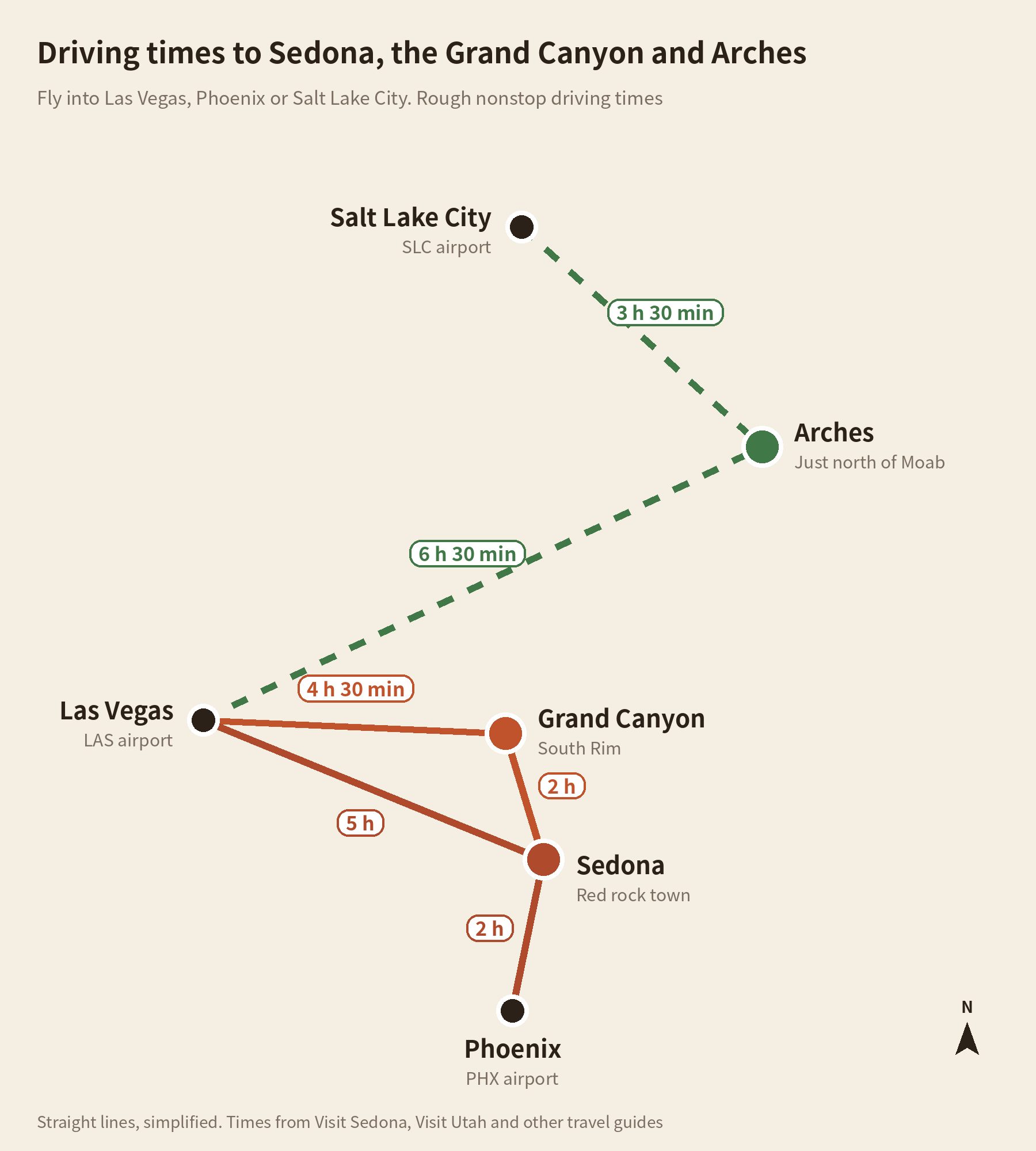
Start with which airport you fly into. From Las Vegas, the natural route runs to the Grand Canyon’s South Rim (about 4½ hours) and then down to Sedona (about 2 hours from the South Rim); from the Phoenix airport, Sedona is about 2 hours by car. Arches sits at the far eastern edge of Utah, about 6½ hours from Las Vegas, but only about 3½ hours from the Salt Lake City airport, closer than you might think. That means Utah’s parks, Arches and Canyonlands among them, also work as a separate trip through Salt Lake City. On a short trip starting in Las Vegas, pair the Grand Canyon with Sedona and save Arches for another trip flying into Salt Lake City. Distance and driving aside, the two feel different. Sedona has an overwhelming setting, with red rock mountains wrapped around the town. Arches is scattered with thousands of arches carved from sandstone, with colors and shapes that are hard to find anywhere else. Sedona stayed with us more, but hiking up to the arch on Utah’s license plate was worth the long drive.
If we went back
Our morning at Arches was wonderful. As the sun rose, the sky cleared to that deep blue you get in the West, and the sandstone below came alive in the sunlight, a mix of orange and red. That light, where blue sky meets red rock, is what makes Arches feel like Arches. But the color of the rock changes a lot depending on the light, so next time we’d like to hike up to Delicate Arch in the late afternoon and stay for sunset. We also find ourselves wondering what the arch looks like after dark, under the stars.
A walk that began on a frosty morning ended under an arch at midday. The holes in these rocks are still opening and still falling away. With more than 2,000 arches on record in the park, we saw these on one day somewhere in that long stretch of time.
Related posts
| Part | Post |
|---|---|
| Full itinerary | Winter Grand Circle: a 10-day road trip by rental car Route, hotels and bookings for all 15 stops |
| Previous | Canyonlands’ Island in the Sky in December Mesa Arch, sunset at Green River Overlook, Hampton Inn Moab |
| Next | Goblin Valley and Capitol Reef, then Byway 12 to Bryce Dusk in the hoodoos, petroglyphs and Hickman Bridge, Scenic Byway 12 to Bryce Canyon |
Location and route
From the Hampton Inn on the north side of Moab, the Arches entrance is about 10 minutes up Route 191. The park road runs about 18 mi (29 km) from the entrance to Devils Garden at its northern end. Partway along, a side road branches off to Wolfe Ranch, where the Delicate Arch trail starts. We hiked Delicate Arch first, drove up to the north end, then came back down the same road.
What we used on this trip
Booking
- Hotel in MoabThe Arches entrance is just over 10 minutes away, so we were on the trail early.Hampton Inn Moab (US dollars)Hampton Inn Moab (Canadian dollars)
- Rental carWe picked it up at the Las Vegas airport and drove it for nine days. Every road in Arches is paved, so a regular car is fine.Las Vegas airport car rentals
- Annual park passWith several national parks on the route, it came out ahead of paying each entrance fee. You can buy it at the park entrance.
Gear
- MicrospikesThere was a thin layer of ice on the shaded slickrock and in the puddles.Microspikes
- WaterAs the trailhead sign advised, we carried 1 liter (about 1 quart) per person.Insulated water bottle
- Layers that come off easilyThe temperature swung a lot between the frosty morning and the warmer stretch once we were walking.
- Tripod and camera remoteThe Peak Design carbon tripod was light enough to carry the whole 3 mi (4.8 km) without noticing it, and with the remote we got photos of all three of us together.Peak Design Travel TripodBluetooth camera remote
- A pack that stays putThe Peak Design bags didn’t shift around, even on the climb.Peak Design backpack
We found our way around the park and to the trailheads with the maps app on our phones.
For flights, search with Las Vegas as your destination.
Getting there
Flights to Las Vegas
Sources
- National Park Service: Arches fees and passes, visiting in winter, Delicate Arch, Skyline Arch, Landscape Arch, Wall Arch collapse (checked October 23, 2026)
- NASA: The Arches That Salt Built
- Discover Moab: Arches National Park, The Salt Lake Tribune on the end of timed entry in 2026, Visit Utah: Arches travel tips, Visit Sedona: getting to Sedona
Not in the list? Search it yourself
Places to stay nearby, on a map
Affiliate link: if you book through this search, the blog earns a commission at no extra cost to you. Results open in a new tab. About affiliate links
Discover more from Elsewhere, Mostly
Subscribe and get new posts sent straight to your inbox.