Grand Circle in winter, part 5: Tuesday, December 21, 2021, midday to night
We drove from Monument Valley, took a wrong turn toward the Needles and doubled back. We watched dusk from a mesa that looks like an island floating in the sky, then spent the night in Moab.
- This postDay five, afternoon, of a counterclockwise winter road trip around the Grand Circle in a rental car. From Monument Valley we drove north into Utah to Canyonlands National Park. We headed toward the Needles district by mistake and turned around, then saw Mesa Arch and Green River Overlook in Canyonlands Island in the Sky and spent the night at the Hampton Inn in Moab.
- Date and weatherDecember 21, clear, then high clouds in the afternoon (sunset around 5 p.m.)
- StopsChurch Rock and UT-211 The road to the Needles district; we turned back partwayMesa Arch Island in the Sky district, 0.5-mile (800 m) round-trip loopGreen River Overlook Sunset viewpoint
- AdmissionIt’s a national park, so there’s an entrance fee. The national parks annual pass is accepted.
- ReservationsA room in Moab. Nothing to book for the park itself. To skip the driving, there are guided tours from Moab.
- Where we stayedDecember 21: Hampton Inn Moab
- Who wentThe three of us (one kid)
- The day’s routeTuesday, December 21, midday to night
- Leave Mexican HatDriveContinued from the previous post
- 🚗 US-163, US-191
- Church Rock and UT-211SightDrove toward the Needles, turned back around 1:40 p.m.
- 🚗 US-191 north, UT-313
- Mesa ArchSight1 hrIsland in the Sky district
- Green River OverlookSight45 minSunset
- 🚗 UT-313, US-191
- Dinner in MoabMealThai food
- Hampton Inn MoabStayHeated outdoor pool, open in winter
Table of contents
North from Monument Valley on US-191
We passed through Mexican Hat, a small town named for a hat-shaped rock, followed US-163 to Bluff, then turned north onto US-191. From Bluff up through Blanding and Monticello, the small towns of southeastern Utah come every 30 to 40 minutes.
Past Blanding, snow-covered mountains appeared up ahead. After nothing but Monument Valley’s red rock, the white peaks made it feel like we had driven into another season on the same day.
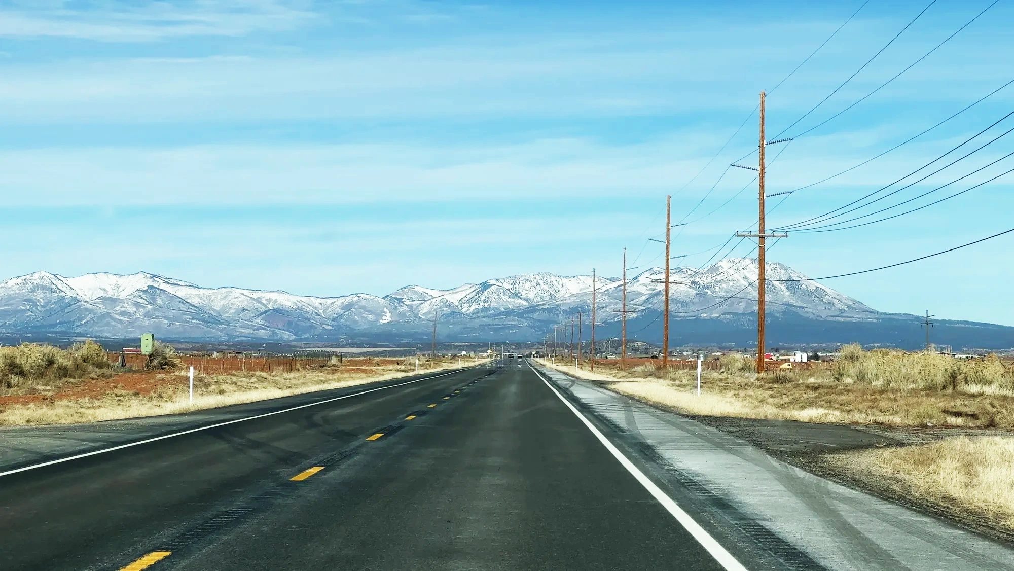
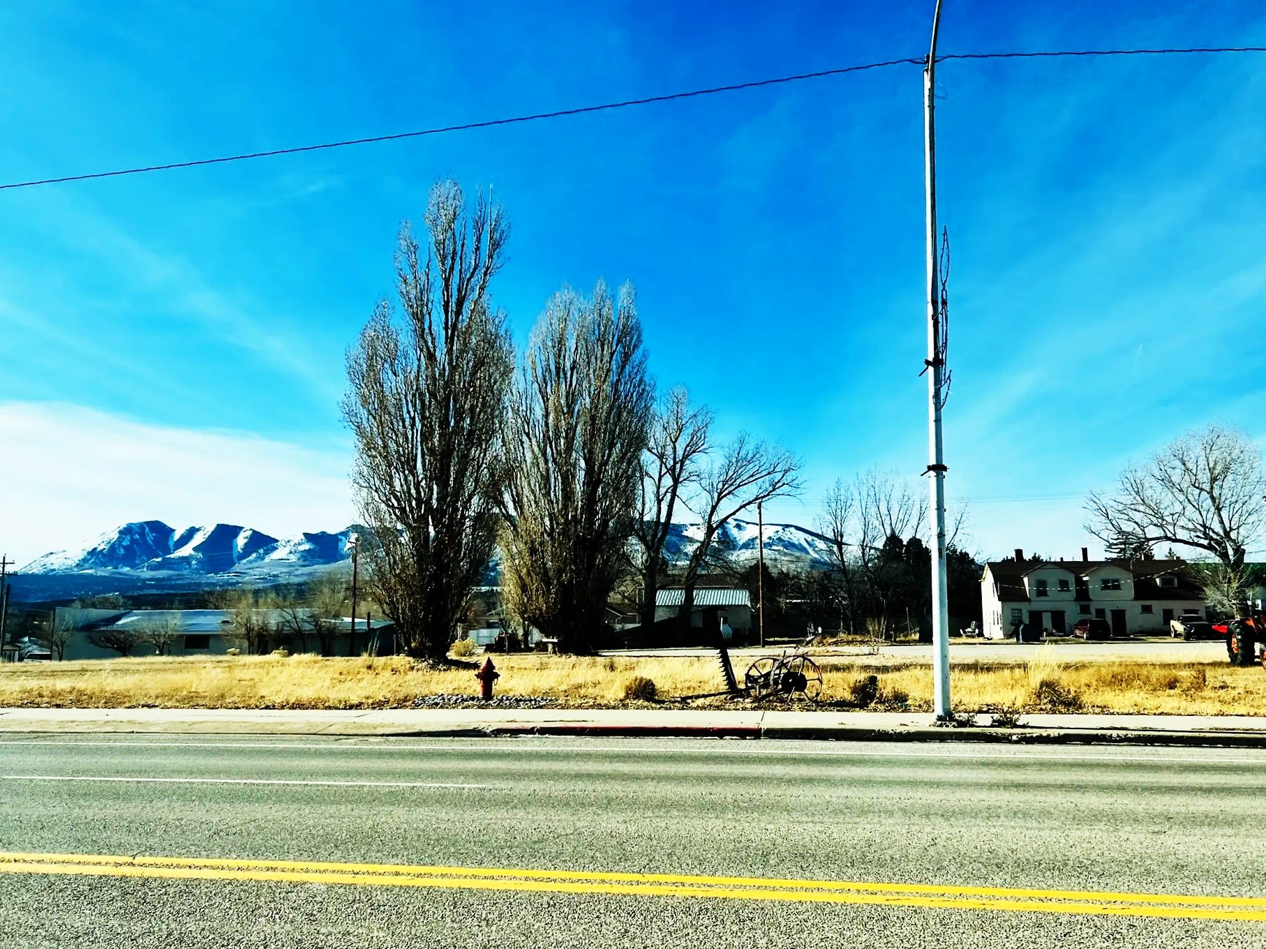
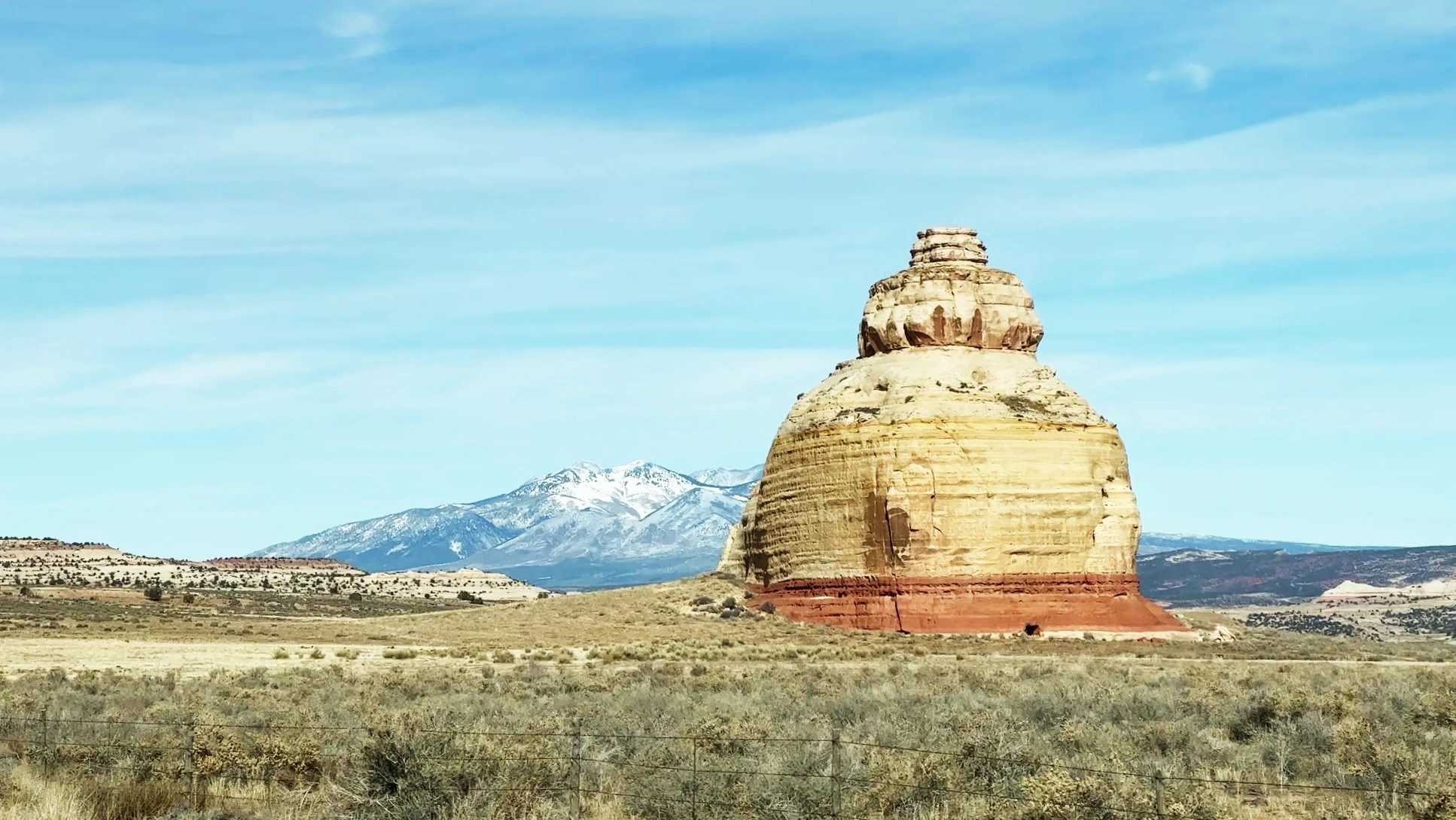
About 15 minutes past Monticello, a lone rock shaped like a rounded tower stands beside the road. This is Church Rock. UT-211 branches off west here, and if you follow it to the end, you reach the Needles district of Canyonlands National Park.
A long detour on UT-211 toward the Needles
Thinking it was the way to Canyonlands, we turned onto UT-211 at Church Rock. The road soon dropped into a narrow canyon. Snow still lay on every shaded slope, and a little farther on, red cliffs lined Indian Creek like a folding screen.
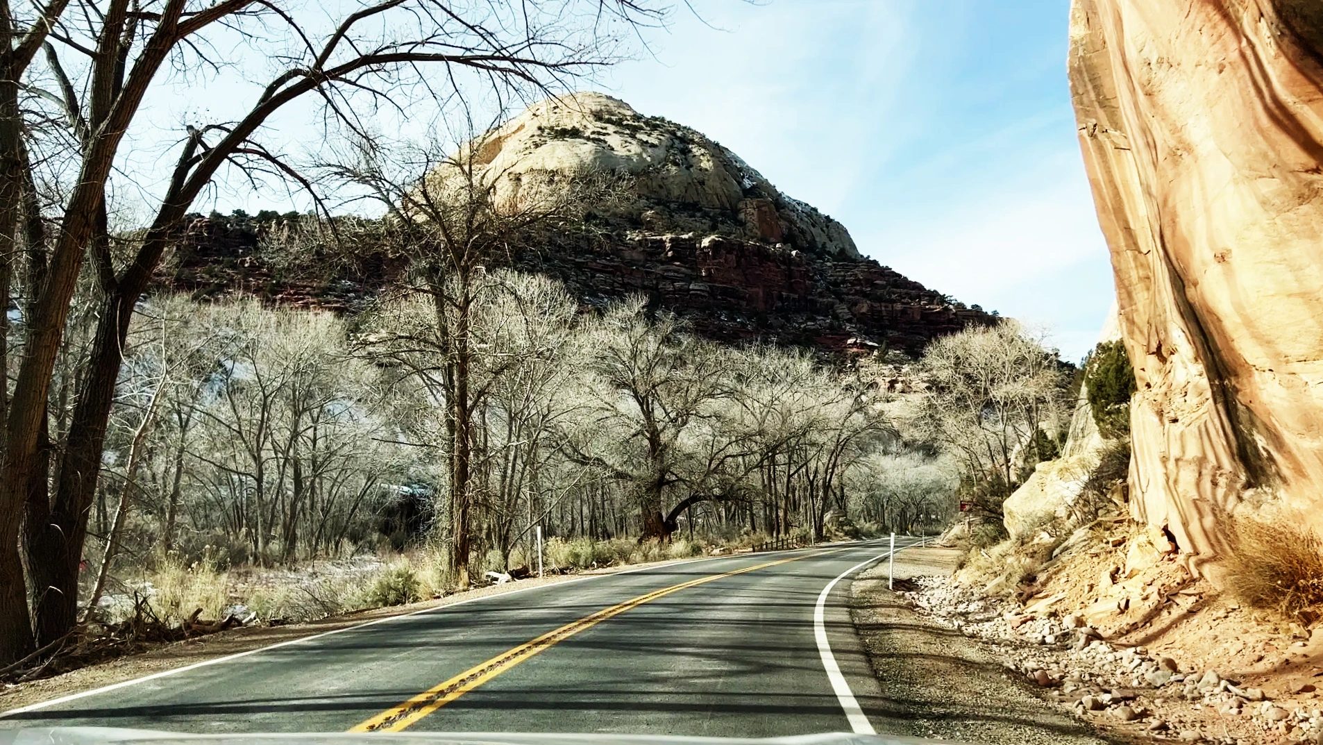
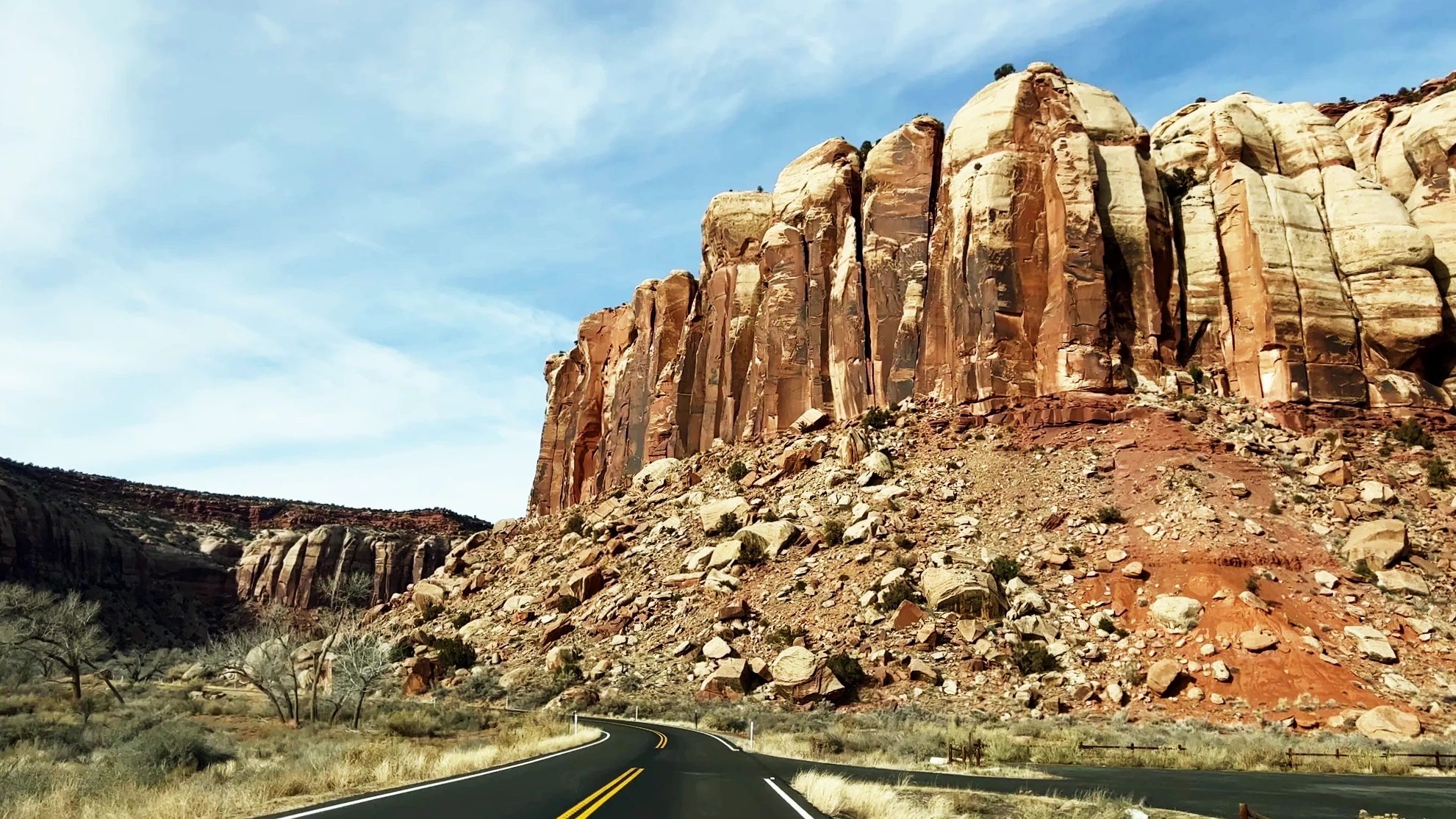
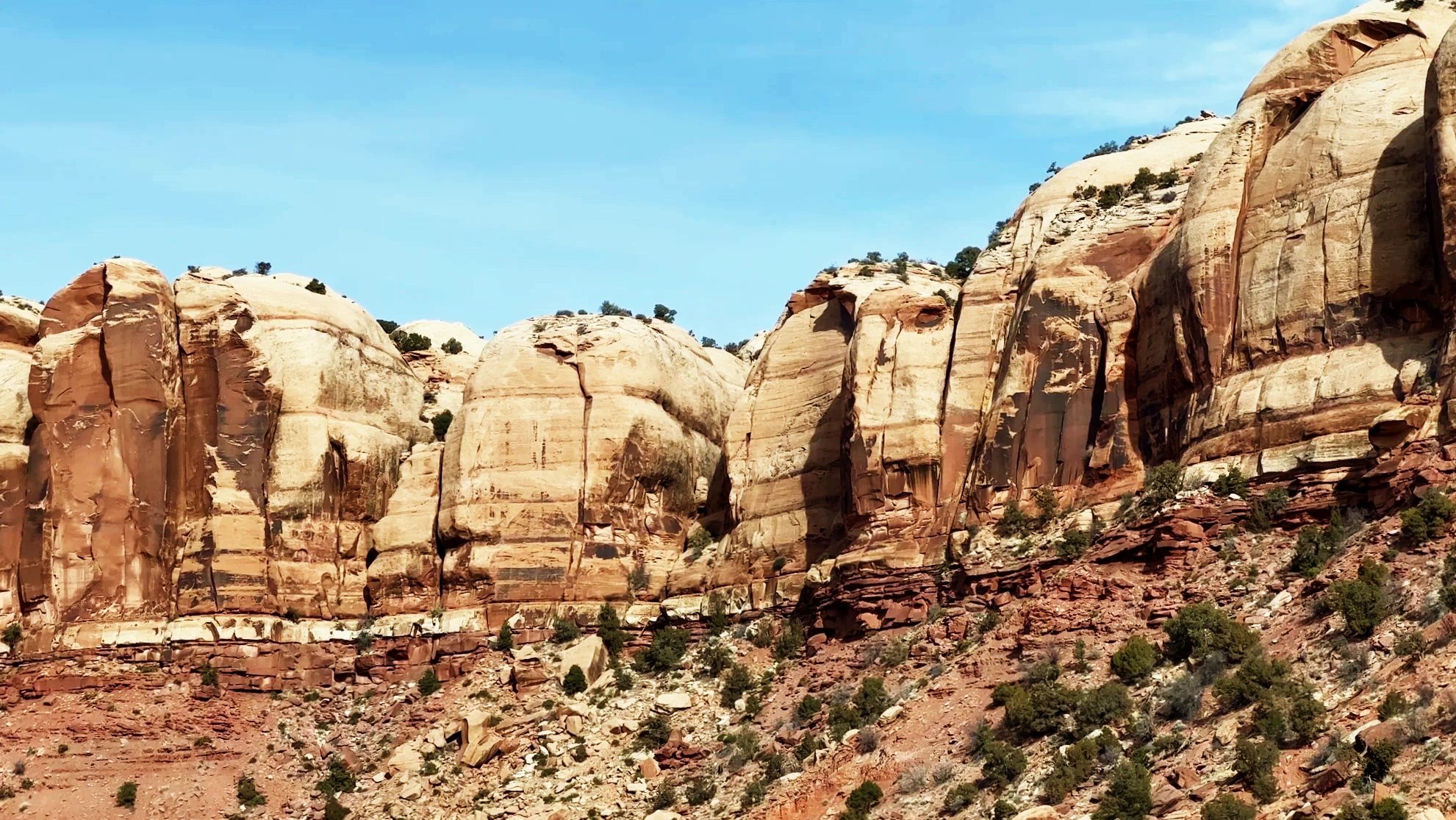
Every bend brought cliffs and rocks of a different shape, and we kept driving for a long while just for the scenery.
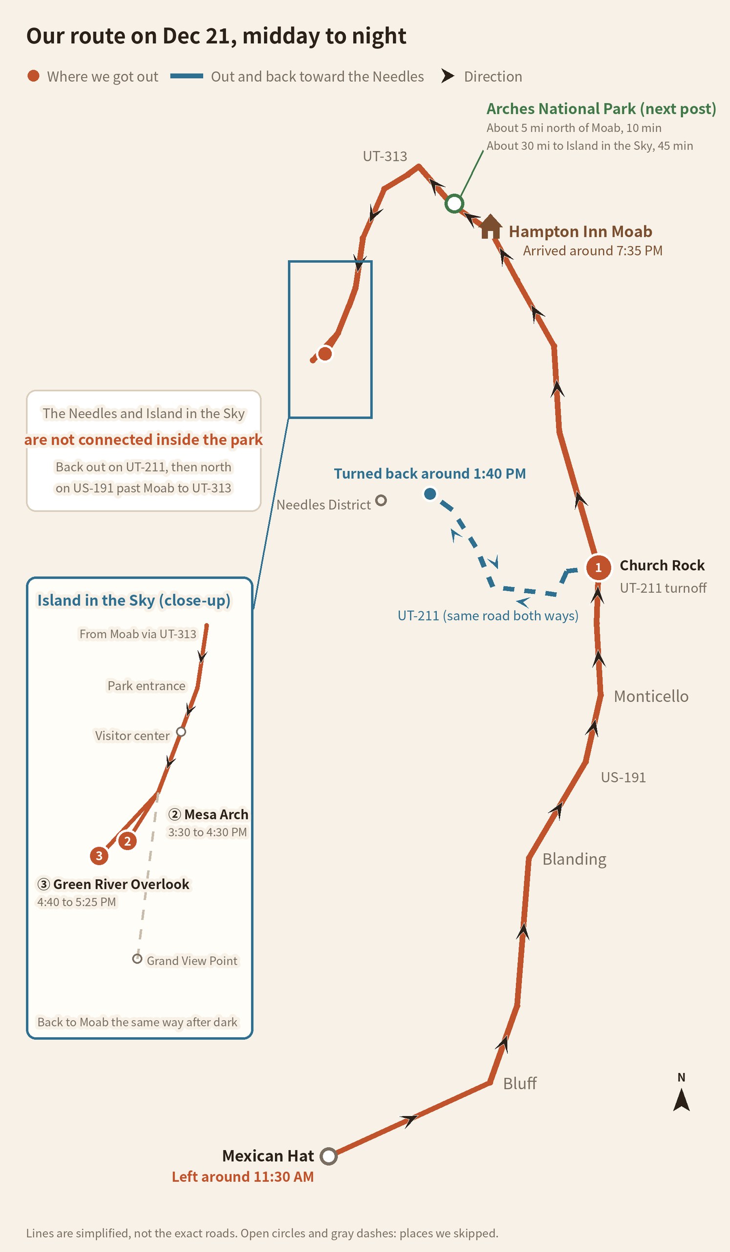
The catch: this road doesn’t go to Mesa Arch, which was what we had come to see. Mesa Arch is in the Island in the Sky district, and no road inside the park connects it with the Needles. We figured that out around 1:40 p.m., about 5 miles (8 km) short of the Needles visitor center. We skipped the Needles and turned the car around right there.
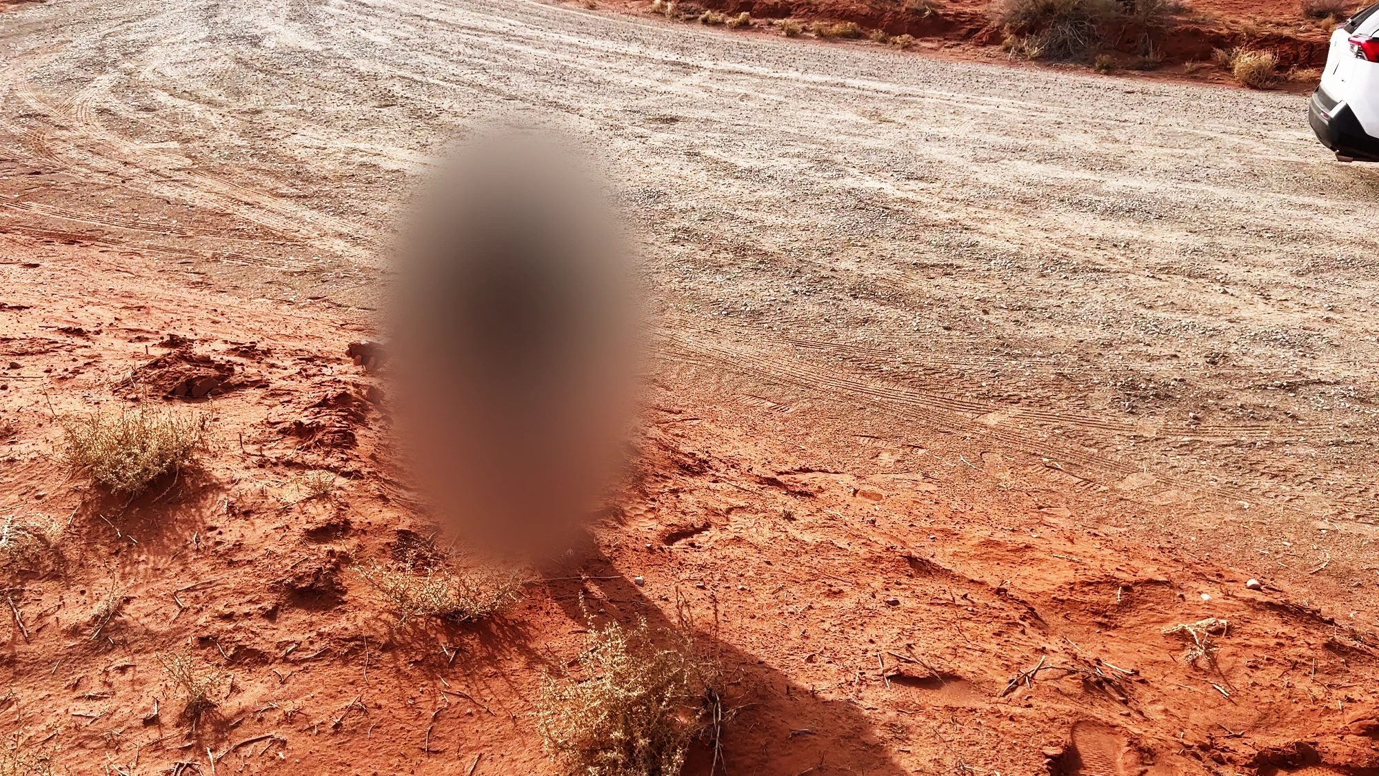
Before heading back, we stopped briefly at a field of red sand. Our kid was thrilled by the sand alone and ran around kicking it up.
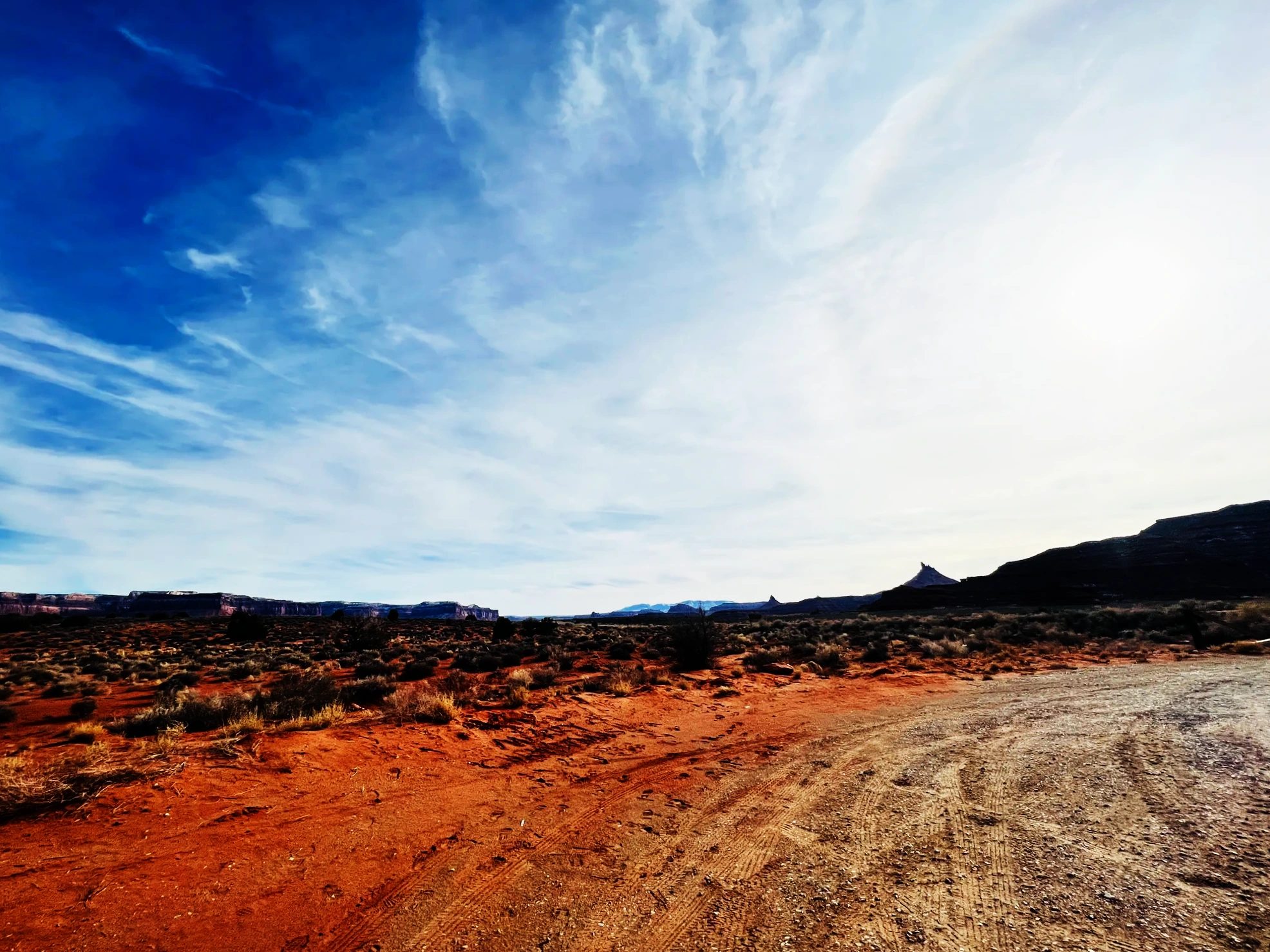
All told, the wrong turn added about 43 miles (70 km) of UT-211, out and back. If it’s your first visit, put the district visitor center into your GPS, something like “Island in the Sky Visitor Center,” instead of the park name. The National Park Service itself warns that GPS often sends people the wrong way and recommends checking a map too.
Canyonlands at a glance: three districts and the rivers
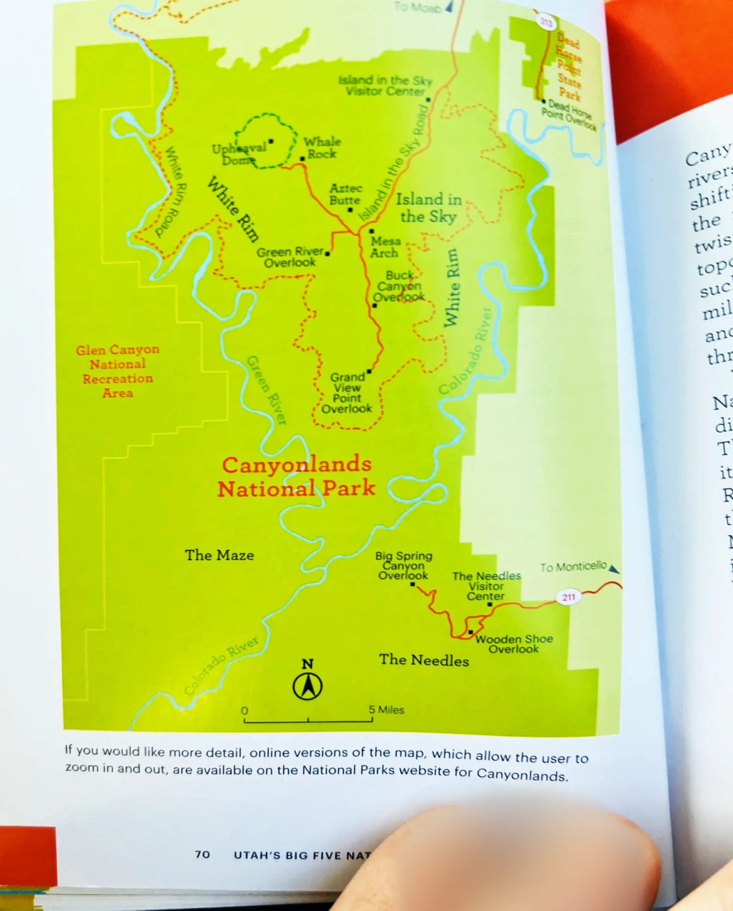
Canyonlands is a national park in southeastern Utah, southwest of Moab. The Green River coming down from the north and the Colorado River coming in from the east meet in the middle of the park and split the land into a Y. Between them, deep canyons and high mesas (flat-topped land ringed by cliffs) stack up layer after layer. Below the confluence, the Colorado flows south and eventually runs through the Grand Canyon in Arizona. Same river, but two separate national parks.
The National Park Service divides the park into four districts: the three land areas separated by the rivers, plus the Rivers themselves. If you only have half a day, as we did, Island in the Sky is the easy pick. It’s closest to Moab and every road is paved.
| District | From Moab | What it is | What we did |
|---|---|---|---|
| Island in the Sky | About 40 minutes north via US-191 and UT-313 | A scenic drive between overlooks on top of a high mesa: Mesa Arch, Green River Overlook, Grand View Point | Mesa Arch and Green River Overlook |
| The Needles | About 1 hour 30 minutes south via US-191 and UT-211 | A hiking area among banded rock spires | Mistook it for the way to Mesa Arch; turned back about 5 miles (8 km) short of the visitor center |
| The Maze | West, on 4WD dirt roads | The most remote backcountry district | Didn’t go |
| The Rivers | By boat from Moab | The Green and Colorado rivers inside the park, reached by raft or canoe | Didn’t go |
No roads inside the park link the districts. To get from one to another, you leave the park and drive around, which takes 2 to 6 hours.
Through Moab and up to Island in the Sky
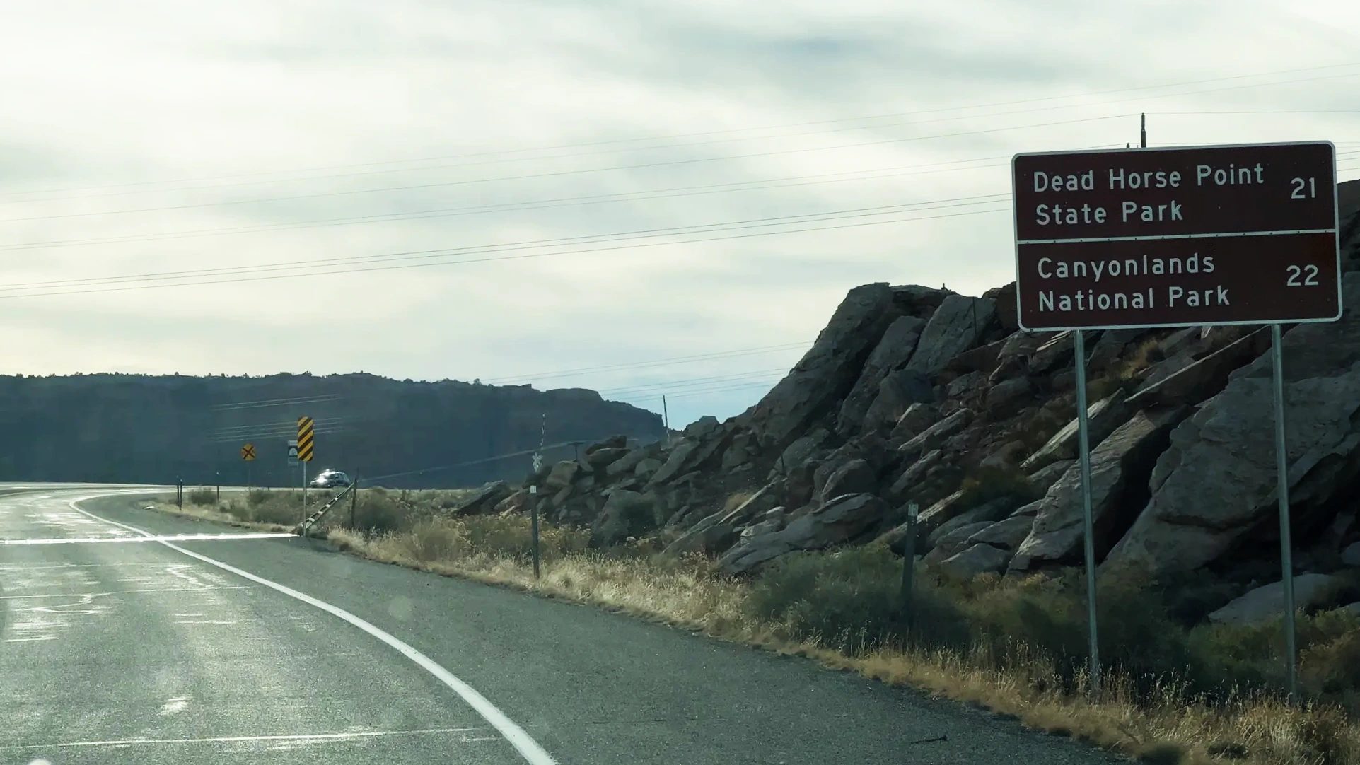
Back on US-191, we drove north for about an hour and rolled into Moab. There are no gas stations in the park, so we filled up in town, continued a little farther north and turned onto UT-313. A sign at the junction pointed to both Dead Horse Point State Park and Canyonlands National Park.
UT-313 winds up a grade and then runs out across a flat plateau. In the car, we looked at the map in the park brochure, and it was obvious at a glance that the rivers cut the park into three pieces. Had we seen that map earlier, we never would have turned onto UT-211.
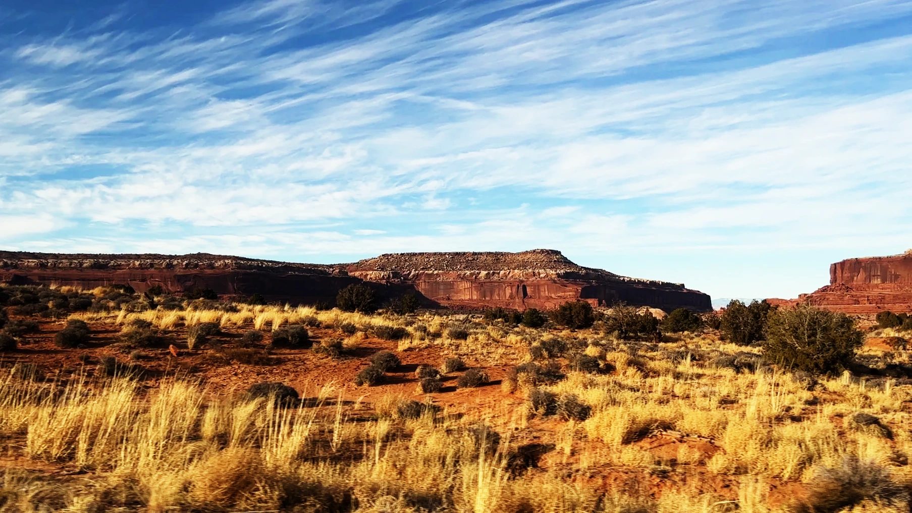
Past the park entrance, both sides of the road open into wide grassland and low junipers. The district sits on a huge mesa that rises about 1,000 feet (300 m) above the surrounding land, at an elevation of about 6,100 feet (1,860 m). Once you’re on top, it’s so flat you hardly sense how high you are. Hence the name: an island floating in the sky. Having been there, I can’t think of a better one.
From downtown Moab to the Mesa Arch parking lot took about 50 minutes by car. We got there around 3:30 p.m. We had a national parks annual pass, so we showed it at the entrance and drove in.
Mesa Arch, a stone bridge on the cliff edge
Mesa Arch is reached on a loop trail of about 0.5 mile (800 m) round trip from the parking lot. There’s hardly any climbing, so it’s an easy walk with a kid. The rocks along the trail are pocked with holes worn out by wind and water.
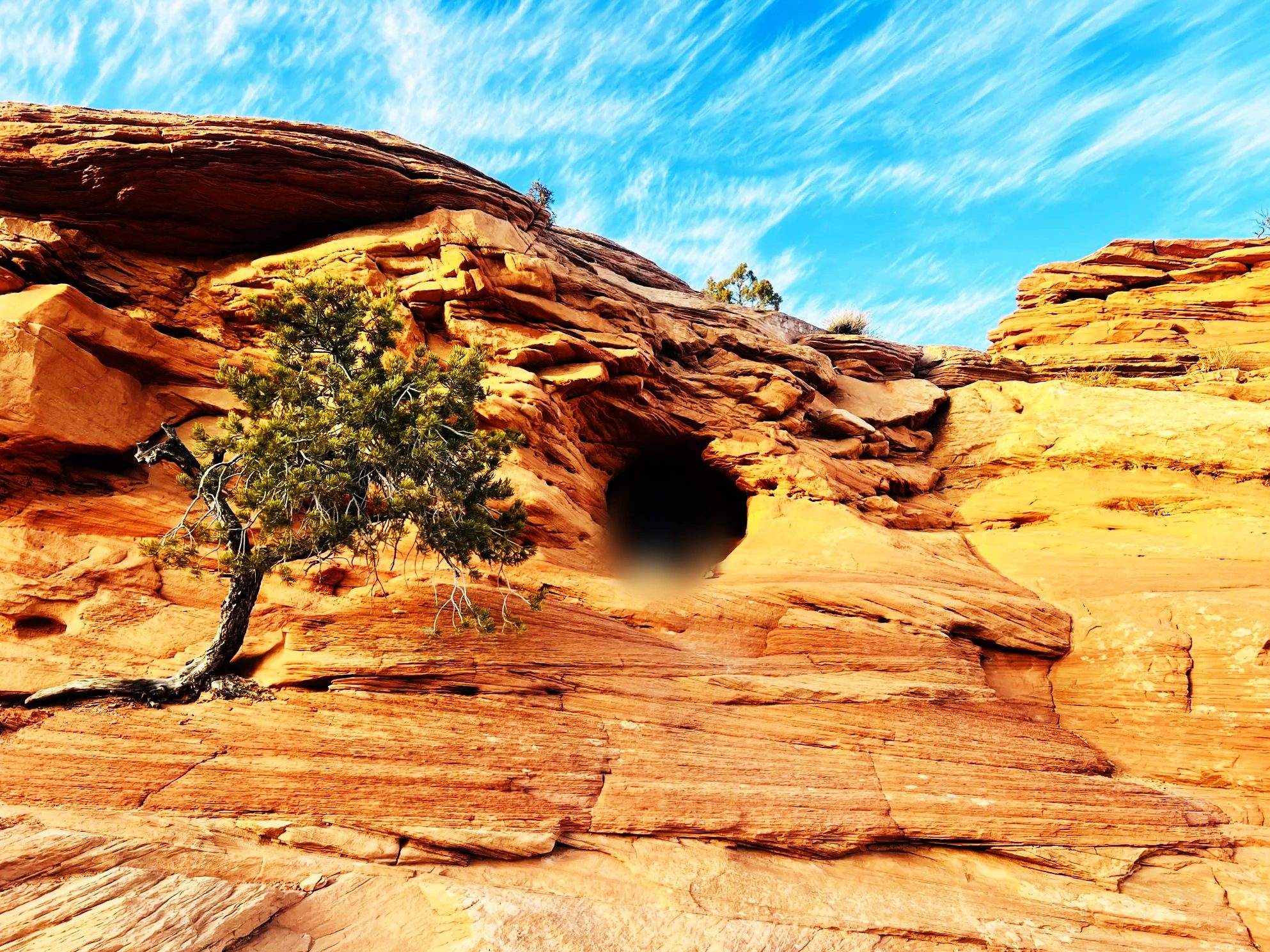
At the end of the trail, the arch appeared, hanging on the edge of the cliff. Through the opening, the canyon far below sat framed like a picture. It was a view I’d seen many times in ads and photos. The moment our kid saw the arch, out came a happy dance.
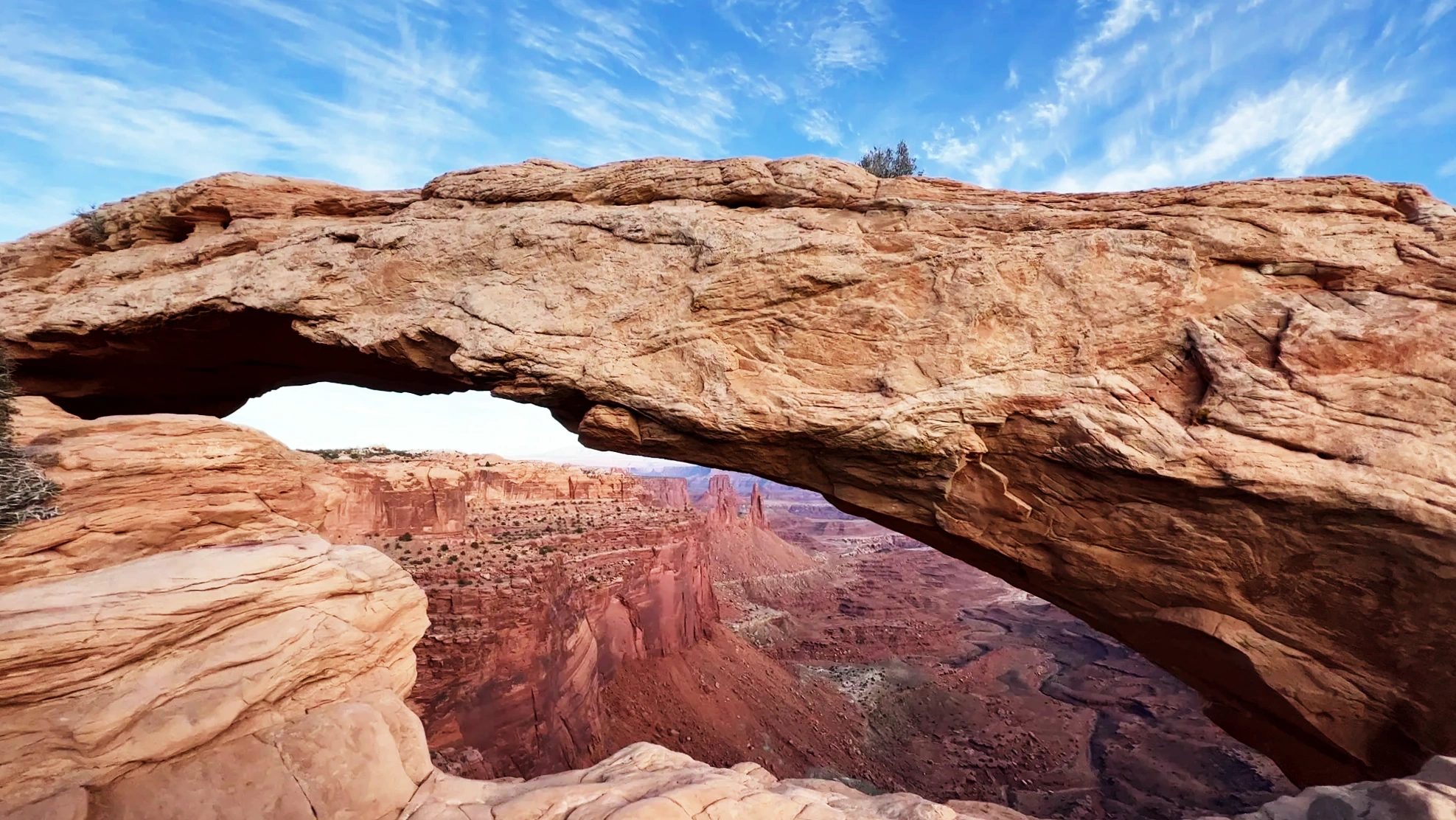
The flat ground simply stops, and right below it is the canyon. It was the first landscape like this we’d seen on the trip. Mesa Arch is famous for the way its underside glows red at sunrise, and plenty of people come before dawn to photograph it.
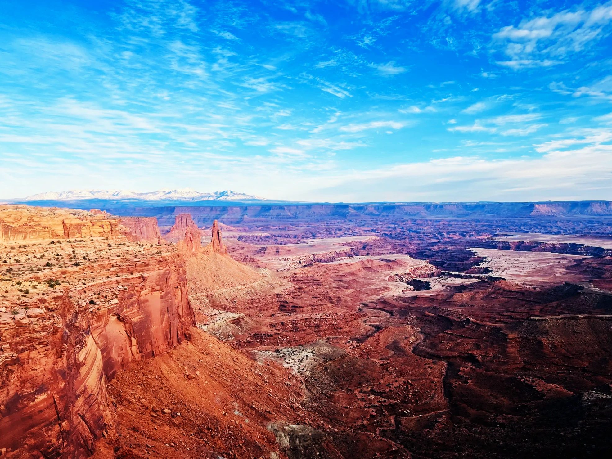
At the cliff edge stood a dead juniper, its trunk twisted. It looked like the kind of tree a raven would land on in a movie.
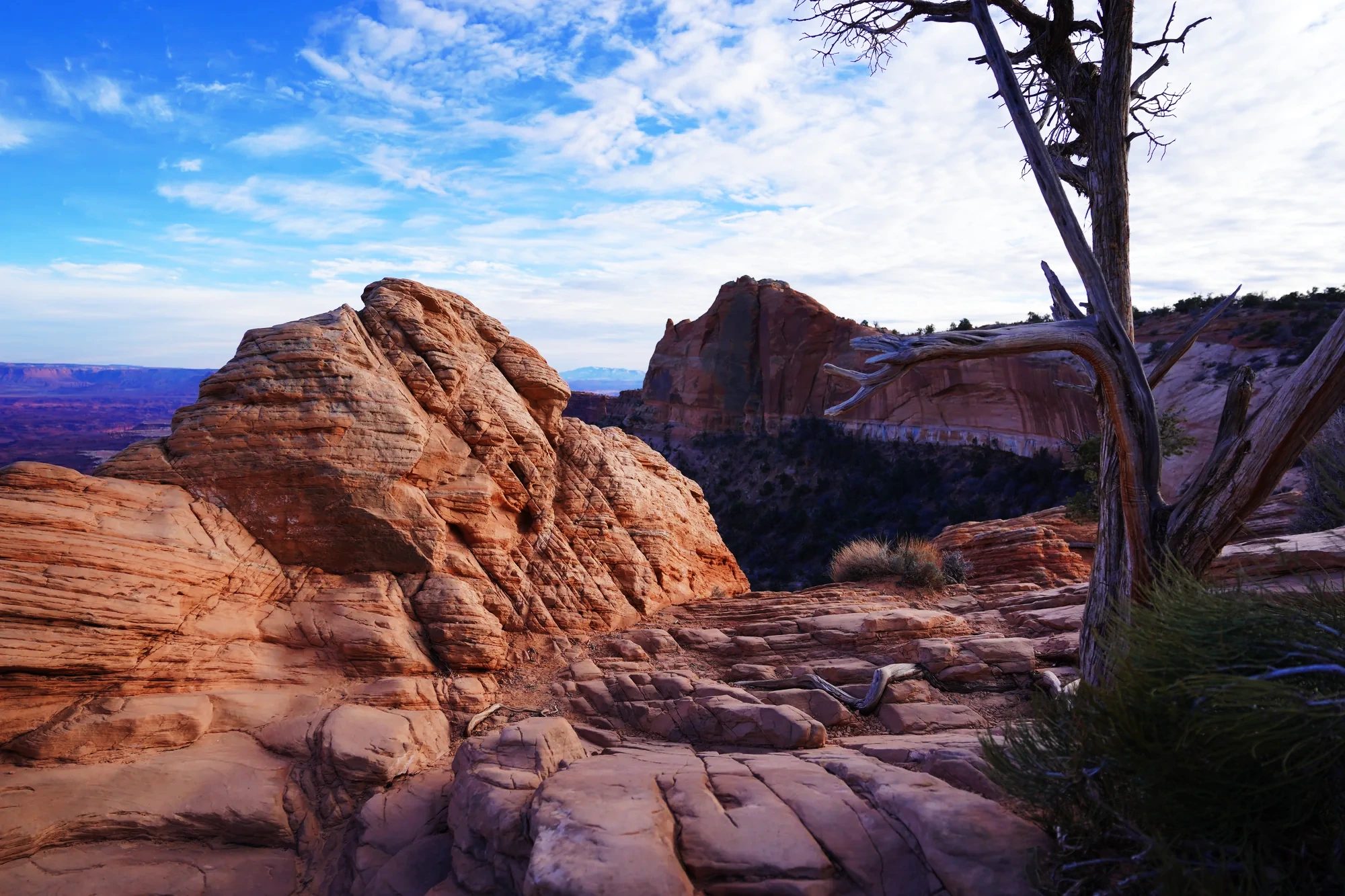
If other national parks are the polished goods in the showroom, Canyonlands felt like the stuff left in the back stockroom: still wild. There are few signs or railings, and step off the trail and you’re on bare rock at the edge of a drop. Rocks and landforms that would be called a scenic wonder anywhere else, even one at a time, were scattered all over the place here as if they were nothing special. I’d been to the Grand Canyon before, so this time I really wanted to see Canyonlands. Plenty of people skip it, and I went back and forth on whether to fit it in, but I’m glad we came. If the Grand Canyon is a place where you look down into one deep gorge from its rim, Canyonlands is a plateau with canyons sinking away between its flat stretches, layer after layer. The strange rocks we passed on the way and the brightly colored rock walls around Moab were sights you don’t come across often, either.
If you’d like to see Island in the Sky without driving yourself, a half-day 4×4 tour from Moab takes you up to the mesa top on backcountry roads, including the Shafer Trail switchbacks, with a guide at the wheel.
Sunset at Green River Overlook
From Mesa Arch, we drove about 10 more minutes toward the southwest end of the mesa and reached Green River Overlook around 4:40 p.m. It faces west, so it draws a lot of people at sunset. The canyons drop away below you in layers, and about 1,300 feet (400 m) down, the Green River winds along the bottom. Looking at the brown cliffs, carved layer upon layer, we agreed they looked just like chocolate.
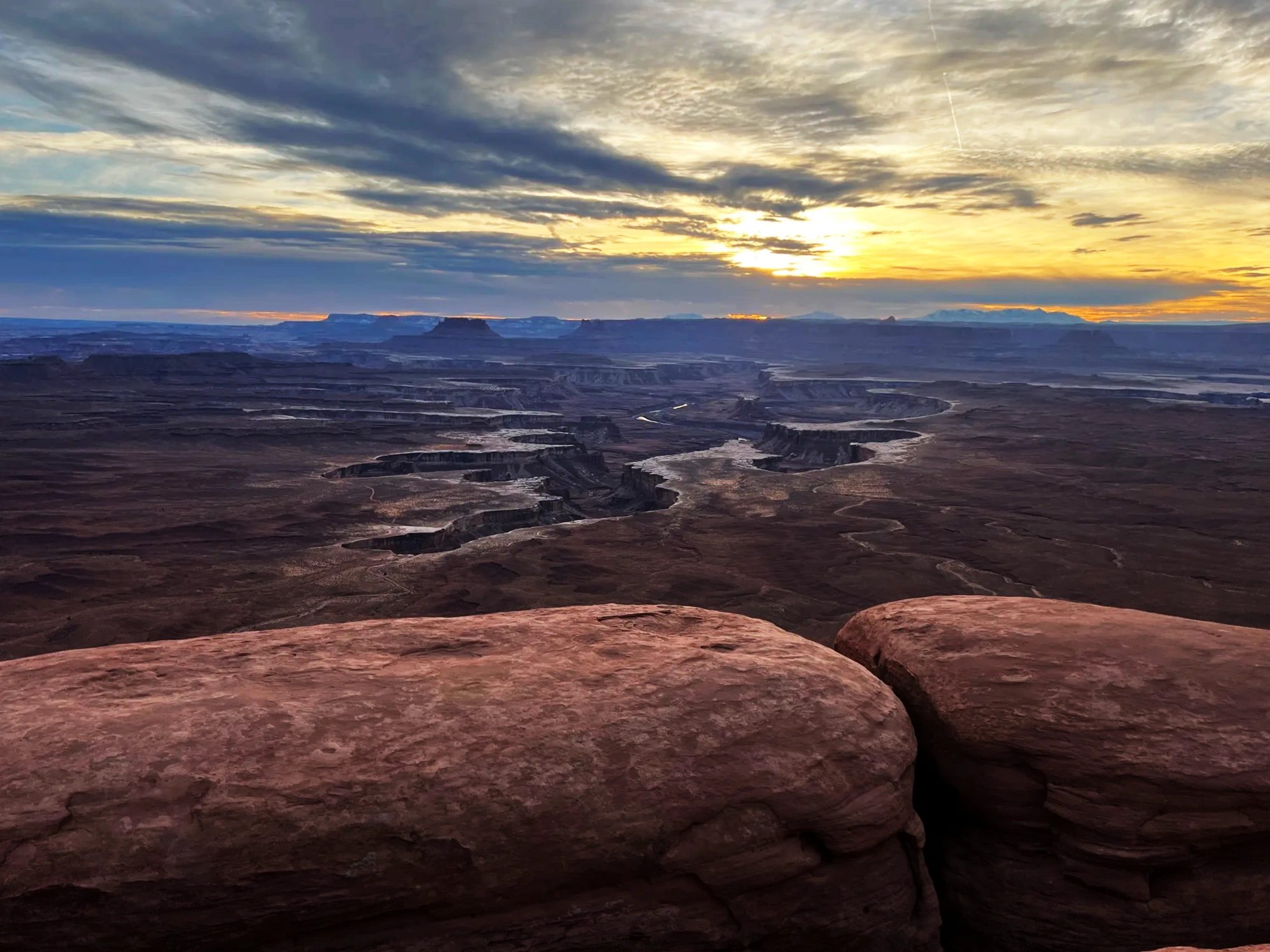
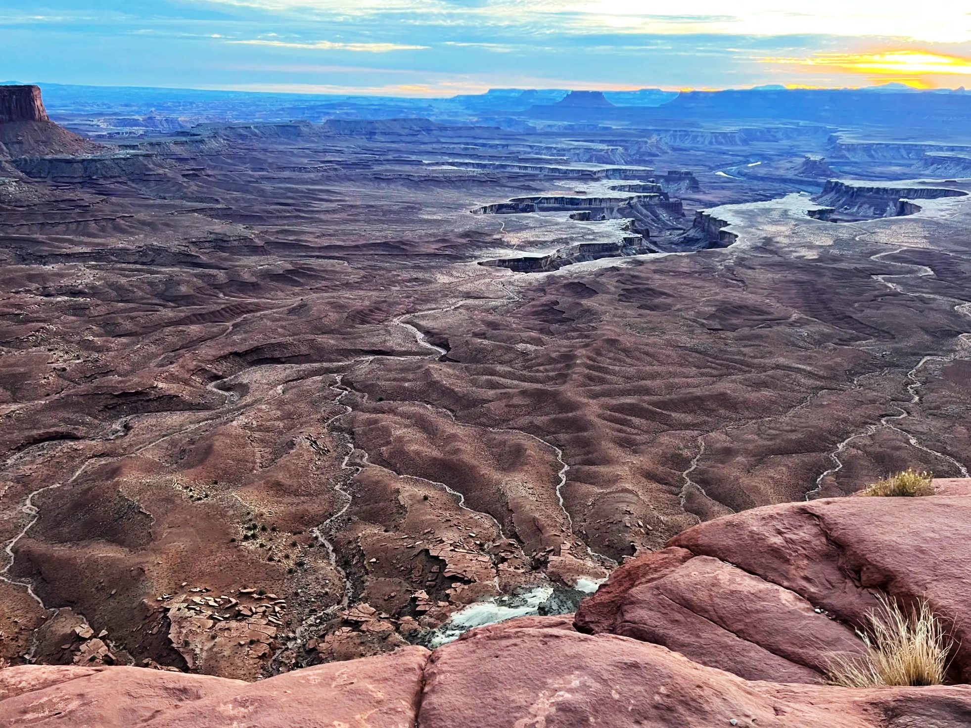
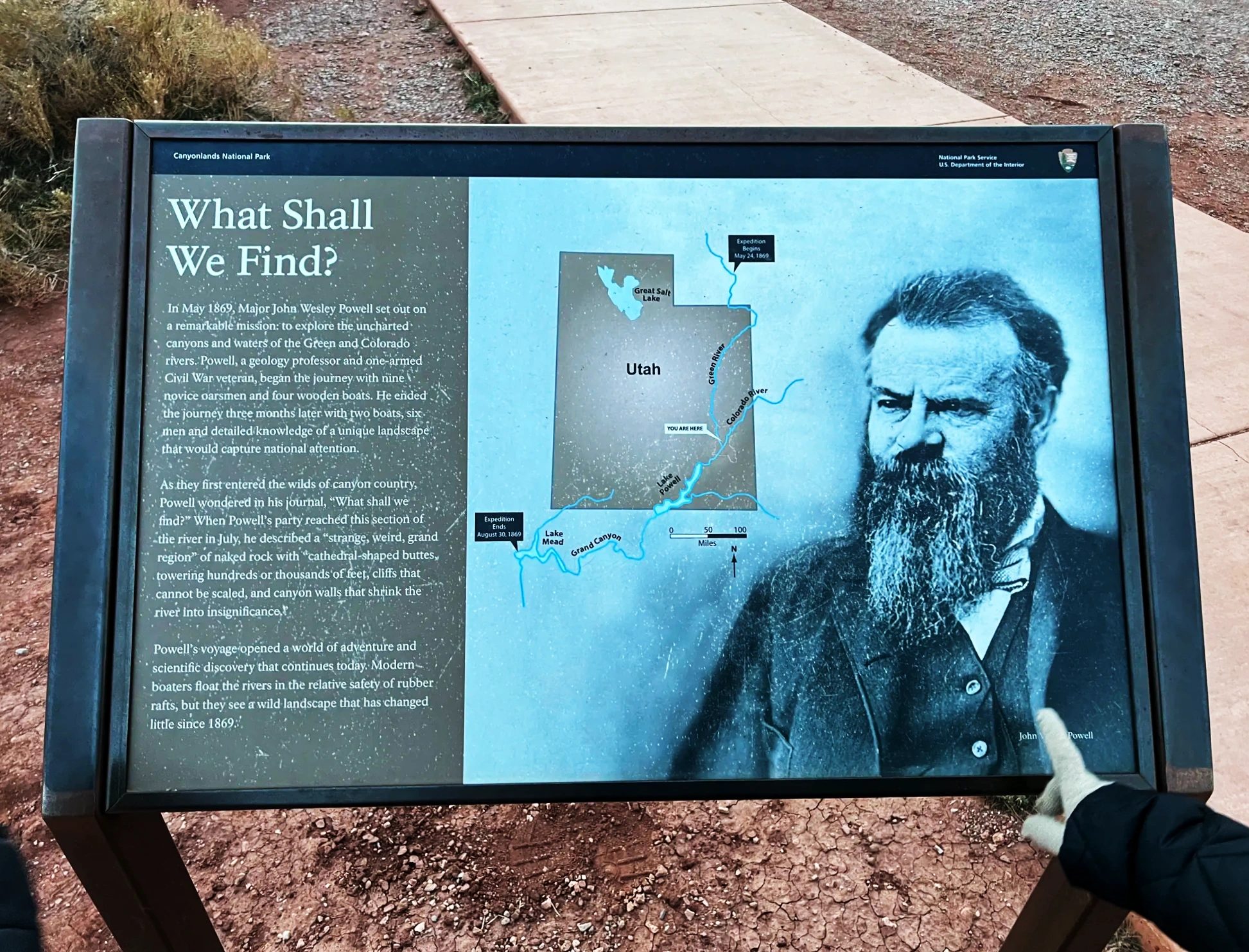
A sign beside the overlook tells the story of John Wesley Powell and his party, who came down this river by boat in 1869. Its title, “What Shall We Find?”, still fit, standing in front of this view.
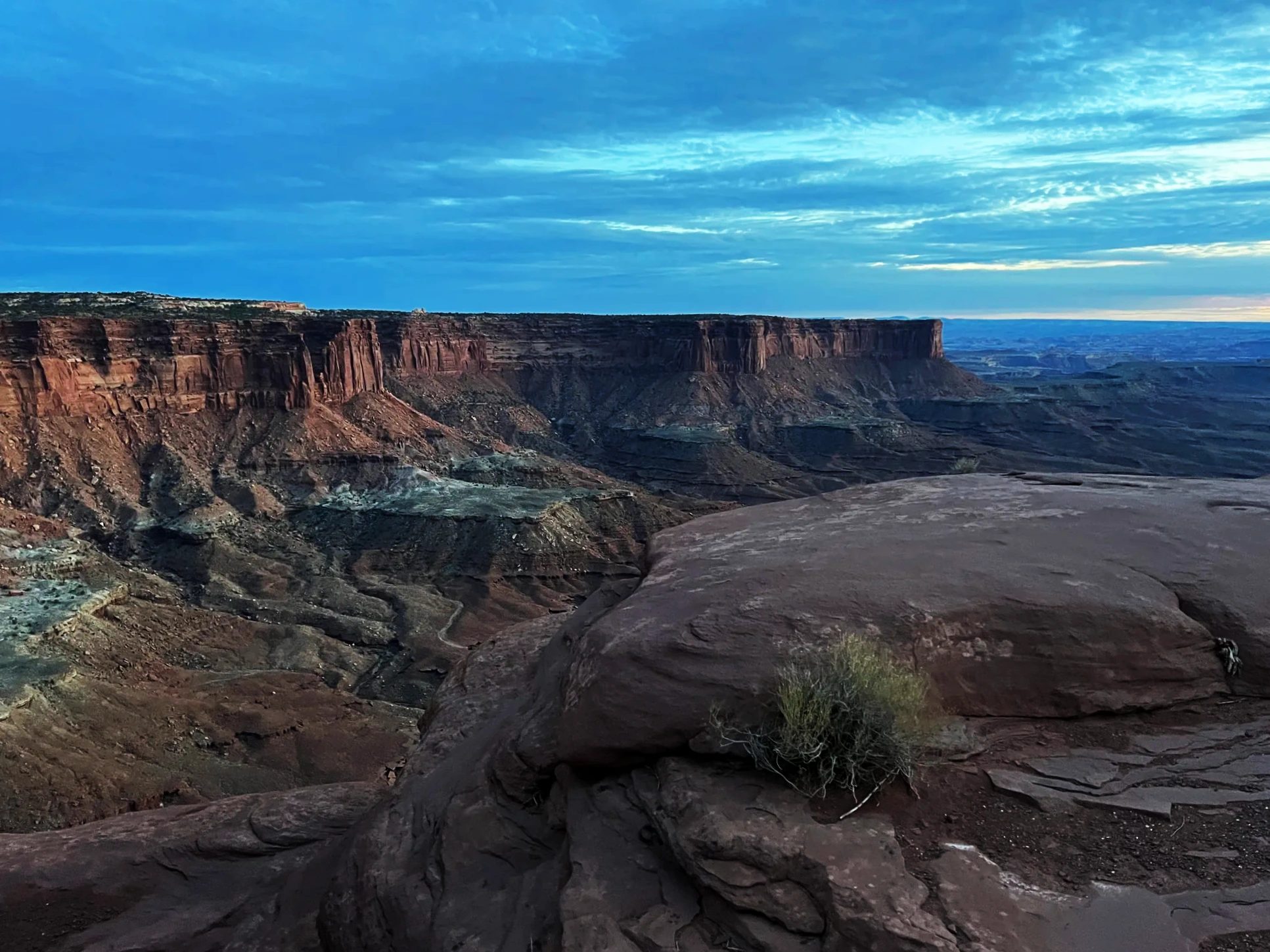
The sun set around 5 p.m. that day. Thick clouds over the western sky meant we didn’t get a red sunset. Instead, we spent a long while watching the rocks on the far side slowly lose their light and go dark. After sunset, the canyon turned purple, then sank into gray.
We left the overlook around 5:25 p.m. There are no restaurants or gas stations in the park, so we planned to eat dinner in Moab. We drove down UT-313, with not a single light along it, relying on our headlights.
Photographing Mesa Arch and Green River Overlook
Look up photos of Canyonlands and the two scenes that come up most are Mesa Arch and Green River Overlook. They’re only 10 minutes apart by car, so it’s easy to see both in one visit, but their best light comes at opposite ends of the day.
| Spot | Best time | What you get | Our visit |
|---|---|---|---|
| Mesa Arch | Sunrise | When the sun comes up over the La Sal Mountains to the east, the underside of the arch glows orange | Around 3:30 p.m., the canyon through the arch |
| Green River Overlook | Sunset | The sun going down between the canyons, and the Green River | From 4:40 p.m. until after sunset |
For sunrise at Mesa Arch, people with tripods crowd in behind the arch well before the sun comes up. To get a spot up front you need to arrive in the dark, so plan for the roughly 50-minute drive from Moab. To fit the arch and the canyon into one frame, you’ll want a wide-angle lens. At the overlook at dusk, the light fades fast, so a tripod keeps your shots sharp.
The dark, lumpy soil beside the trail is biological soil crust, and a single footstep can take years to recover. Don’t leave the trail for a photo.
Canyonlands in December: weather and what to wear
In December, Canyonlands sees average highs around 41°F (5°C) and lows around 18°F (-8°C). Island in the Sky sits about 2,000 feet (600 m) higher than downtown Moab, so it’s noticeably colder. On our day it was clear, with high clouds moving in during the afternoon, and snow from a few days earlier still lay along shady roadsides and in the UT-211 canyon. Once the sun went down, the overlook got cold fast.
Snow doesn’t fall often, but even a little can leave roads and trails icy and slippery. In winter, bring a heavy coat, gloves and shoes with good grip, and if it has snowed recently, check road conditions on the park website before you go.
Dinner in Moab: Singha Thai Cuisine
Back in downtown Moab, we went into Singha Thai Cuisine around 6:25 p.m. We ordered tom yum, pad thai, red curry and dumplings. We hadn’t had Thai food in a while, and it was delicious.
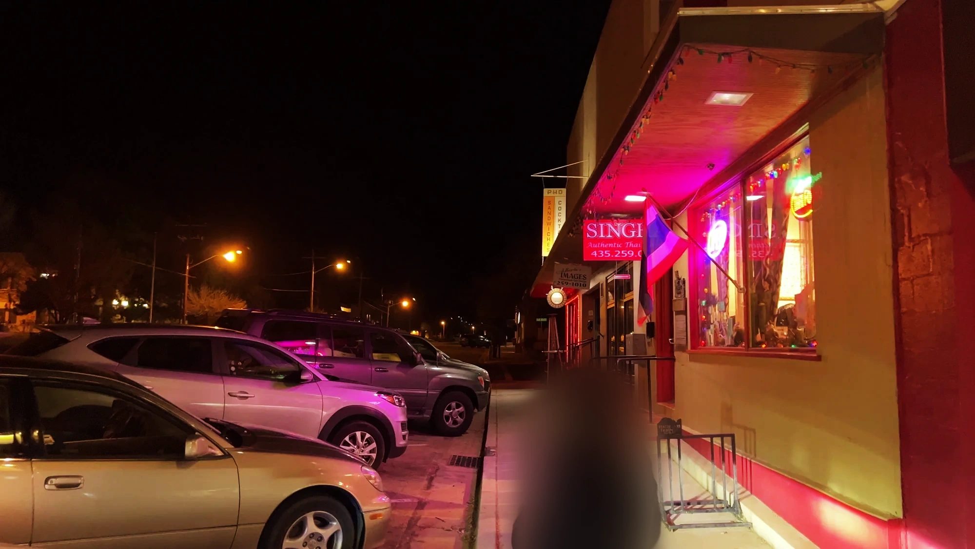

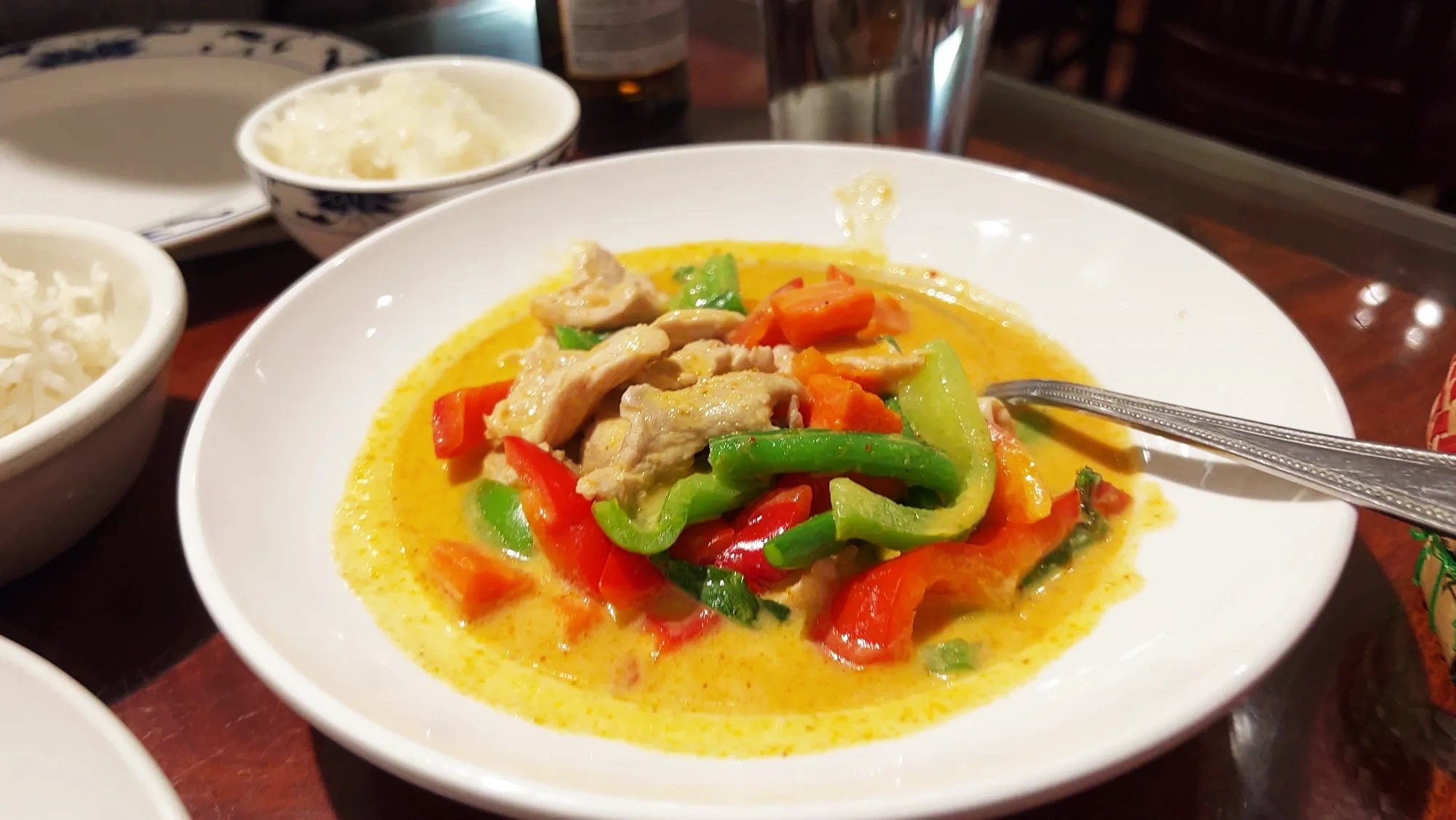
Moab is a small town between two national parks, Arches and Canyonlands, so hotels and restaurants are clustered here. With an extra night, you could do a half-day rafting trip on the Colorado River, or take an evening dinner cruise down the river.
Hampton Inn Moab and a heated winter pool
That night we stayed at Hampton Inn Moab, next to US-191 on the north side of town. We got there around 7:35 p.m. This was our only night in Moab. On our counterclockwise loop from Las Vegas, it was the farthest point northeast, the turnaround farthest from where we started. We’d also stayed at a Hampton Inn in Page, and since it’s the same chain, the room layout felt familiar.
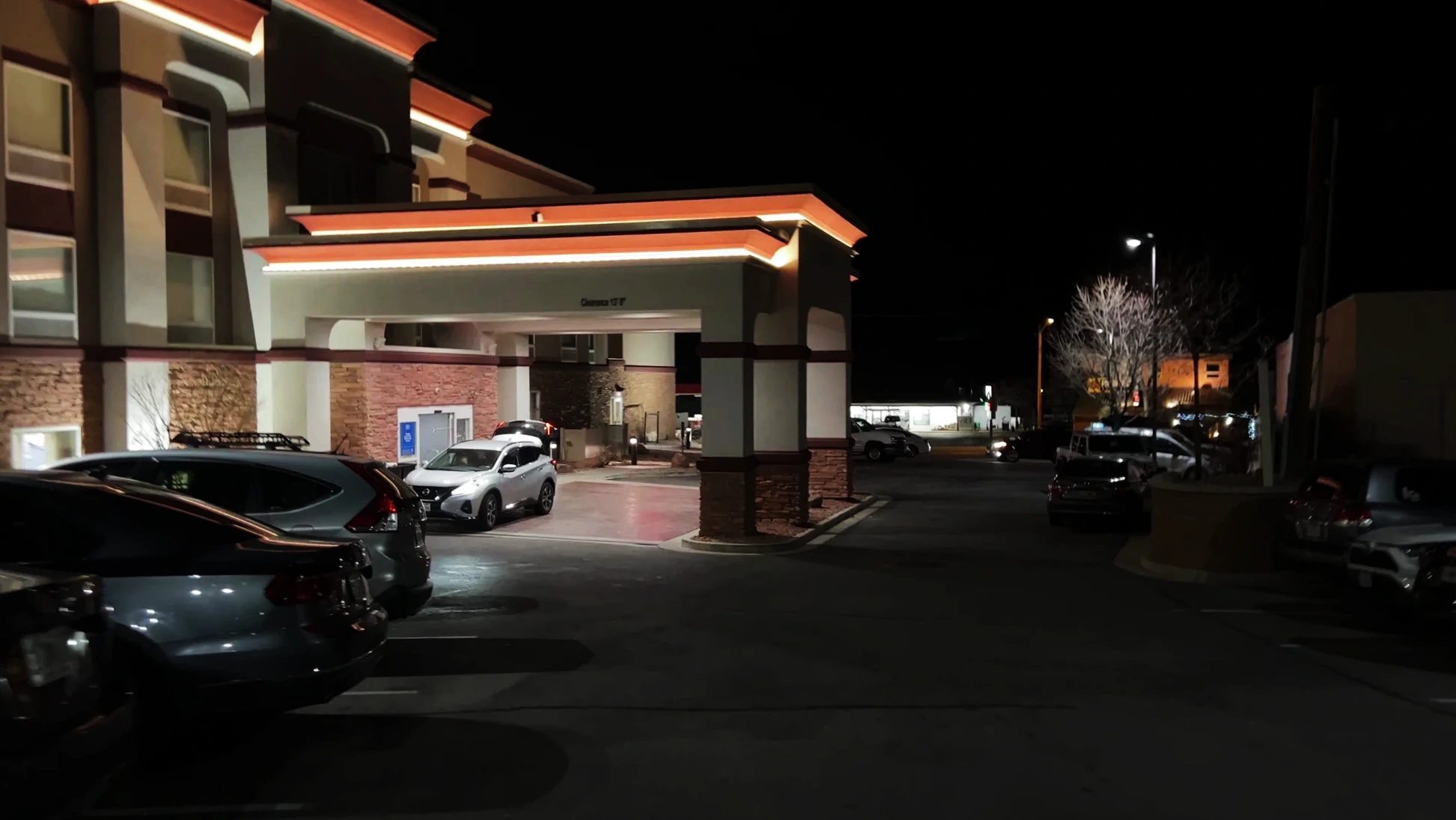
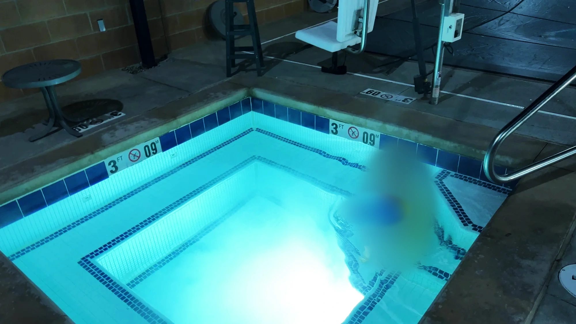
The hotel has an outdoor pool that stays open in winter. The air was chilly, but the water was warm.
Moab has plenty of chain hotels, so choosing isn’t hard. It mostly comes down to whether you want a kitchen in your room or would rather be able to walk around downtown.
Where to stay
Hotels in Moab
Two days in Moab: splitting time between Canyonlands and Arches
Canyonlands and Arches are both close to Moab. Some people do both in one day. We saw Canyonlands in the afternoon, slept in Moab, and went to Arches the next morning. The drive up from Monument Valley had been long, and at Arches we wanted to hike up to Delicate Arch. Splitting it gave us unhurried time at Green River Overlook at dusk and at Delicate Arch in the morning.
| Date | Place | Time | Time spent |
|---|---|---|---|
| December 21, afternoon | Mesa Arch | 3:30–4:30 p.m. | 1 hour |
| December 21, dusk | Green River Overlook | 4:40–5:25 p.m. | 45 minutes |
| December 22, morning | Delicate Arch, Arches | On the trail at 9:15 a.m.; at the arch 10:20–11:15 a.m. | 55 minutes at the arch |
| December 22, midday | Devils Garden, Arches | 12:50–1:40 p.m. | 50 minutes |
Arches continues in the next post.
If you only plan to stop at two or three overlooks, half a day at Island in the Sky is enough. Hiking in the Needles needs a day of its own. Leaving your bags in Moab for two nights and driving out from there also makes the driving less tiring.
Tours from Moab
Canyonlands is a long way from Las Vegas, but if you’re staying in Moab you can add a half-day 4×4 tour locally. Before you book, check which district of Canyonlands the tour visits and whether the park entrance fee is included.
Tours
Canyonlands and the river from Moab
For seeing Canyonlands without driving, or spending an extra half day on the Colorado River.
The full Grand Circle itinerary, where we stayed, and how we booked the rental car are in our 10-day winter Grand Circle itinerary.
Know before you go
| Item | Details (as of October 2026) |
|---|---|
| Entrance fee | $30 per vehicle, or $15 per person on foot or by bike (15 and under free); valid for seven days. No timed-entry reservations. |
| Annual pass | The national parks annual pass costs $250 for non-US residents. The $100 per-person nonresident surcharge introduced in 2026 applies in Utah at Bryce Canyon and Zion, not at Canyonlands. |
| Facilities in the park | No restaurants, gas stations, or lodging. Bring water and snacks, and fill up in Moab. |
| Visitor center | Open year-round, with some closed days in winter. Check dates on the official site before you go. |
| Mesa Arch | 0.5 mi (800 m) round-trip loop. The arch sits on an unfenced cliff edge. |
FAQ
Are the Grand Canyon and Canyonlands the same place?
No, they’re separate national parks. The Grand Canyon is in Arizona; Canyonlands is near Moab, Utah. The Green and Colorado Rivers meet in Canyonlands and flow south through the Grand Canyon. At the Grand Canyon you look across one vast gorge carved all the way to the far rim. At Canyonlands the land drops in two steps: first to a broad, flat rock bench below your feet, then again into the river canyons cut into that bench.
Which district is best for a first visit?
Island in the Sky is the easy choice: it’s close to Moab and every road is paved. Put “Island in the Sky Visitor Center” into your GPS instead of the park name, or you may end up heading toward the Needles like we did.
Can you drive a regular car in December, or do you need an SUV?
The Island in the Sky roads to Mesa Arch and Green River Overlook are all paved, so a regular car is fine. We drove an SUV. Unpaved backcountry routes such as the White Rim Road below the cliffs need a high-clearance four-wheel-drive vehicle and a permit. After snow, check road conditions on the park website first.
Can you see Arches and Canyonlands in one day?
Both are close to Moab, so you can visit both in one day. It depends on how much you want to hike at Arches. We split them over two days because the drive up from Monument Valley was long and we wanted to hike up to Delicate Arch. Our times are in the table above.
What’s the closest airport to Canyonlands?
The small Canyonlands Regional Airport (CNY) is about 30 minutes north of Moab. Larger airports are Grand Junction (GJT) in Colorado and Salt Lake City (SLC) in Utah. If you’re driving the whole Grand Circle loop like we did, flying into Las Vegas and driving a rental car to Moab is a common choice.
| Airport | Drive to Moab |
|---|---|
| Canyonlands Regional Airport (CNY) North of Moab | About 30 minutes |
| Grand Junction Regional Airport (GJT) Grand Junction, Colorado | About 2 hours |
| Salt Lake City International Airport (SLC) Salt Lake City, Utah | About 4 hours |
| Harry Reid International Airport (LAS) Las Vegas, Nevada | About 7 hours |
Is 127 Hours set in Canyonlands?
Bluejohn Canyon, where the accident in the movie happened, lies southwest of Canyonlands’ Horseshoe Canyon unit, on land outside the park boundary. It’s hours by car from Island in the Sky and Mesa Arch.
Can you visit on a tour?
If you’re staying in Moab, there are half-day 4×4 tours of Island in the Sky that leave from town. From Las Vegas, there are multiday Grand Circle tours that include Arches. A one-day tour from Las Vegas can’t realistically get there; it’s too far.
If we went back
Next time we’d enter “Island in the Sky Visitor Center” from the start, and on top of Mesa Arch and Green River Overlook, drive all the way to Grand View Point at the south end. The Needles we’ll save for another trip, with a full day to hike slowly.
Someday I’d also like to see the underside of Mesa Arch turn red at sunrise. Leaving Moab before dawn, you could fit it in ahead of a day at Arches. If I saw both the sunset and the sunrise from this island in the sky, I think I could say I’d really seen the park.
The wrong turn cost us a long detour, but it threw in a drive through a canyon of red cliffs. The canyons we looked down on from the edge of the tableland at dusk stayed with us as the wildest scenery of the trip.
Related posts
| Type | Post |
|---|---|
| Full itinerary | Winter Grand Circle: a 10-day road trip by rental car Route through 15 stops, where we stayed, and bookings |
| Previous post | A night at The View Hotel in Monument Valley Sunset over Mitten Butte from our room and a morning valley drive |
| Next post | Arches National Park in December Delicate Arch on a frosty morning, then Devils Garden to Landscape Arch |
Map and directions
On December 21 we drove north from Mexican Hat on US-163 and US-191. At Church Rock we turned onto UT-211 toward the Needles, turned back, passed through Moab, and climbed UT-313 to Island in the Sky. In the evening we came back down the same way and spent the night in Moab. Arches National Park, where we went the next day, is about 5 mi (8 km) north of downtown Moab, partway to the UT-313 turnoff.
What we used on this trip
Bookings
- A room in MoabMoab sits between Canyonlands and Arches, so that’s where we booked this one night.Hampton Inn Moab: US dollars / Canadian dollars
- Rental carFrom Monument Valley to Moab and up to Island in the Sky, we covered more than 280 mi (450 km) in one day.Rental cars at Las Vegas airport
What to pack
- A paper map or offline mapThe park is split into separate districts. Trust the GPS alone and you can end up in the wrong one.
- Water and snacksThere are no restaurants or stores inside the park.
- A warm coat and glovesThe wind picked up at the overlook around sunset, and it got cold fast.
- A wide-angle lensTo fit Mesa Arch and the canyon beyond it in one frame, we needed a lens that shoots wide.Wide-angle lenses on Amazon
- A tripodAs the overlook went dark, a Peak Design carbon tripod kept our photos sharp.Carbon travel tripods on Amazon
We picked up our rental car at the Las Vegas airport and kept it for nine days. To fly in, search with Las Vegas as your arrival airport.
Getting there
Las Vegas flights and rental cars
It was the map on a phone, by the way, that told us we’d taken the wrong road on UT-211.
Sources
- National Park Service: Canyonlands fees, Island in the Sky, Places to go, The Needles, Green River Overlook (checked October 22, 2026)
- Visit Utah: National park fee changes, Mesa Arch
- Island in the Sky elevation, Photographing Mesa Arch at sunrise
- Canyonlands weather by month, Airports near Moab, Wikipedia: Bluejohn Canyon, Wikipedia: Utah State Route 211
Not in the list? Search it yourself
Places to stay nearby, on a map
Affiliate link: if you book through this search, the blog earns a commission at no extra cost to you. Results open in a new tab. About affiliate links
Discover more from Elsewhere, Mostly
Subscribe and get new posts sent straight to your inbox.