elsewheremostly / Gaspésie, Quebec, Canada / August 6–9, 2026, four days and three nights
Down the Matapédia Valley, around Percé and Gaspé, and back along the north shore: our route and where we stayed
This is the itinerary and route of our four-day Gaspé Peninsula road trip from Montreal, a full loop by car around Gaspésie (Gaspésie) at the eastern end of Quebec. We went because our kid wanted to try mackerel fishing, so we fished from a wharf at every stop by the sea. In between, we saw Percé Rock, Bonaventure Island, the Miguasha fossils and Grande-Grave in Forillon.
- At a glance4 days, 3 nights Thursday, August 6, to Sunday, August 92 places to stay Château Bahia for one night, Le 125 for twoAbout 2,200 km (1,370 mi) round trip from Montreal3 fishing spots Grande-Rivière, Grande-Grave, Sainte-Anne-des-Monts
- RouteMontreal → Rimouski → Matapédia Valley → Chaleur Bay coast → Percé → Gaspé → north shore → MontrealWe drove the peninsula counterclockwise Map →
Contents
Lines are simplified and don’t match the actual roads.
What kind of trip this was
Gaspésie (Gaspésie), the Gaspé Peninsula, sits more than 900 km (560 mi) east of Montreal. We live in Montreal, but we had never seen Quebec’s sea, let alone the far end of the peninsula, and I had always wondered what it was like. Then our kid said they wanted to try mackerel fishing, and when we looked up where mackerel bite well, Gaspésie came up. So we left from Montreal and drove a full loop around the peninsula in four days and three nights.
Summer days are long, so we could stay out late into the evening. Days ran the same way: sights during the day, fishing from a wharf around sunset. The schedule was tight. We spent most of the first and last days in the car.
Why we drove it this way
At Sainte-Flavie (Sainte-Flavie), Route 132 splits into a southern and a northern branch, and the full loop runs 885 km (550 mi). We took the southern road (the Matapédia Valley and Chaleur Bay) on the way out, saw Percé and Gaspé, and came back along the north shore. From Sainte-Flavie to Percé, the southern road is 410 km (255 mi) and the northern one is 475 km (295 mi), so going in from the south gets you to Percé a little sooner (Tourisme Gaspésie distance chart).
We drove up from Montreal to Rimouski (Rimouski) and circled the peninsula counterclockwise from there. On the first day, we took the highway to Rimouski, stopped at a lighthouse on the coast, crossed the Matapédia Valley and slept at the peninsula’s southern entrance. On day two, we headed east along the south coast with stops at a fossil park and a few beaches. Day three went entirely to Percé and Gaspé. On the last day, we came up to the north shore, caught mackerel at Sainte-Anne-des-Monts and drove home.
Where we stayed
- 1 night Auberge du Château Bahia (Auberge du Château Bahia), Pointe-à-la-Garde. August 6
- 2 nights Le 125 (Le 125), Sainte-Thérèse-de-Gaspé. August 7–8
Night 1
Where we stayed: Auberge du Château Bahia
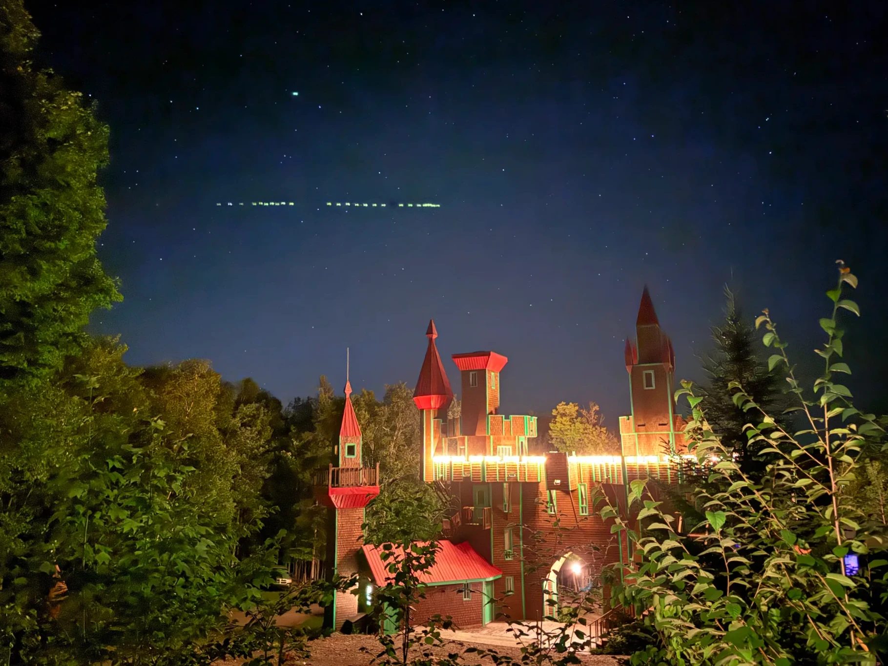
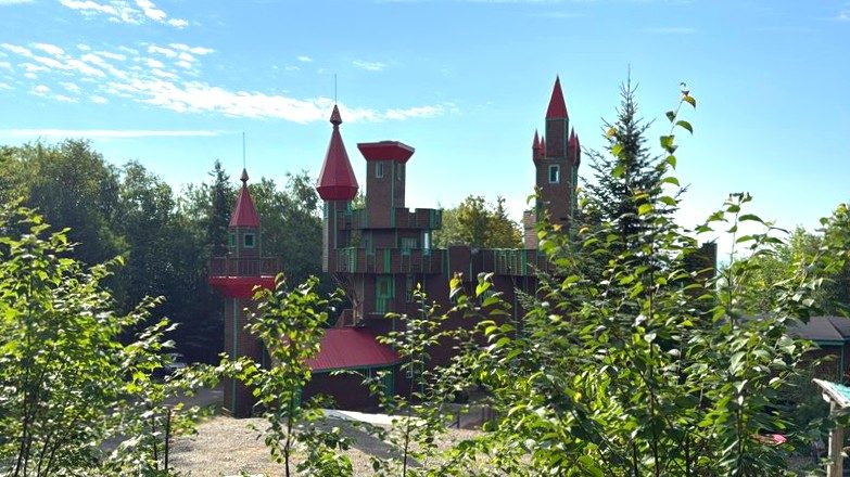
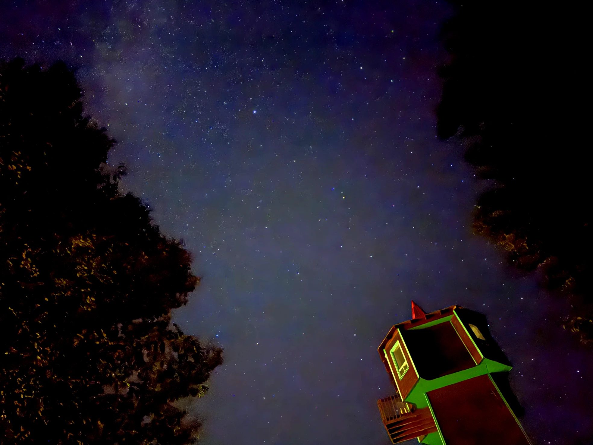
The castle-shaped main building lit up at night, a tower the next morning, the Milky Way from the inn’s grounds
Same inn in Canadian dollars (Expedia)Other places to stay in Campbellton and Carleton (Booking.com)
Nights 2–3
Staying near Percé
Le 125, where we spent two nights (in Sainte-Thérèse-de-Gaspé, a small place with a shared kitchen), isn’t on booking sites, so these picks are in Percé village instead. If you stay in the village, you can walk to the boat wharf.
Places to stay in each town
Tap a town to see nearby stays and prices on the map.
Day 1: Montreal to the south gate of the peninsula
- MontrealStart
- 14 hoursLength of the day
- Château BahiaStay
- Le Roy Jucep, Drummondville: poutine to go
- Parfum de Corée, Rimouski: lunch
- Pointe-au-Père lighthouse: tide pools
- Causapscal: salmon river
- Routhierville covered bridge
- Tide Head, DQ
- Château Bahia
We picked up poutine and ate it in the car on the way out. Lunch in Rimouski, tide pools at the Pointe-au-Père lighthouse, then the salmon river and covered bridge of the Matapédia Valley, and a sunset over the river on the New Brunswick side.
① Le Roy Jucep, Drummondville 8:05 a.m., a little over an hour from Montreal by highway
Our first stop was Le Roy Jucep in Drummondville, which bills itself as the place that first put poutine on the menu, in 1964. It was just past 8 a.m. and there was a breakfast menu, but we wanted something to eat in the car, so we took the classic poutine, the one they’re known for, to go. We liked it. The dining room is big, and next time we’re on this road I’d like to set aside time to sit down and eat there.
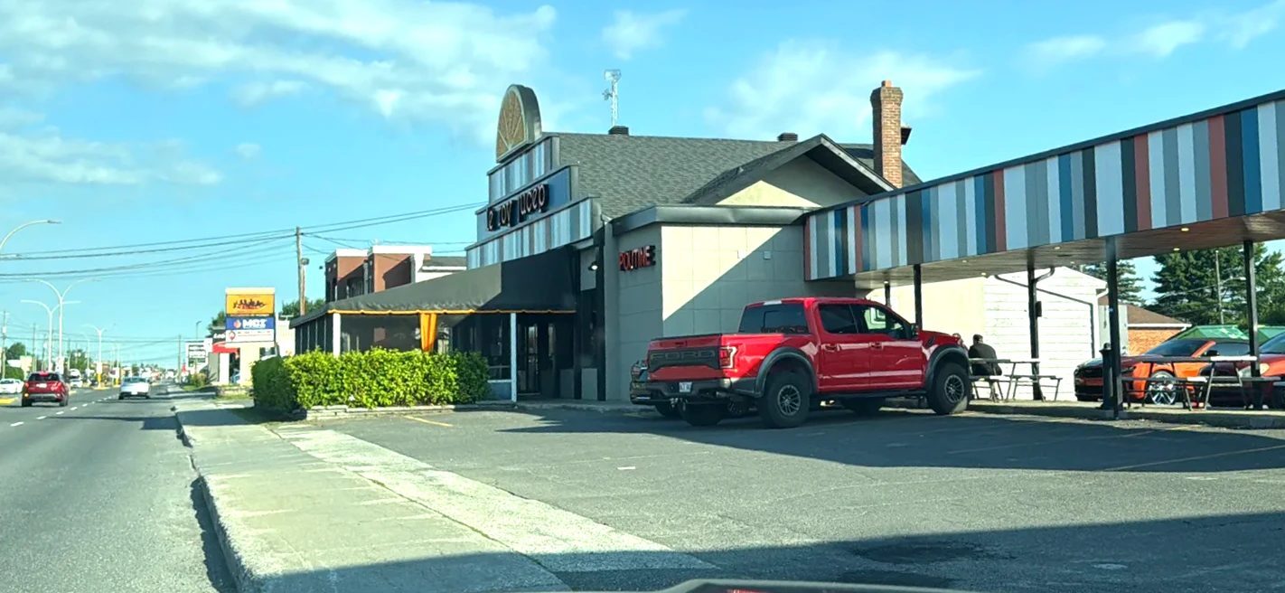
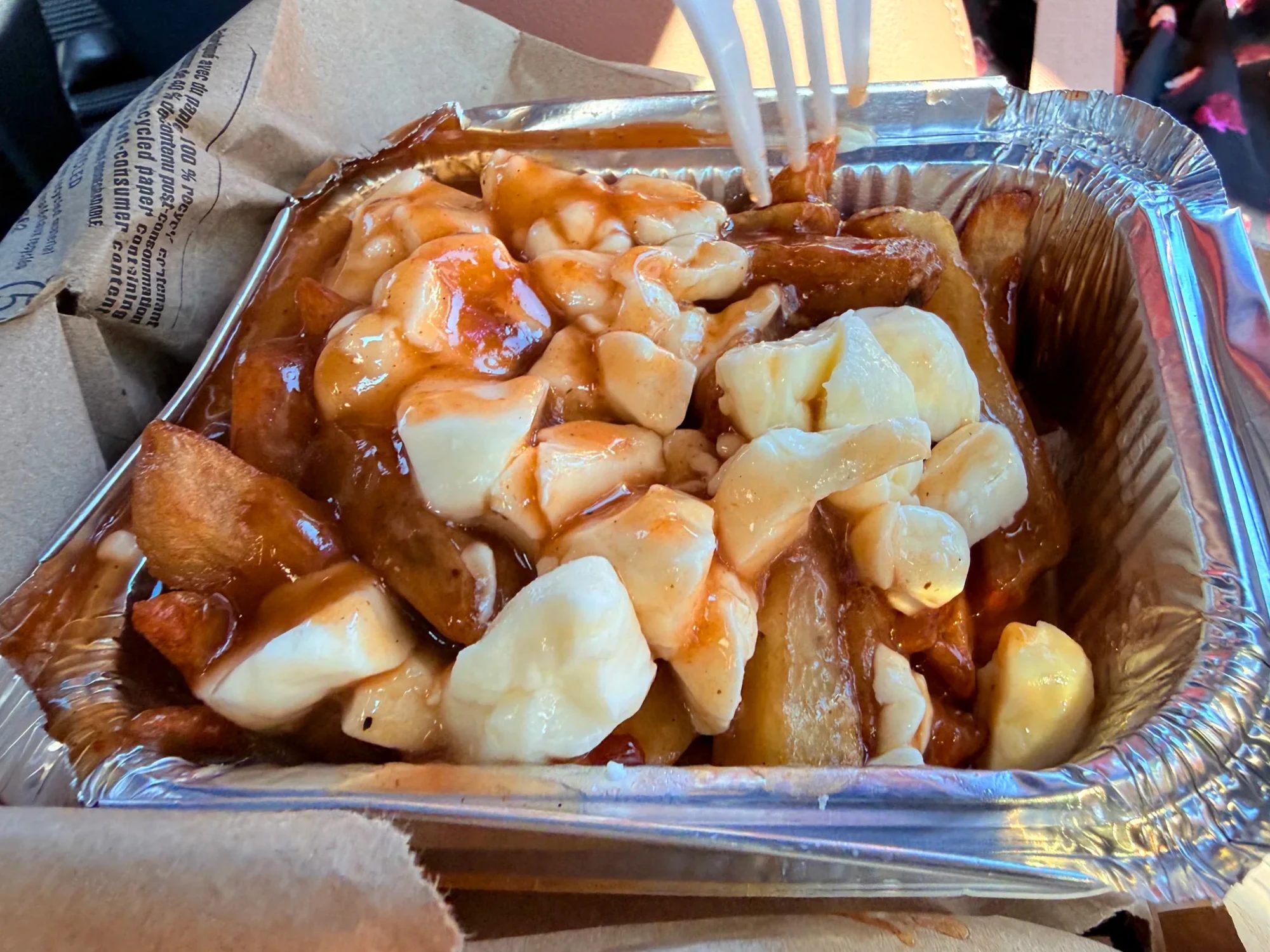
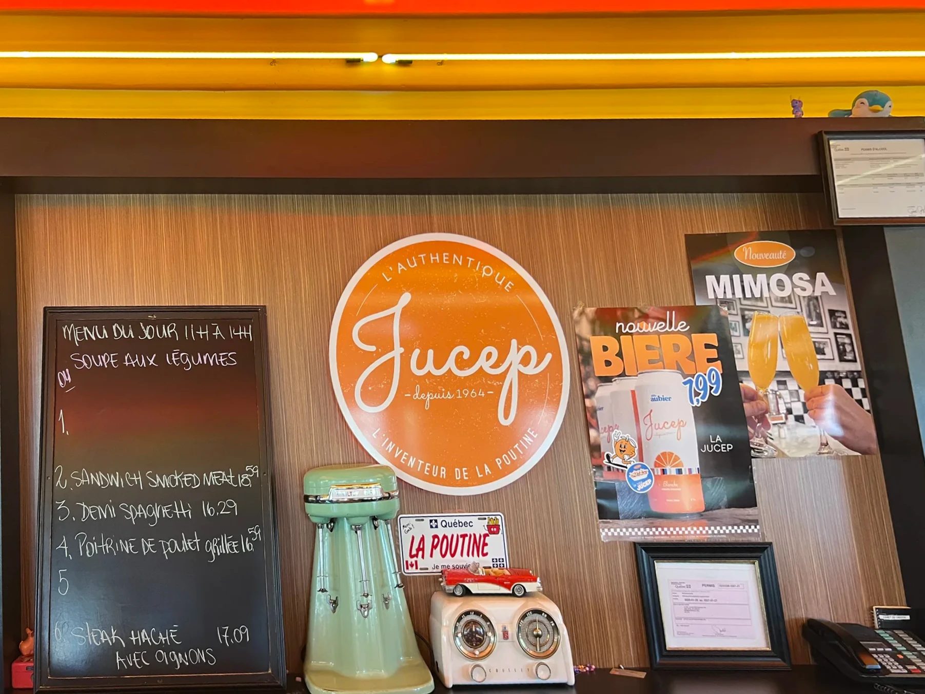
Who invented poutine is disputed; a restaurant in neighboring Warwick has its own claim. This place is said to be the first to list fries topped with cheese curds and sauce on one plate under the name “poutine” (Wikipedia: Poutine).
② Parfum de Corée, a Korean restaurant in Rimouski 1:20 p.m., about 4.5 hours from Drummondville by highway
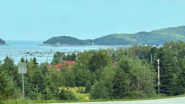
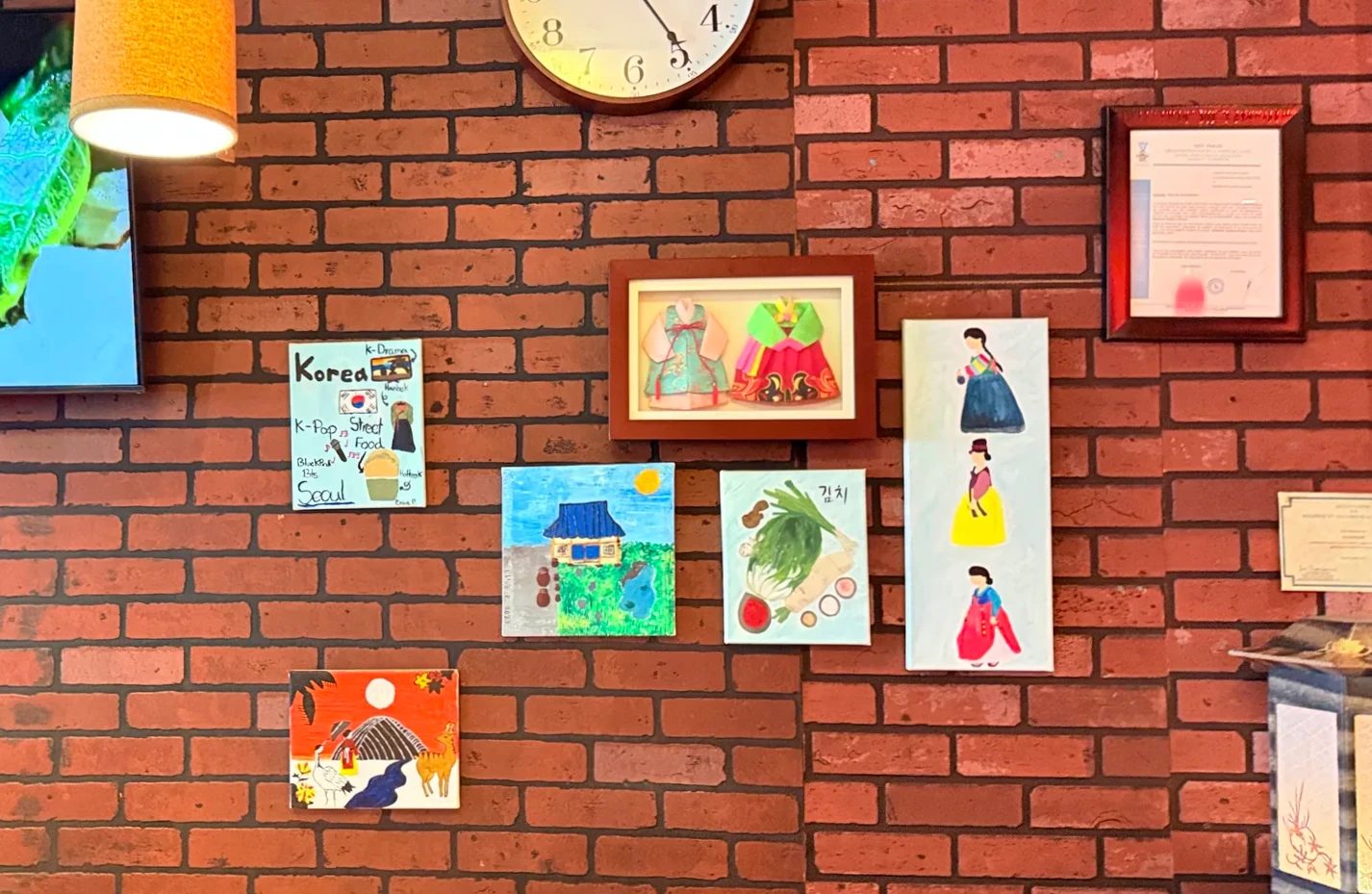
We drove northeast past fields and rivers under a summer sky. Around Le Bic, low mountains and bays ran down toward the St. Lawrence. Lunch was at Parfum de Corée, a Korean restaurant in downtown Rimouski. Finding one in a small city in eastern Quebec made us happy.
Breaking up the drive
If you stop for the night in Rimouski
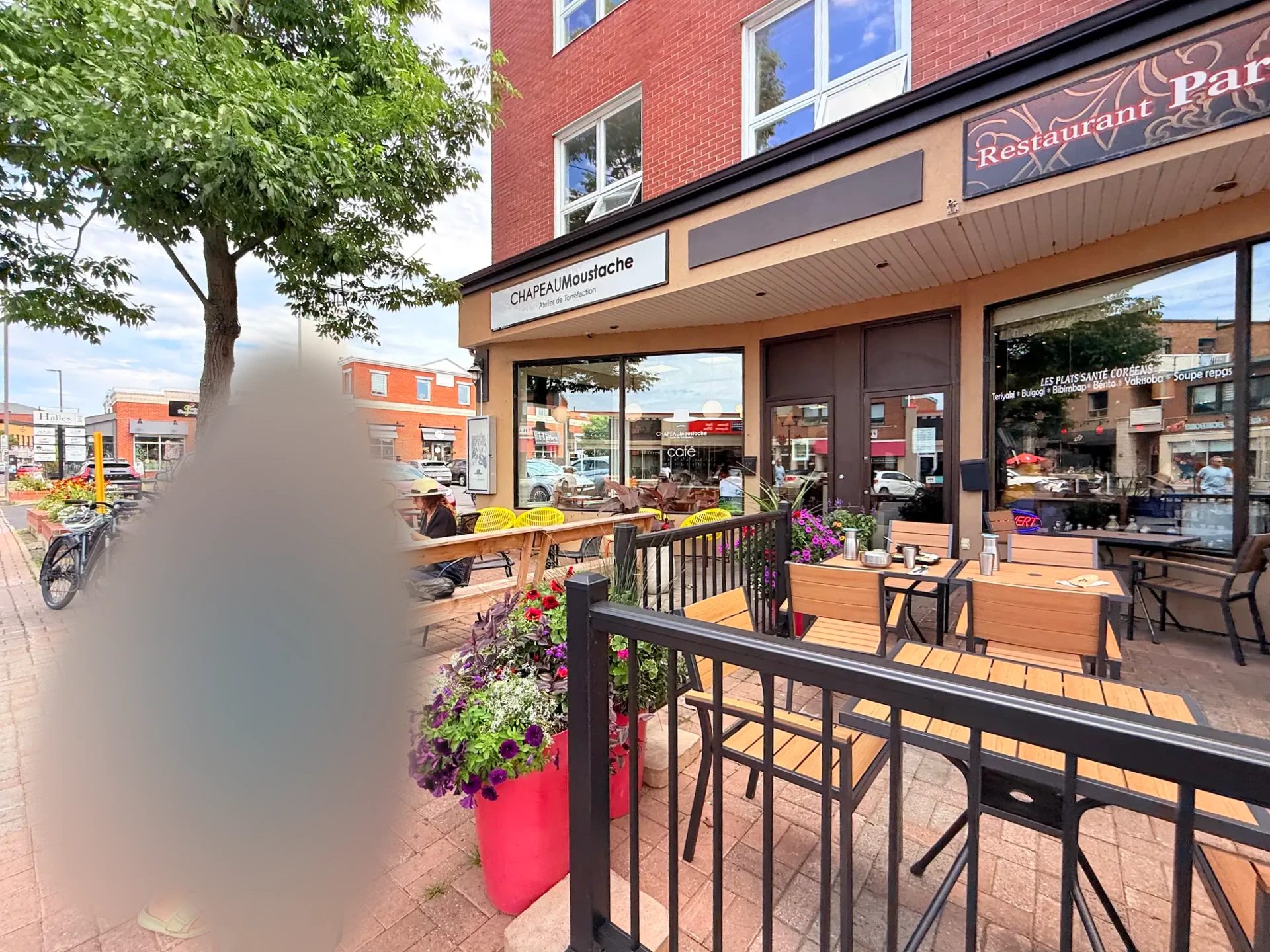
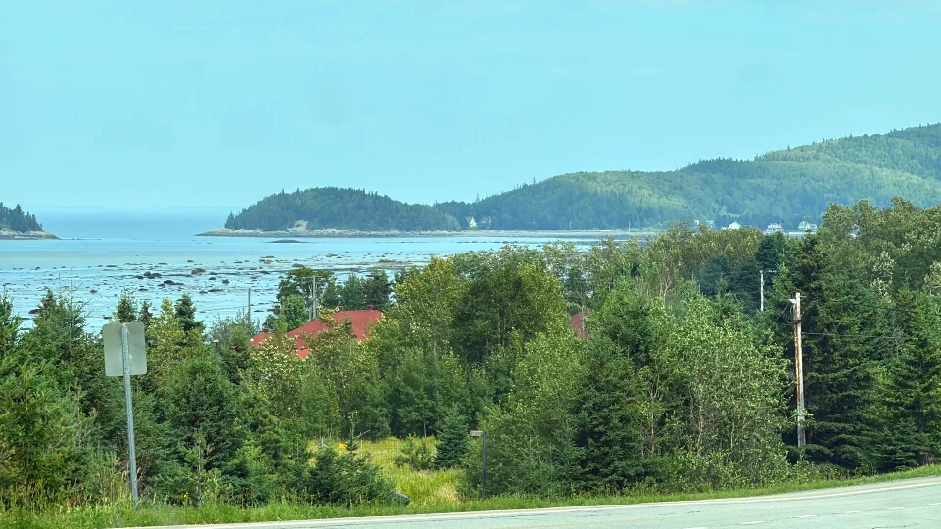
Downtown Rimouski, where we had lunch, and the Bic coast just west of town
③ Pointe-au-Père lighthouse 2:25–4:25 p.m., 15 minutes from Rimouski by car
Just east of Rimouski, Pointe-au-Père has a white lighthouse and a maritime history site. At low tide, clear pools form on the rocky shore in front of the lighthouse, and when we looked in, tiny shrimp were swimming around. Our kid loves playing in water, so instead of going into the lighthouse or the submarine exhibit, we spent close to two hours at the tide pools. We also found a four-leaf clover in the grass nearby.
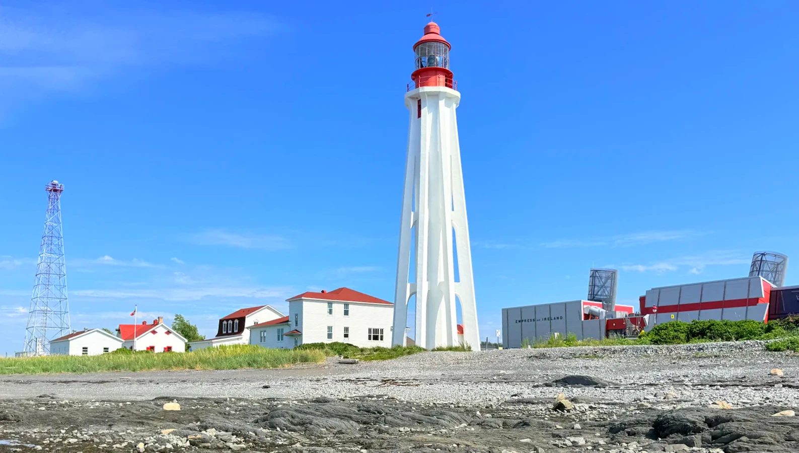
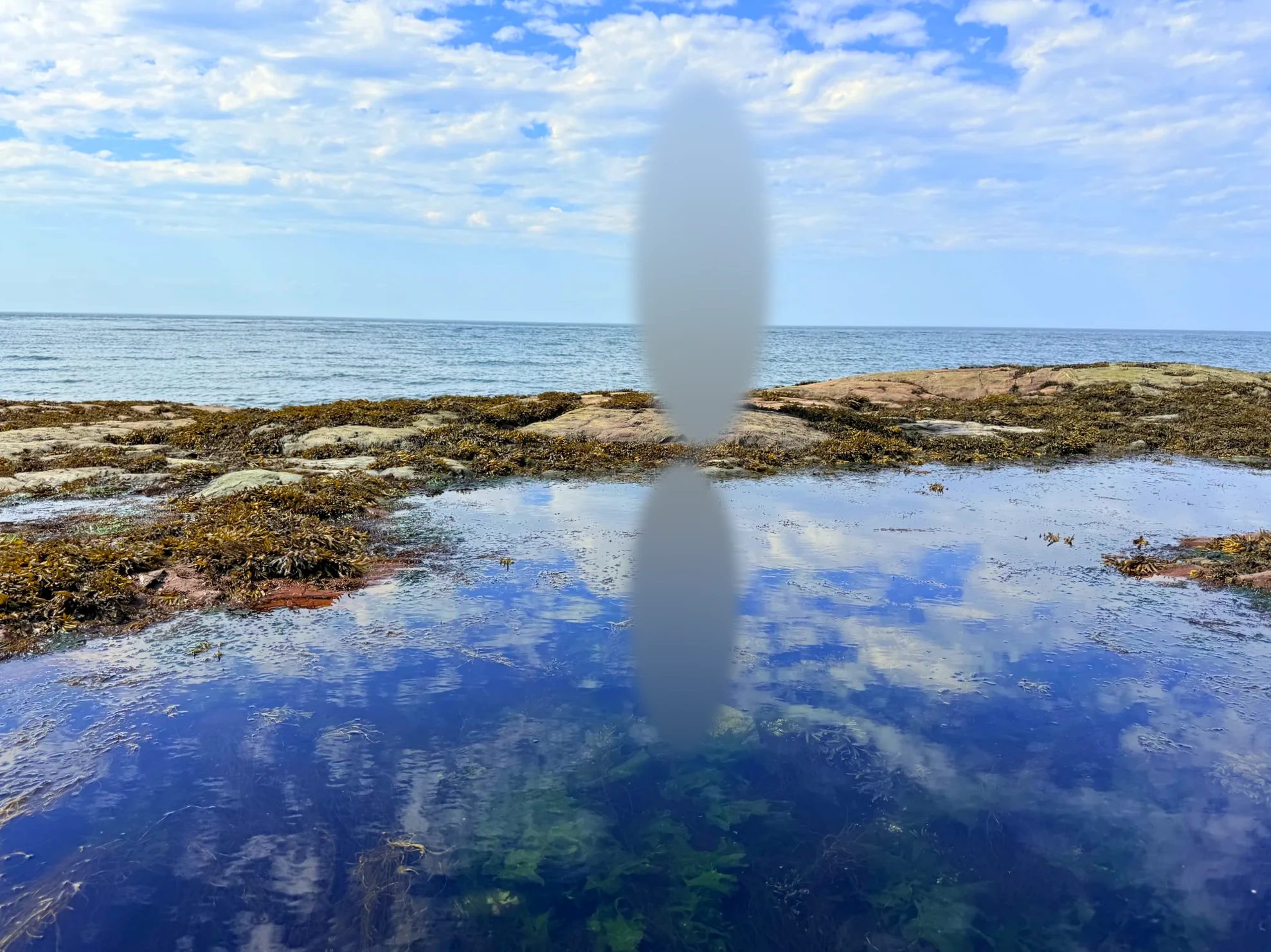
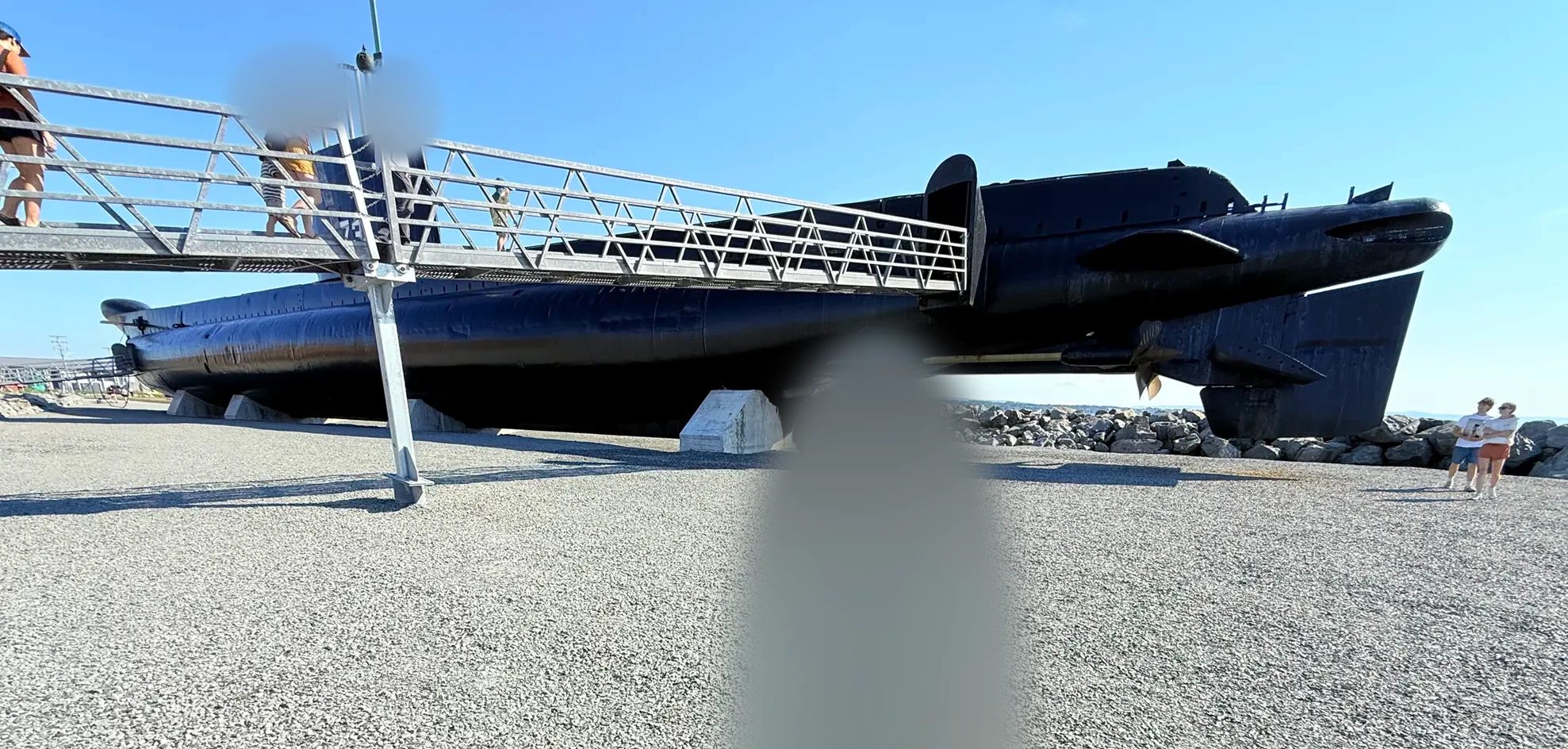
Look, don’t take We scooped up a few tiny shrimp, looked at them for a moment and let them all go right away. Several shrimp fishing areas in the Quebec part of the St. Lawrence and the Gulf have been closed since 2023 (Fisheries and Oceans Canada notice). I couldn’t find a rule against briefly handling tide pool creatures, but this is the shore in front of a national historic site, so it’s better to stick to looking.
The site has an exhibit on the Empress of Ireland, the passenger ship that sank offshore here in 1914, and the submarine Onondaga, which you can actually go inside. Walking around the lighthouse and along the shore didn’t require a ticket.
Gear
Water shoes for the rocky tide pools
Places like Pointe-au-Père and Port-Daniel have plenty of slippery rocks and pebble beaches.
④ Causapscal, a salmon river 6:40 p.m., Matapédia Valley
We turned into the Matapédia Valley (Vallée de la Matapédia) and took a short break in Causapscal. The village sits where the Matapédia and Causapscal rivers meet and is known for Atlantic salmon fishing. Someone was fly fishing at the water’s edge, and there were salmon decorations all over town. We didn’t see any salmon, but the idea of fish swimming up this river was amazing enough that we stood watching the water for a long while.
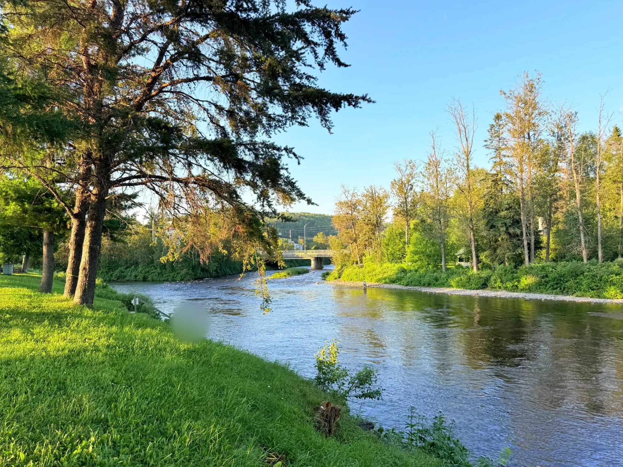
At the confluence is the Site patrimonial de pêche Matamajaw, a museum in the buildings of a salmon fishing club that dates back to 1873. In 2026 it’s open June 14 to September 27; admission is C$17.50 for adults and free for kids under 11 (Québec Maritime).
⑤ Routhierville covered bridge 7:20 p.m., 20 minutes from Causapscal on Route 132
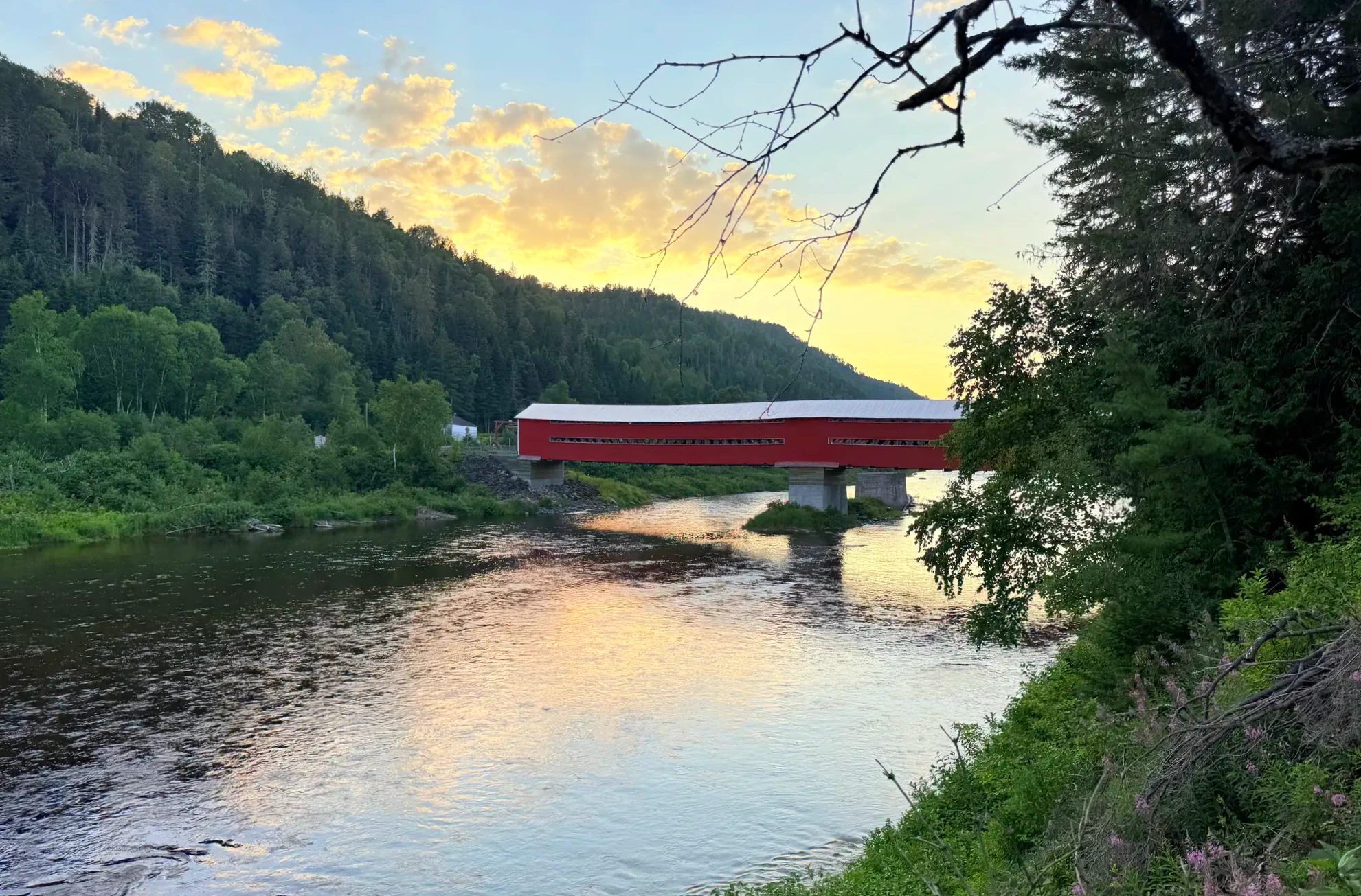
Heading down Route 132, we saw a red wooden bridge over the river and pulled over. This is the Routhierville covered bridge (Pont de Routhierville), built in 1931. At 78.5 m (258 ft), it’s the longest covered bridge in the Bas-Saint-Laurent region. A 2010 restoration brought back its original dark red (La Matapédia). It’s a pretty bridge, so we took photos and walked through it.
⑥ Tide Head beach and DQ, New Brunswick 9:05 p.m. (Atlantic time), a little over an hour from Routhierville
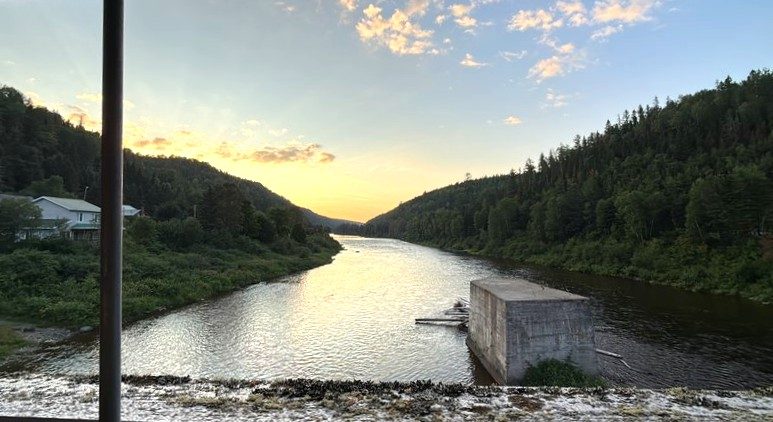
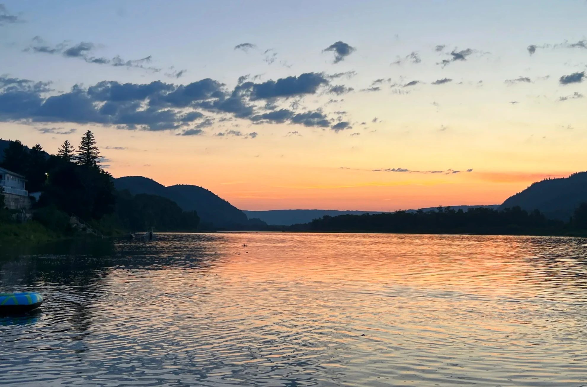
Out of the valley, we crossed the Restigouche River and briefly entered New Brunswick. We’d planned to eat at a particular restaurant, but I forgot New Brunswick is an hour ahead of Quebec, and by the time we got there it had closed. So we stopped rushing and went to the beach at Tide Head instead. The sun setting over the river was lovely. We had a paddleboard in the car, but the sun was already going down, so we just took in the view and left.
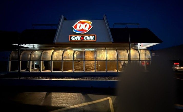
Dinner was at the DQ in Atholville. Some DQs in Quebec sell only ice cream, but this one was a DQ Grill & Chill with burgers too. It reminded me of eating there now and then when we lived in the US.
Where we slept: Auberge du Château Bahia
We got in late at night. The inn is a building shaped like a small castle in the woods. With few lights around, the sky was full of stars, and the Milky Way even showed up in our photos. In the morning, in daylight, we saw for the first time what the place looked like. The atmosphere is special, and I’d stay again next time we pass this way.
Photos and booking for Château Bahia are in the lodging box above →
Where we slept: Auberge du Château Bahia, night 1 of 3
Miguasha fossils and the south coast to Percé
- South coastRoute
- 10 hoursDay length
- Le 125Stay
- Miguasha National Park, fossils
- Carleton-sur-Mer, seafood poutine
- Maria, shallow water
- Paspébiac, Canadian Tire
- Port-Daniel, barachois
- Plage des Beaux Sables, A&W
- Percé Rock, lookouts
- Grande-Rivière harbor, first fishing
- Le 125
Fossils at Miguasha National Park, seafood poutine in Carleton, the shallow water at Maria and Port-Daniel, the sand beach in Chandler, and in the evening our first look at Percé Rock.
① Miguasha National Park 10–11:50 a.m., 15 minutes by car from the inn
Miguasha National Park (Parc national de Miguasha) is a UNESCO World Heritage Site for its fish and plant fossils from the Devonian, 380 million years ago. There are fossil spots near Montreal too, and we came across Miguasha while looking up fossil museums and parks. We followed a guided tour down to the fossil cliff on the shore, and our kid got a small fossil activity kit. We also went through the indoor exhibit. We have an annual pass from Sépaq (the agency that runs Quebec’s provincial parks), so the tour didn’t cost us anything extra.
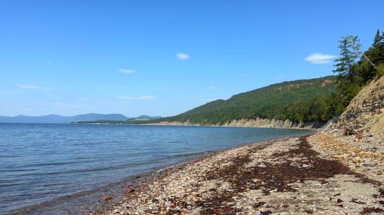
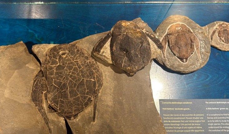
The Miguasha fossil cliff and exhibit get their own post →
② Carleton-sur-Mer, seafood poutine 12:15–1:25 p.m., 15 minutes from Miguasha
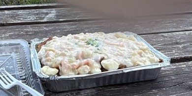
For lunch we picked up a seafood poutine at Poissonnerie Carleton (Poissonnerie Carleton), a fish market in Carleton-sur-Mer (Carleton-sur-Mer). It came with seafood in a cream sauce, and we ate it quickly at an outdoor table facing the water.
Staying on the south coast
A night in Carleton-sur-Mer
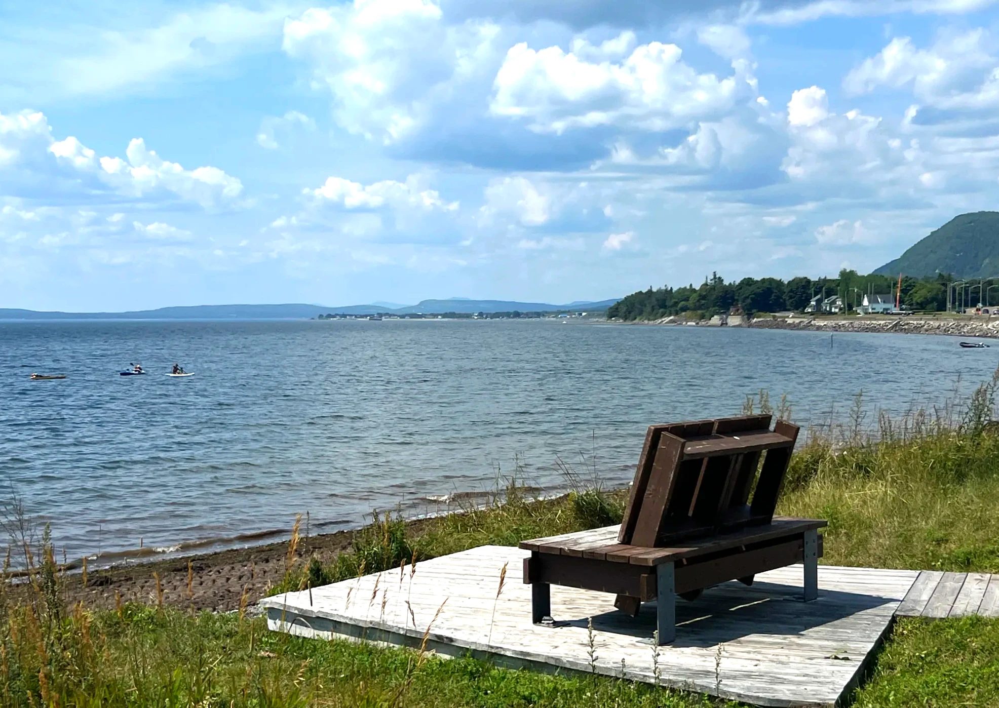
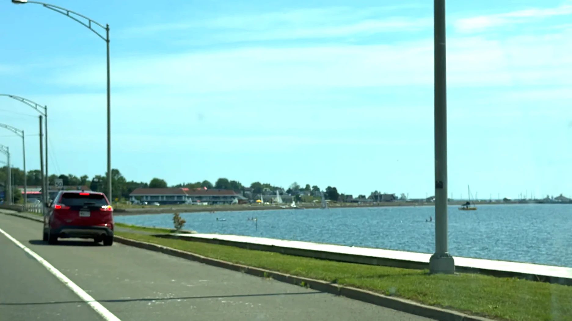
The Carleton waterfront path, with Mont Saint-Joseph behind
③ Maria, Plage des Goélands 1:45 p.m., 15 minutes from Carleton
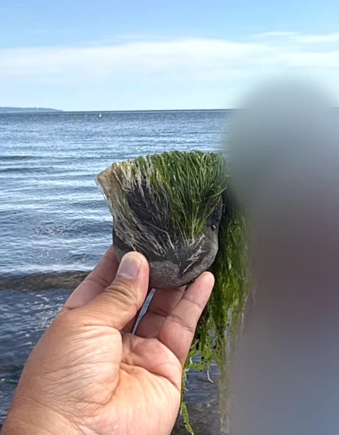
At Plage des Goélands (Plage des Goélands) in Maria (Maria), the shallows spread out wide, and we waded around along with everyone else. Several of the rocks underwater had green seaweed growing on them that looked like a troll doll’s green hair, which we found funny. A large picture-frame sculpture on the beach frames the view.
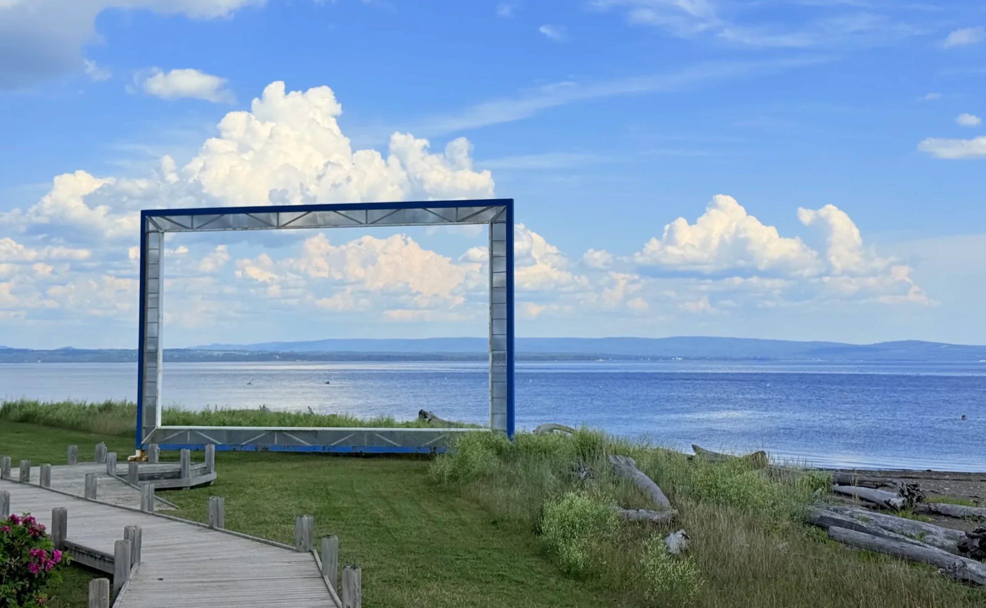
④ Canadian Tire in Paspébiac, then Port-Daniel 3:10 p.m. and 3:55 p.m.
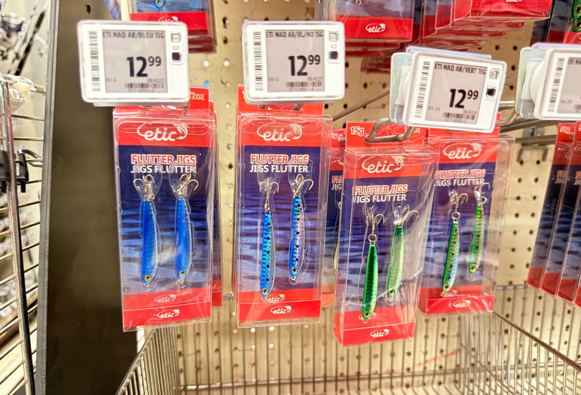
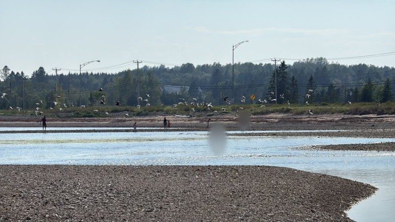
We stopped at the Canadian Tire (a Canadian general-merchandise chain) in Paspébiac (Paspébiac) to buy mackerel tackle. If we went again, I’d buy the jigs before leaving. In Port-Daniel (Port-Daniel) we walked the shallow channel of a barachois (barachois), where the river runs out to the sea. A barachois forms where river and sea meet: a bar of sand and gravel builds up, and shallow water pools behind it. You see them often along the Gaspésie coast (Université Laval).
Fishing tackle
Mackerel tackle: where to get it
What worked best for us were metal jigs (flutter jigs) of about 15 g (0.5 oz) in blue and green. The Korean-market option is a 5-pack of chrome mackerel jigs in 30 g or 40 g, heavier than our 15 g and easier to cast far. The sabiki rig we brought at first had small hooks, and only small fish bit.
Sabiki rigs on Amazon (cut them down to fit the three-hook rule)
⑤ Plage des Beaux Sables and A&W 4:55–5:25 p.m., 15 minutes from Port-Daniel
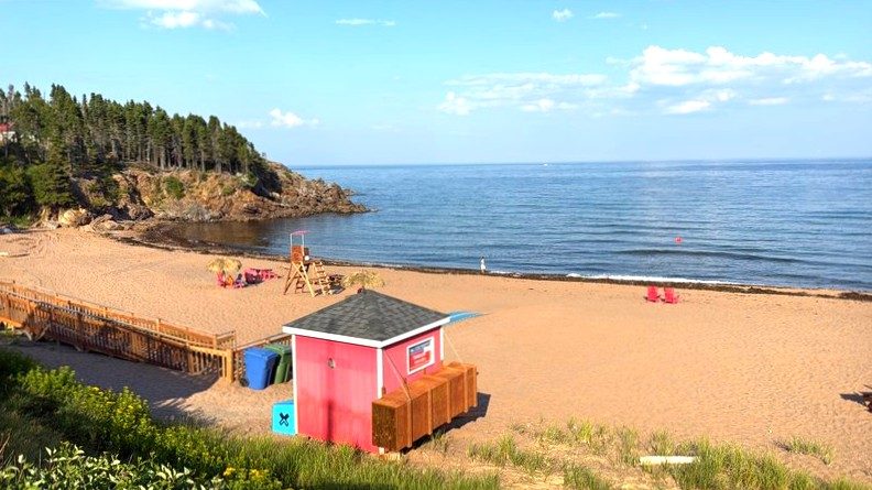
Plage des Beaux Sables (Plage des Beaux Sables), on the Newport side of the town of Chandler (Chandler), is a beach I remember as really good. Much of the Gaspésie coast is gravel, but this is a wide beach of fine sand, which is rare here, with red chairs and a lifeguard tower. We had an early dinner at the A&W in Chandler, and our kid picked the fishing one from the summer-only toys.
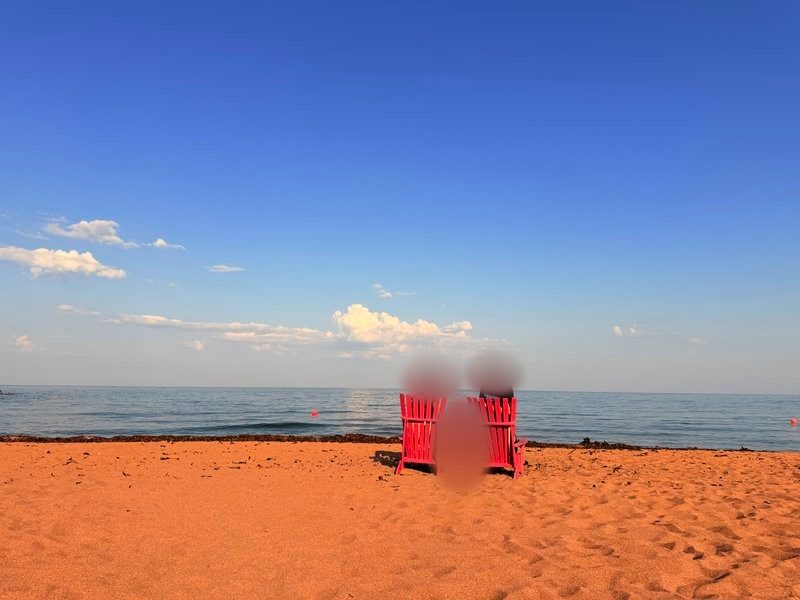
⑥ A first evening at Percé, and a first try at fishing 7:15–7:55 p.m., about 20 minutes from where we stayed
We dropped our bags at Le 125, a small place with a shared kitchen outside. At night, a family from another town asked if we wanted to share their campfire. Before sunset we headed to Percé. The rock came into view from the hill, and from the Côte Surprise lookout and the Mont-Joli lookout deck we watched it turn red in the evening sun. On the way back we stopped at the harbor in Grande-Rivière (Grande-Rivière) and cast a line for the first time. Local kids showed us the fish they’d caught; we got bites but caught nothing.
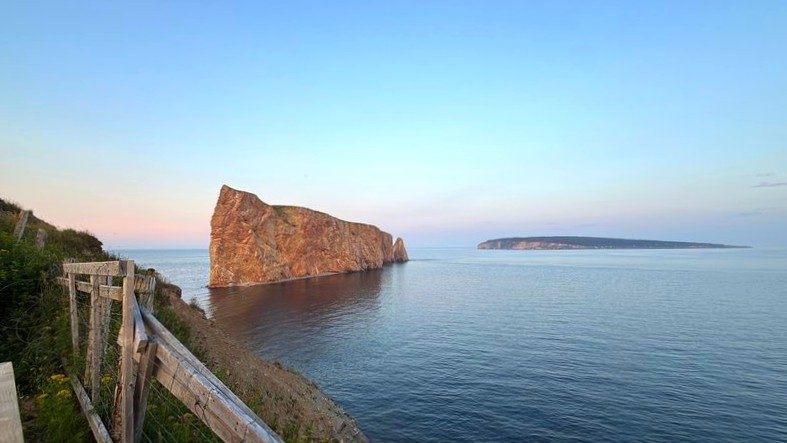
Where we slept: Le 125, night 2 of 3
Day 3: Percé Rock, Bonaventure Island, Gaspé and Grande-Grave
- Percé, GaspéWhere we went
- 15 hoursLength of the day
- Le 125Where we slept
- Percé wharf, boat cruise
- Bonaventure Island, northern gannet colony
- Gaspé, Birthplace of Canada
- Grande-Grave in Forillon, fishing
- Le 125, shared kitchen
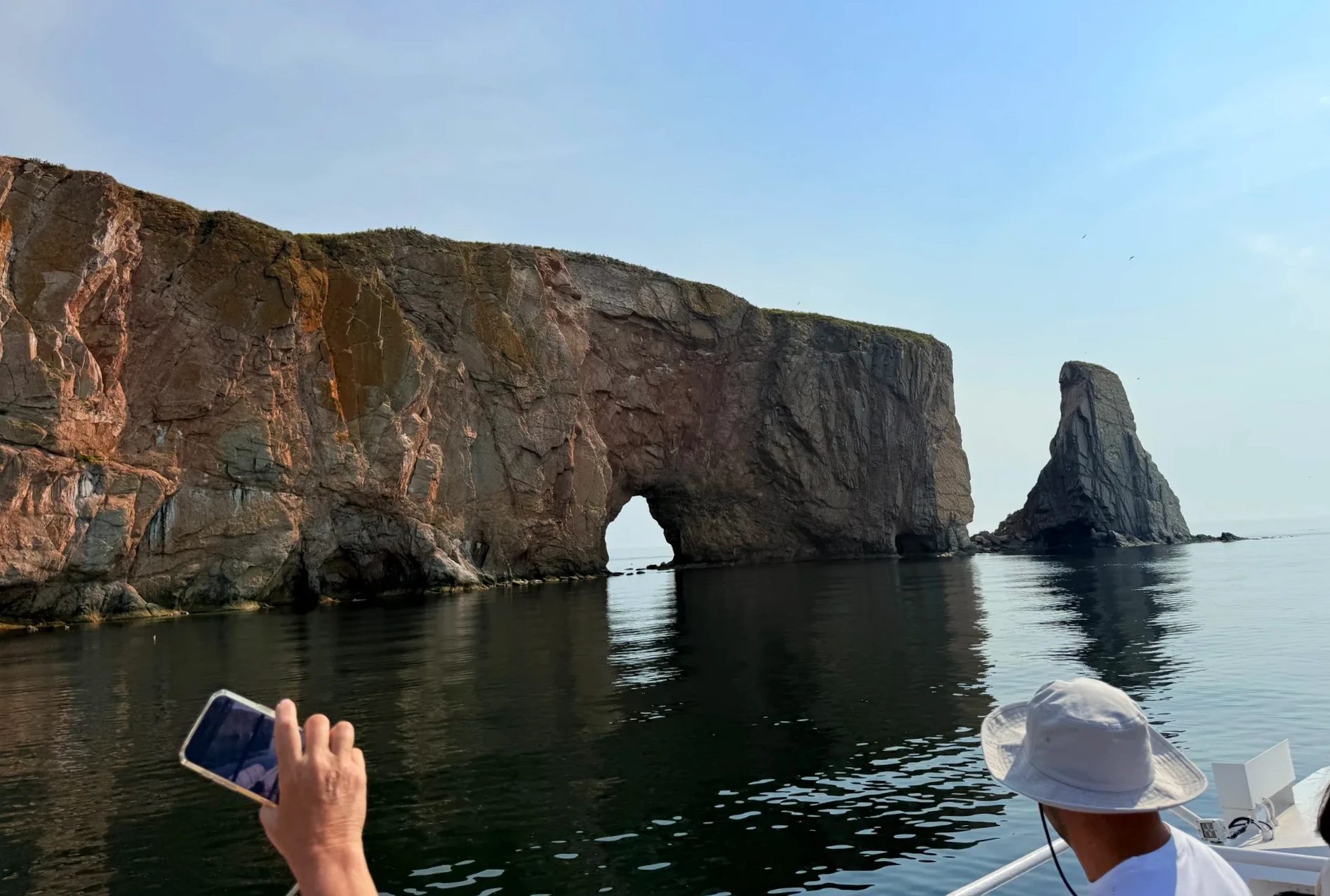
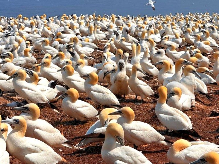
A morning cruise around Percé Rock, then off the boat on Bonaventure Island and a walk to the northern gannet colony. In the afternoon we saw Gaspé’s Birthplace of Canada, and around sunset we fished in the fog off the Grande-Grave wharf in Forillon National Park and caught our first fish.
① Percé Rock and Bonaventure Island 8:35 a.m.–3 p.m.
At the Percé wharf we bought tickets for a Julien Cloutier cruise. The boat circled the rock, slowed under the Bonaventure Island cliffs so we could watch seals and gannets, and then let us off on the island. We had lunch at the island restaurant and walked the Les Colonies trail to the northern gannet colony, where we spent an hour and a half. The birds weren’t afraid of people. Gannets were sitting everywhere, a great many of them.
② Gaspé and the Birthplace of Canada 4:15–5:30 p.m., an hour from Percé
We drove up to downtown Gaspé (Gaspé), had a late lunch at McDonald’s, and took photos at the waterfront square called the Birthplace of Canada (Berceau du Canada). It marks the spot where Jacques Cartier is said to have planted a cross in 1534. There’s a large stone cross and a cluster of buildings recreating an old village.
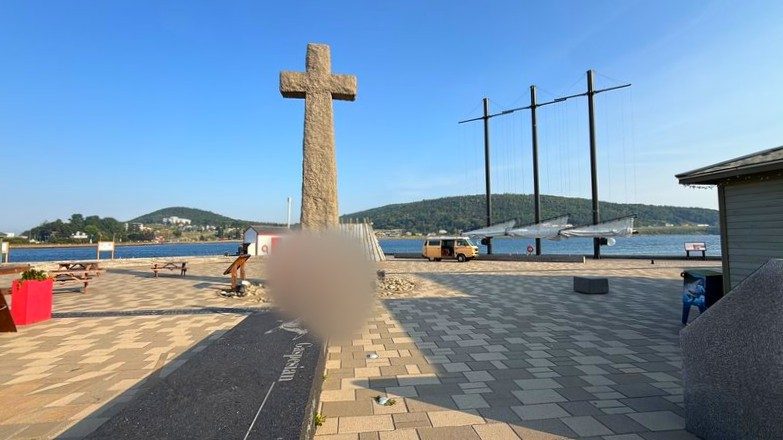
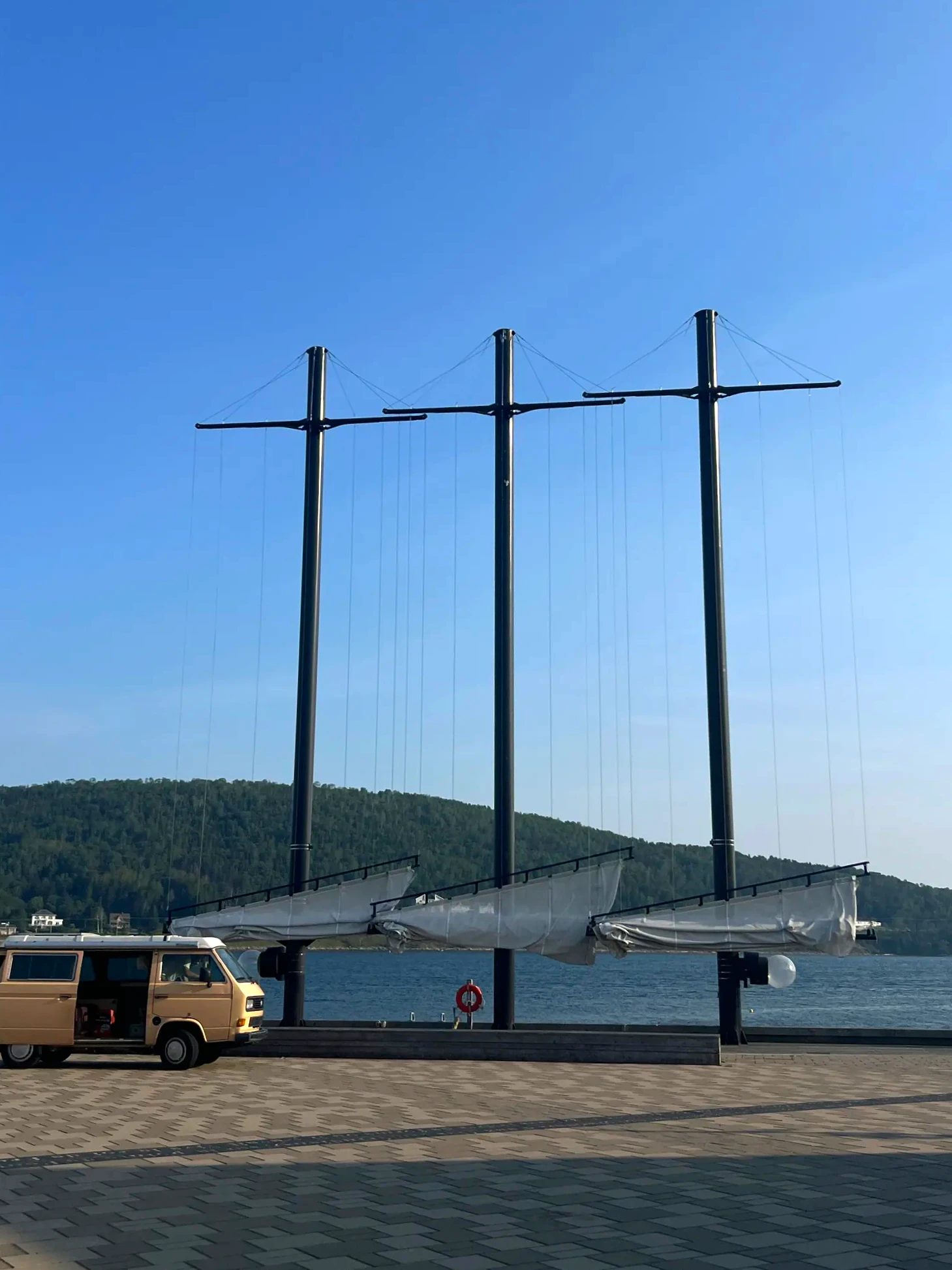
③ The Grande-Grave wharf in Forillon 6:10–8:30 p.m., 30 minutes from Gaspé
The Grande-Grave (Grande-Grave) wharf in Forillon National Park (Parc national Forillon) is one of the places we remember most from this trip. Around sunset the fog was thick, and plenty of people were out on the wharf fishing. We fished until the sun went down and kept going after. Seals swam close to the wharf, and we caught one small fish: our first catch of the trip.
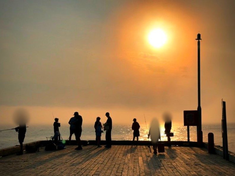
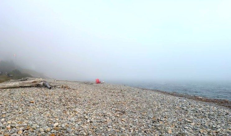
Grande-Grave and Gaspé get their own post → (the fishing-rules post is coming)
On the way back we picked up sausages and campfire snacks at a grocery store in Gaspé, and late that night we cooked sausages and instant ramen in the shared kitchen at Le 125. The kitchen had several fridges.
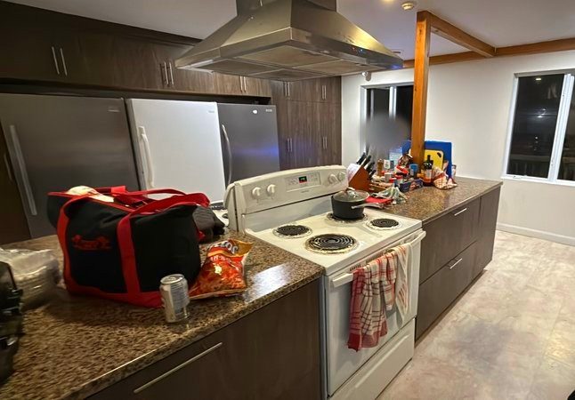
Where we slept: Le 125, night 3 of 3
Staying near Gaspé
Downtown Gaspé or Douglastown
Le 125, where we stayed, isn’t on booking sites, so these are picks on the Gaspé side.
If you’d rather see Percé, Bonaventure Island and Forillon without a car, there’s a three-day Gaspé tour from Montreal (Expedia). It’s in the comparison table further down.
Day 4: Home along the north shore
- North shoreRoute
- Rain and fogWeather
- MontrealEnd point
- Percé, the rock under cloud
- Tim Hortons in Gaspé, breakfast
- Route 198 to the north shore
- Sainte-Anne-des-Monts wharf, mackerel
- Rimouski, dinner
- Home in Montreal
One more look at Percé Rock under low cloud, breakfast in Gaspé, then Route 198 across the peninsula to the north shore. In rain and fog we stopped at the Sainte-Anne-des-Monts wharf, caught several mackerel and got home late that night.
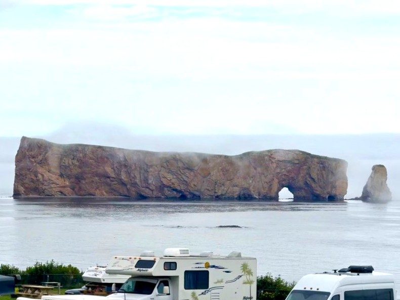
① Percé under cloud, and a souvenir shop 9:25–10 a.m.
The day before had been beautiful. This morning was much grayer, and the rock looked like a different place. We stopped at a souvenir shop in the village and bought one piece of clothing for our kid. Buying one thing like that on a trip means the trip comes back to you now and then.
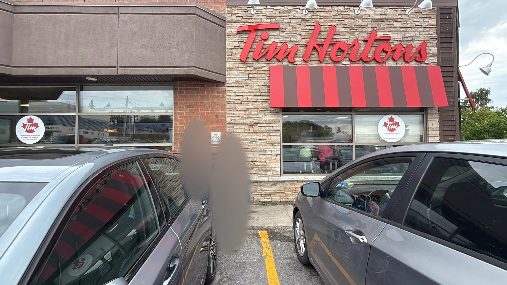
② Breakfast at Tim Hortons in Gaspé, then Route 198 10:50–11:25 a.m.
We drove back up to Gaspé for a quick breakfast at Tim Hortons, the Canadian coffee-and-donut chain. To reach the north shore, we skipped the coastal road around the tip of the peninsula and took Route 198, which cuts across its upper part.
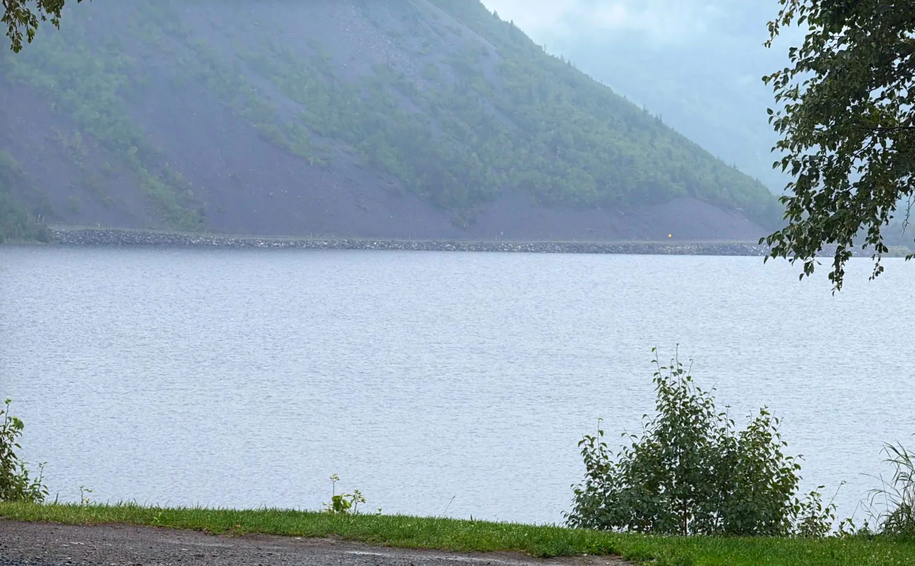
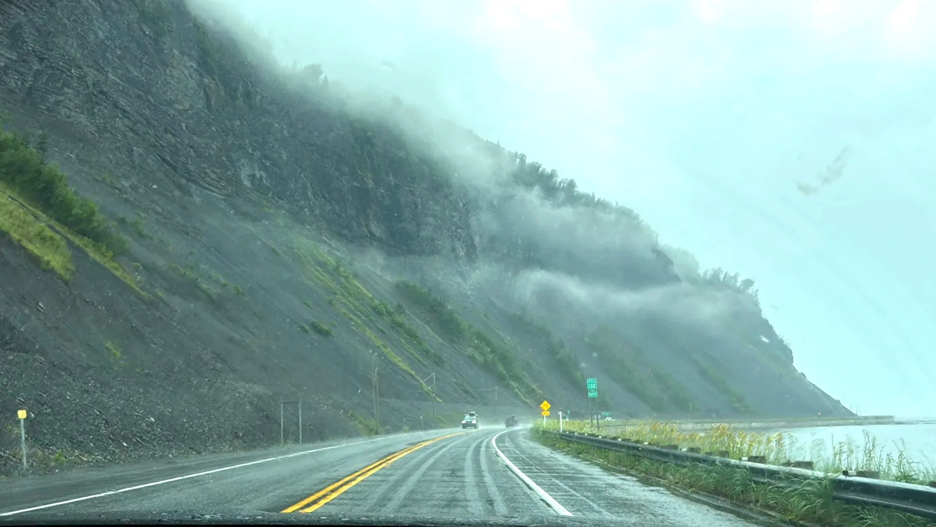
③ The north shore in rain and fog 1:05–2 p.m.
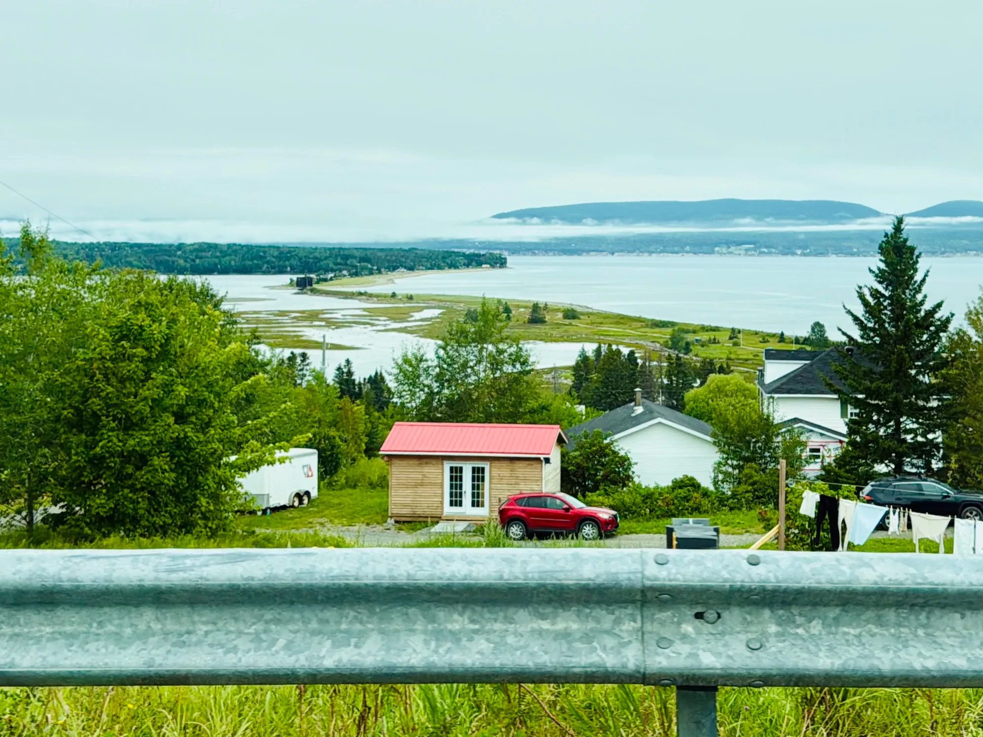
By the time we reached the north shore it was raining, and fog covered the slopes of the hills. Route 132 wound between the sea and the mountains.
④ Sainte-Anne-des-Monts wharf: mackerel 2:10–3 p.m., an hour along the north shore
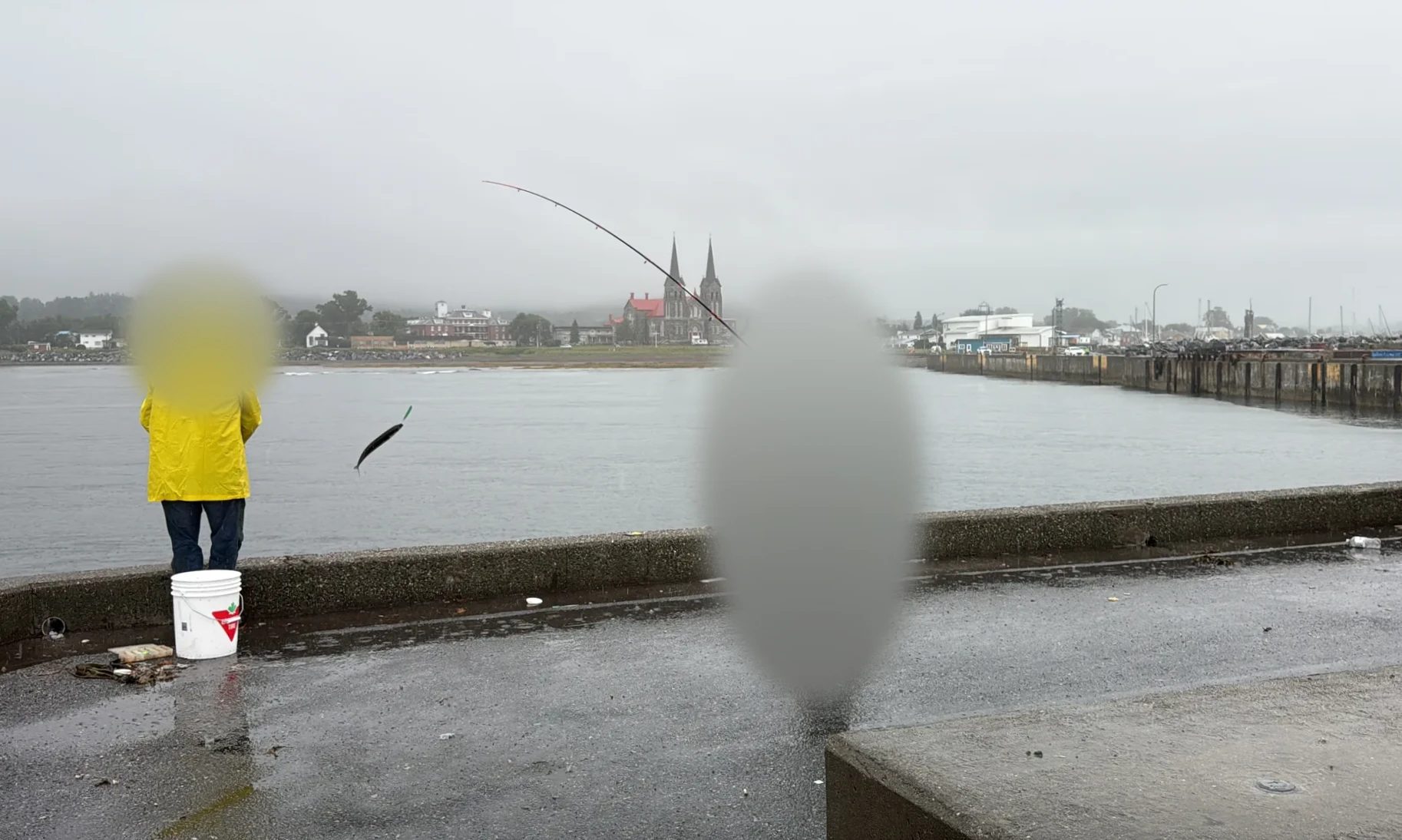
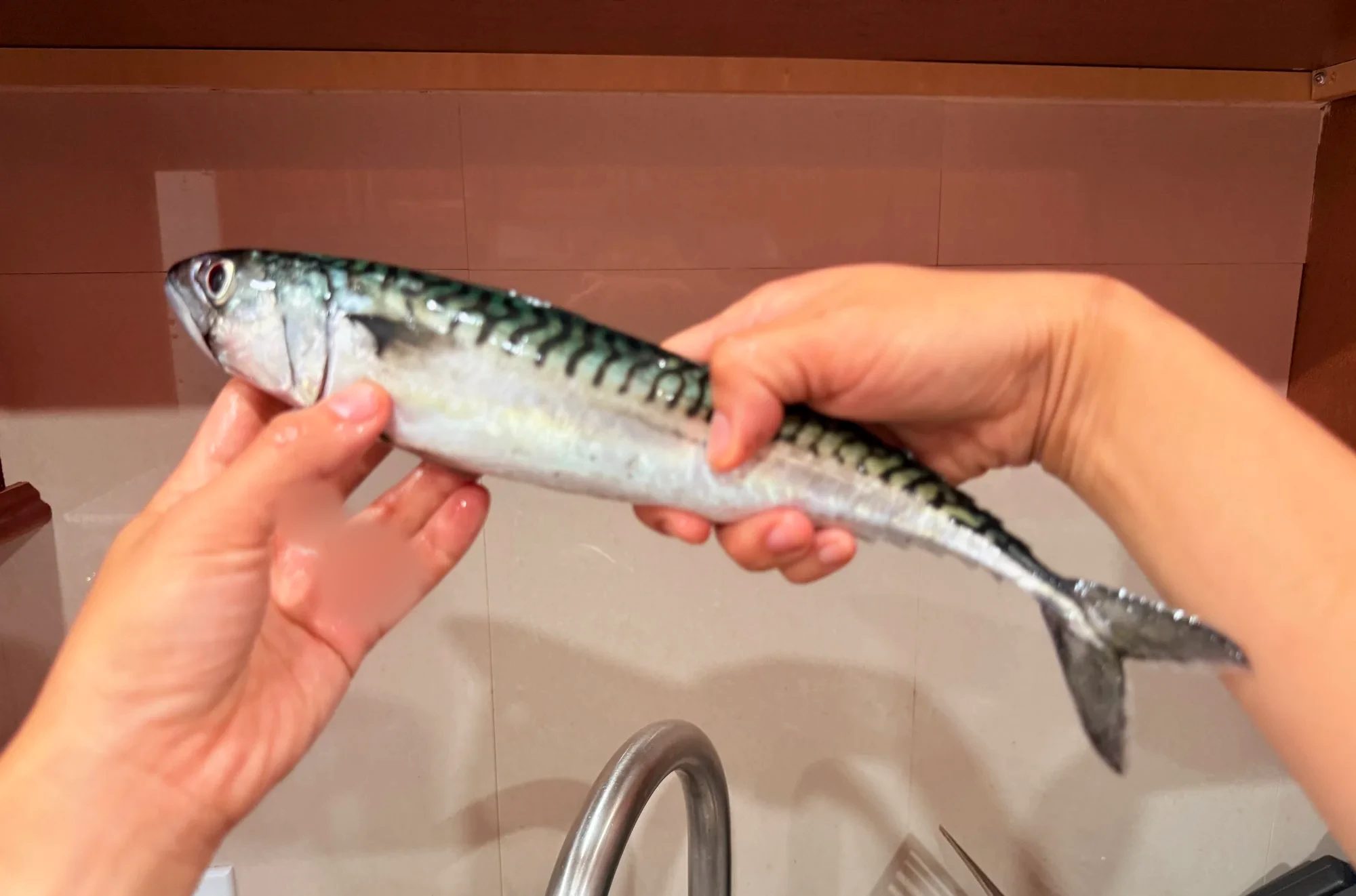
We had heard that mackerel bite well at Sainte-Anne-des-Monts. It was raining, so we put on rain gear and went out on the wharf anyway. Here we finally caught several mackerel. The whole trip had started because our kid wanted to catch one, and it happened on the last day.
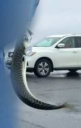
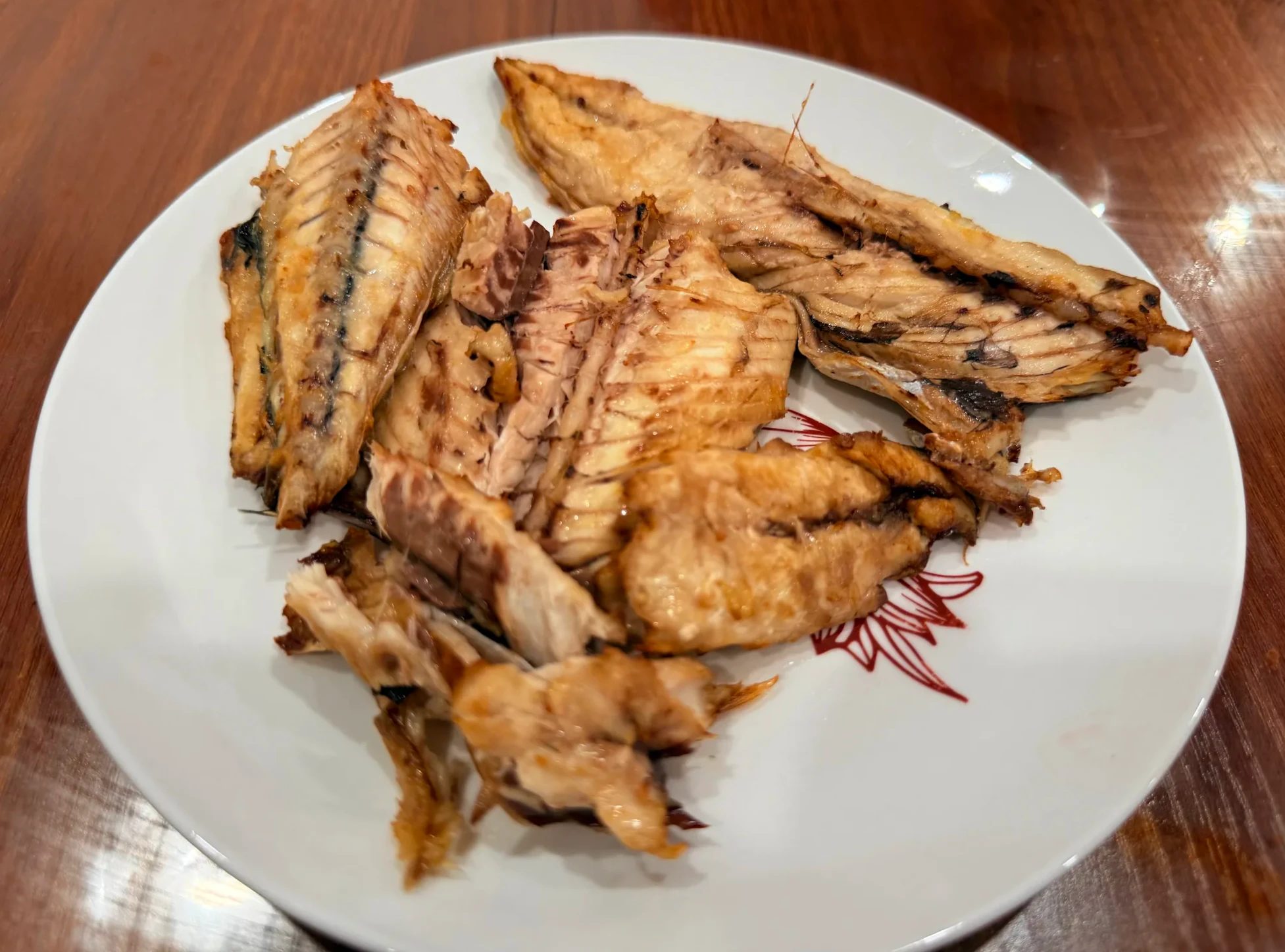
Clean them right away Mackerel spoil fast, so it’s best to bleed and gut them as soon as they’re caught and put them in a cooler full of ice. We were a long way from home, so ours rode back in a cooler and we grilled them that night. Coolers (Amazon)
Staying on the north shore
A night in Sainte-Anne-des-Monts
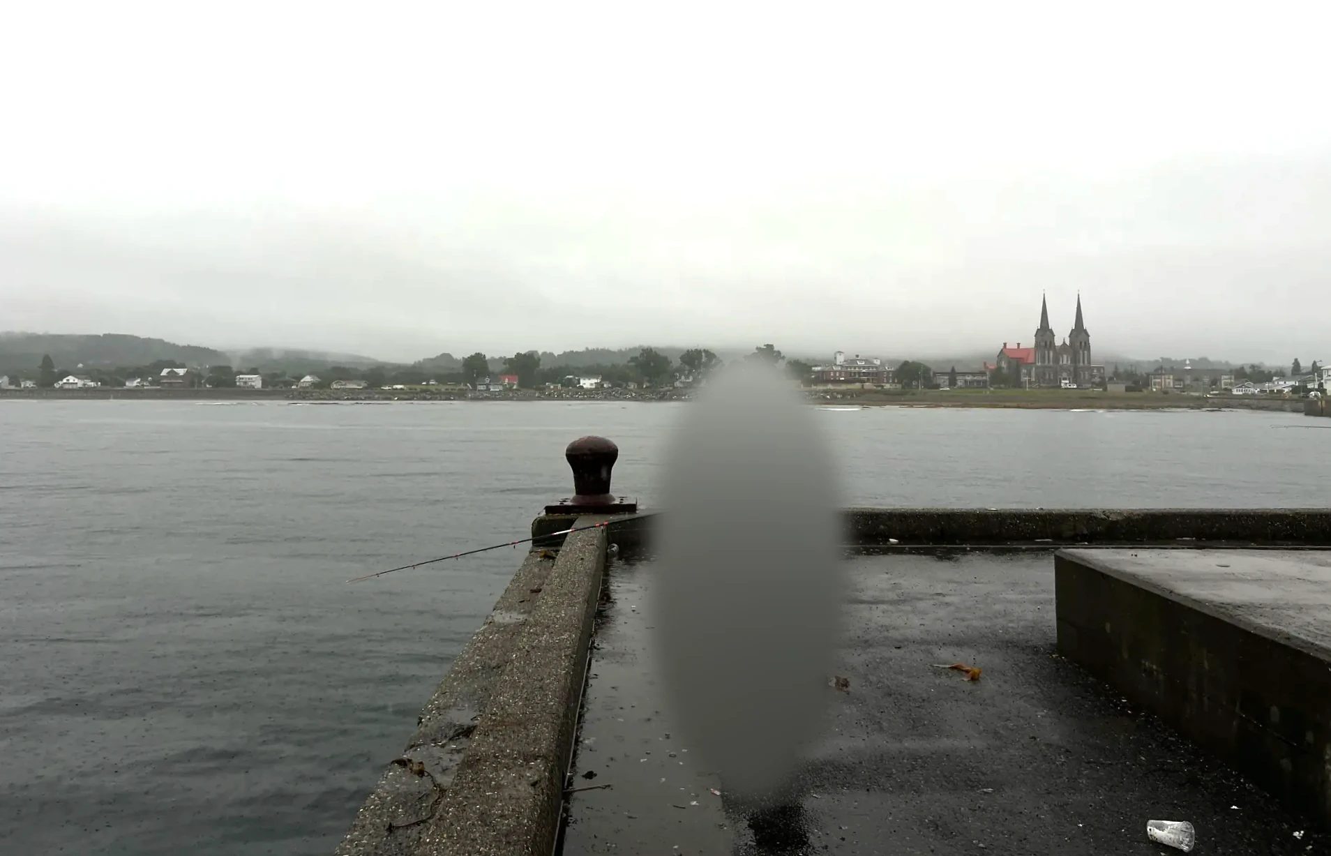
The wharf and the village across the water on a rainy day. You can see the church from the wharf.
⑤ Dinner in Rimouski, then home 5:55 p.m. to the small hours
We ate dinner at a St-Hubert, Quebec’s rotisserie chicken chain, near Rimouski. Late at night we made one more stop, at the McDonald’s in Saint-Léonard-d’Aston on the way to Montreal, and got home in the early hours. We cleaned the mackerel and grilled them that night.
Good to know
Distances and drive times
Montreal to PercéAbout 975 km (606 mi) via the south route, a little over 12 hours without stops
Quebec City to PercéAbout 750 km (466 mi), a little over 10 hours
Full peninsula loopSainte-Flavie back to Sainte-Flavie, 885 km (550 mi), 11 hours of driving alone
Montreal to DrummondvilleAbout 110 km (68 mi) on Autoroute 20, a little over an hour
Where to break up the drive
On our four-day trip we spent the first night at the south gate of the peninsula and the other two near Percé. The first and last days were long drives, and the schedule was tight. If you can add a day or two, splitting it like this is easier (a suggestion based on our own trip).
3 nights (our trip)1 night in Pointe-à-la-Garde → 2 nights in Sainte-Thérèse-de-Gaspé. Long drives on the first and last days Where we stayed →
4 nights1 night in Rimouski → 1 night in Carleton → 2 nights near Percé. Day 1 drops to a little over five hours behind the wheel
5 nightsRimouski → Carleton → 2 nights near Percé → 1 night in Sainte-Anne-des-Monts. Time for wharf fishing on the last morning
Time zones
New Brunswick is on Atlantic time, one hour ahead of Quebec. The clock changes when you cross the Restigouche River from the Matapédia Valley toward Campbellton, so if you plan to eat on that side, work out the closing time in Quebec time first.
Sépaq parks
Miguasha and Bonaventure Island are run by Sépaq, the agency that manages Quebec’s provincial national parks, so you need a park pass. We used an annual pass for both. Forillon is a federal national park, with its own separate admission.
Saltwater fishing
Saltwater fishing in Quebec (mackerel, capelin and so on) doesn’t require a license (Fisheries and Oceans Canada). Inside Forillon National Park, though, you can keep only 10 mackerel per day, and fish you release count toward that limit (Parks Canada). Salmon requires a separate river fishing license, and recreational lobster fishing is prohibited.
If we went again
- Next time we’d set aside time to sit down and eat inside Le Roy Jucep in Drummondville
- Château Bahia has an atmosphere all its own, and we’d stay again if we passed this way
- We skipped the submarine and the Empress of Ireland exhibit at Pointe-au-Père this time. The shore alone was good enough that we spent two hours in the tide pools with our kid
- We’d come better prepared for mackerel fishing
- We’d book our lodging a bit earlier and try staying in Percé village
FAQ
How many days do you need to drive around the Gaspé Peninsula?
The Gaspésie tourism office puts the average at seven to 10 days. We did our Gaspé Peninsula road trip in four days: the first and last were mostly driving, and only one full day went to Percé and Gaspé. Keep in mind how long each day’s drive from Montreal is.
Should you go south or north first?
From Sainte-Flavie to Percé, the south route is 410 km (255 mi) and the north route is 475 km (295 mi), so going south first gets you to Percé a bit sooner. We went in by the south and came out by the north.
Can you fly there?
There are small airports at Gaspé (YGP) and Bonaventure (YVB), with flights from Montreal and Quebec City, but fares tend to be high. If you’re looping the peninsula, a car is easier. The simplest plan is to fly into Montreal and rent a car there (flights to Montreal, Trip.com). To go without driving, there are three-day tours from Montreal (Expedia).
Recap
DatesAugust 6–9, 2026, three nights
LodgingChâteau Bahia 1 night, Le 125 2 nights
Distance drivenAbout 2,200 km (1,370 mi)
FishingGrande-Rivière (bites only), Grande-Grave (first fish), Sainte-Anne-des-Monts (several mackerel)
The trip began because our kid wanted to catch a mackerel, and on the last day, on a rainy wharf in Sainte-Anne-des-Monts, we caught several. Along the way we saw tide pools below a lighthouse, a red covered bridge, the stars over a castle-like inn, Percé Rock and the gannet colony.
Map and getting there
This map zooms in on the stops we made inside the peninsula. The numbers show the order we visited them.
Routes are simplified and don’t follow the actual roads exactly.
Getting around
This is a road trip
We drove the loop from Montreal. If you’re flying in, land in Montreal and rent a car there to follow the same route.
Tour comparison
Gaspésie without a car: three-day tours from Montreal
Both tours leave downtown Montreal by bus at 6 a.m. and return on the evening of day three. They run only in summer, and when we checked on October 28, neither had dates open for booking. Cells where the two tours differ are highlighted.
| A | B | |
|---|---|---|
| Guide language | English | English, French, Chinese |
| Day 1 | Montreal → Reford Gardens in Métis (admission extra) → Gaspé | Montreal → Exploramer aquarium → Gaspé |
| Day 2 | Forillon National Park 1 hr, Percé Rock and Bonaventure Island 3 hr | Percé Rock and Bonaventure Island cruise, Forillon National Park and lighthouse in the afternoon |
| Day 3 | Cap-Chat wind farm (admission extra) → Montreal | Reford Gardens → Montreal, back 8–9 p.m. |
| Lodging | Hotel in Gaspé, 2 nights, up to 4 per room | Hotel, 2 nights (Roadway Inn, Hôtel Interprovincial or similar), rooms for 2–4 |
| Included | Round-trip bus, 2 hotel nights in Gaspé, Percé cruise and Bonaventure Island admission, taxes | Not listed on the product page |
| Pay separately | Meals, other admissions, travel insurance | Meals on your own |
| Meeting point | 68 René-Lévesque O, downtown Montreal; hotel pickup within 5 km (3 mi) | Same spot at 6 a.m., Brossard at 6:20 a.m. |
| Confirmation | Instant | Confirmed 2 days after booking; runs only with 20 people |
| Cancellation | Free cancellation (terms on the product page) | Free up to 61 days before; changes within 14 days of departure cost 10% |
| Kids | Infants sit on an adult’s lap | Children who take a seat pay the adult fare; under 2 free without a seat |
| Best for | Paying admissions up front with instant confirmation | Travelers who need French or Chinese commentary |
| Book | Expedia | — |
What we needed for this trip
Gear
Fishing tackleFor mackerel. We bought flutter jigs at Canadian Tire in Paspébiac. Flutter jigs (Amazon) Sabiki rigs (Amazon)
Rain gearWe wore it on the rainy wharf in Sainte-Anne-des-Monts on the last day. Kids’ rain gear (Amazon)
PaddleboardIt rode along in the car. Inflatable paddleboard (Amazon)
CoolerIt got our mackerel home. Cooler (Amazon)
Bookings
LodgingBooked ahead, since August is peak season To the lodging box →
Sépaq annual passUsed for the Miguasha guided tour and Bonaventure Island
Percé cruiseBought that morning at the ticket office in the village
Day-by-day itinerary
Day 1, Aug. 6Montreal → Le Roy Jucep, Drummondville → lunch in Rimouski → Pointe-au-Père Lighthouse → Causapscal → Routhierville covered bridge → Tide Head beach → DQ in Atholville → Château Bahia
Day 2, Aug. 7Miguasha National Park → seafood poutine in Carleton → Plage des Goélands, Maria → Canadian Tire, Paspébiac → Port-Daniel → Plage des Beaux Sables, A&W → Le 125 → Percé lookouts → fishing at Grande-Rivière harbor
Day 3, Aug. 8Percé cruise → Bonaventure Island, gannet colony → Berceau du Canada, Gaspé → fishing at Grande-Grave, Forillon → grocery store in Gaspé → Le 125 shared kitchen
Day 4, Aug. 9Souvenir shop in Percé → Tim Hortons, Gaspé → Route 198 → north shore → mackerel fishing in Sainte-Anne-des-Monts → dinner in Rimouski → Montreal
Sources
- Tourisme Gaspésie: distance chart
- Tourisme Gaspésie: the coastal road
- Québec Maritime: Site patrimonial de pêche Matamajaw
- La Matapédia: Routhierville covered bridge
- Tourisme Gaspésie: Miguasha National Park
- Parks Canada: fishing in Forillon
- Fisheries and Oceans Canada: recreational fisheries
Our 4-day Gaspésie road trip
- August 6Day one: Montreal to the peninsula
- August 7Miguasha and Chaleur Bay
- August 8Percé Rock and Bonaventure Island
- August 8Gaspé and Forillon
- TopicMackerel fishing at three wharves
Not in the list? Search it yourself
Places to stay nearby, on a map
Affiliate link: if you book through this search, the blog earns a commission at no extra cost to you. Results open in a new tab. About affiliate links
Discover more from Elsewhere, Mostly
Subscribe and get new posts sent straight to your inbox.